World Map: City Lights at Night


(Click images to see full-size)
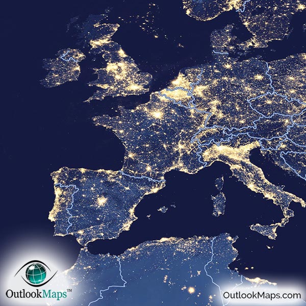
This map shows the human footprint on the earth by showing the lights (primarily from cities and urban areas) that are visible from space during hours of darkness.

Taken entirely from NASA satellites at night, city lights are clearly shown producing a golden white glow.
The most prominent light sources correspond to areas with the most human population and urban development.
Such areas like western and central Europe, eastern United States, Japan, South Korea, and China produce the most light at night.
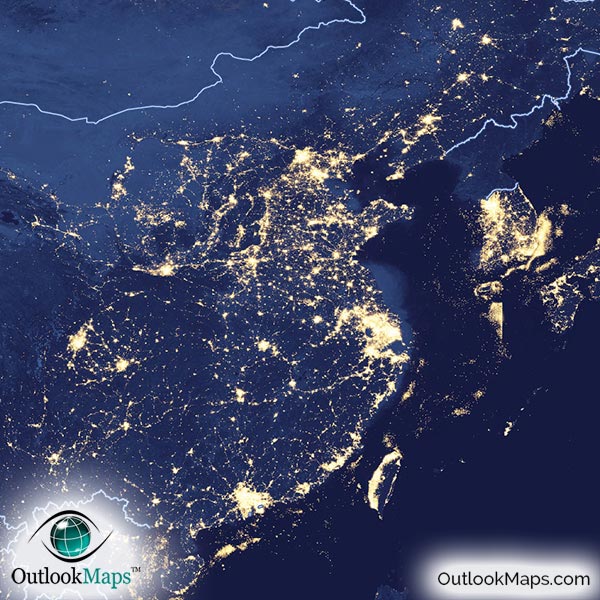
The difference of light emitted from North Korea and South Korea is especially fascinating when viewed from space. South Korea is among the brightest land in the entire planet, while North Korea by contrast looks black and empty.
The population along the Nile River is also very prominent, especially in contrast to the vast deserts of most of Egypt (and North Africa in general).
Some lights are not produced by cities at all. Many of the bright spots areas in the Middle East, Northern USA, Canada, and Russia are actually the result of industry, primarily oil and gas extraction. Lights in central Australia are even the result of natural fires, and were picked up by the satellite sensors that passed overhead on satellites.

This satellite map is an instant hit on any wall, as it's simplicity and uniqueness will draw viewers to explore the map. Since even small cities and towns can be viewed, anyone can enjoy tracking down their hometown lights.
While not the focus of the map, the satellite map also shows natural features that are still visible at night, such as lakes, mountains, forests, and more.
Available in many sizes and with options of framing, you'll need to look no further for an attractive nighttime satellite map of the world.


