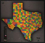
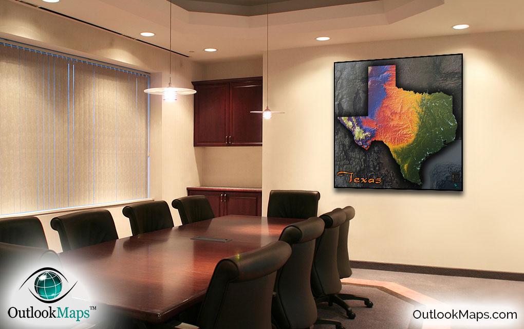
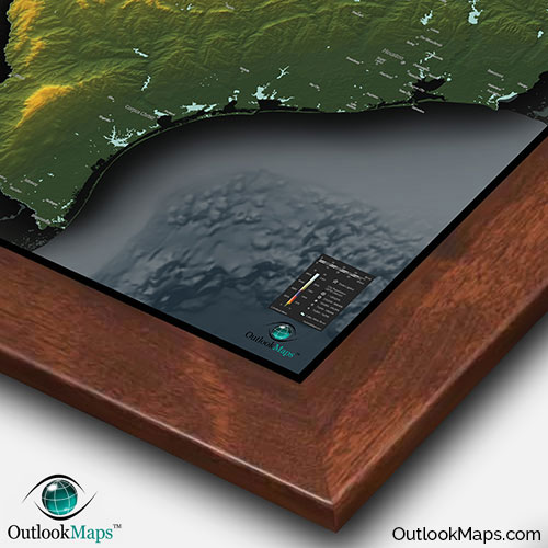
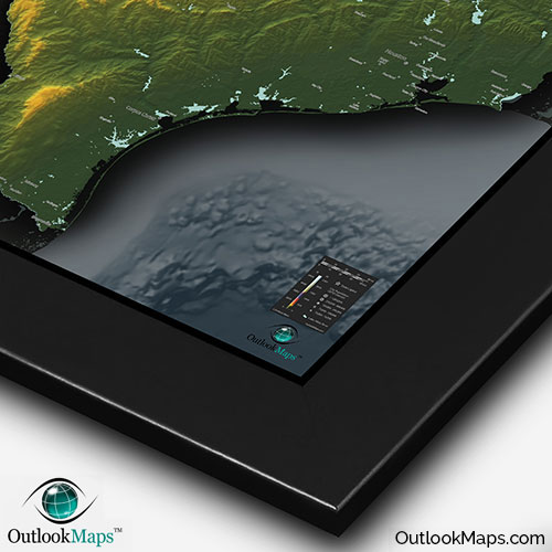
Texas Physical Topography State Wall Map


(Click images to see full-size)
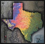
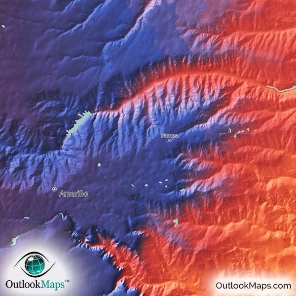
Note: This map is an artistic representation of Texas's terrain. Text labels are intentionally limited.

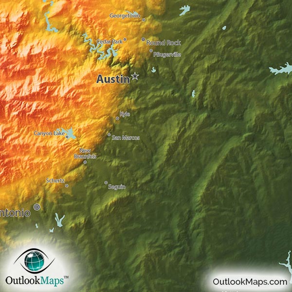
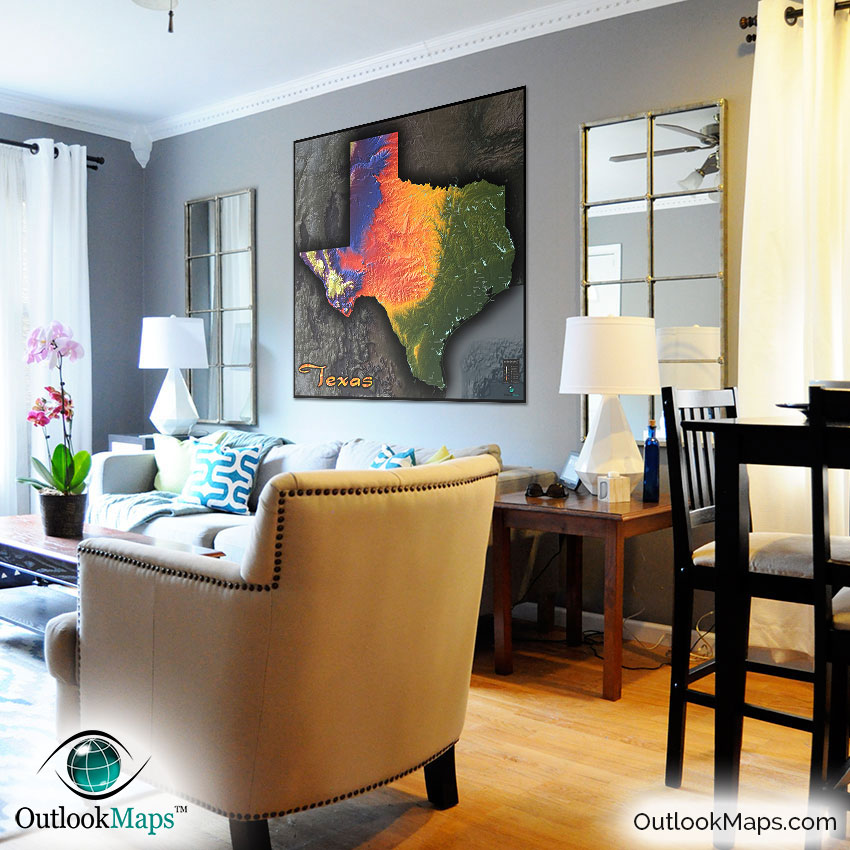
Green represents Texas' low elevation, which includes the flat Gulf Coastal Plain along the southeastern Gulf Coast and much slightly more hilly regions in east Texas. Much of Texas' population lives in this low-elevation areas, including major cities like Houston, Dallas, San Antonio, and Austin.
As elevation increases, land colors in the map change to warm colors of yellow, orange and red. Much of this mid-elevation land exists in central Texas and includes the Edward Plateau.
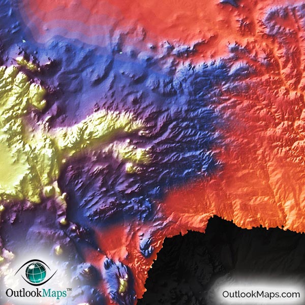
Higher lands are shown in blue and purple, and include most of the north and west portions of Texas. El Paso also lies in this high elevation region.
The highest lands in Texas are colored white, and are made up primarily of Texas' mountain ranges in the western Big Bend Country. Texas' highest point is Guadalupe Peak close to the New Mexico border in far west Texas. The elevation of Guadalupe Peak is 2667 meters or 8751 feet.
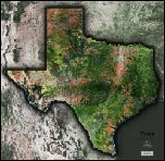
Learn how this Texas topographic image was created with digital elevation data.
Many of Texas physical features can be clearly seen in this physical map. The Great Plains and Llano Estacado in North Texas and mountain ranges in West Texas such as Guadalupe Mountains, Davis Mountains, Glass Mountains, Santiago Mountains, and Chisos Mountains are all very prominently displayed in this map.
Many river valleys can also be seen as they cut through the land on their way across Texas to the Gulf of Mexico. The Rio Grande, Red River, Colorado River, Brazos River, and Sabine River all create such valleys and are easy to see in the map.
Texas reservoirs and lakes are also displayed in this topographical map. Toledo Bend Reservoir, Lake O' the Pines, Sam Rayburn Reservoir, Lake Tawakom, Lewisville Lake, Lake Ray Hubbard, Lake Arrowhead, and Lake Travis are all shown, along with many smaller reservoirs as well.
The bays along the Gulf of Mexico, including Galveston Bay, Matagorda Bay, San Antonio Bay, and Madre Lagoon are also shown in the map.
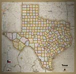
A total of 107 Texas cities and towns are labeled.
All major cities like Houston, San Antonio, Dallas, Austin, Fort Worth, El Paso, Lubbock, Plano, Grand Prairie, and McAllen are shown.
Some of the medium and smaller towns on the map include Waco, Denton, Odessa, Longview, Victoria, Galveston, Huntsville, Del Rio, Waxahachie, Eagle Pass, Weatherford, Corsicana, Plainview, Angleton, Belton, Stephenville, Gatesville, Sulphur Springs, Carrollton, College Station, League City, Baytown, Harlingen, Cedar Park, Channelview, Socorro, Kyle, Denison, Nederland, as well as many others.
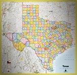
Probably one of the most aesthetic maps of Texas you'll ever find, this Topographic Texas Physical Map will look sensational when on display in any room: home, office, classroom, business, or anywhere else.
The vibrant colors, combined with the bold 3D shading of Texas' terrain, combined with the unique and sleek style make this Texas map as much a piece of art as a useful geographic reference map. Sure to bring some pizzazz to any room's decor, this Texas map will stand out, capture attention, and inspire curiosity from all viewers...and most of all, it displays the natural beauty of Texas in a way you've never seen before.