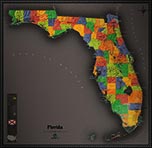
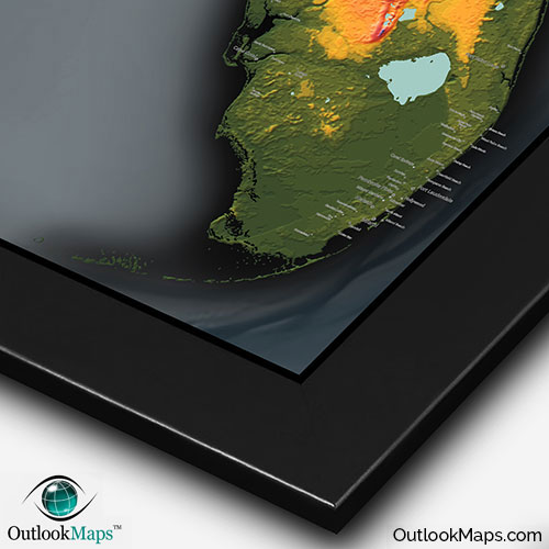
Colorful Florida Physical Topography Wall Map


(Click images to see full-size)
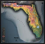
Note: This map is an artistic representation of Florida's terrain. Text labels are intentionally limited.

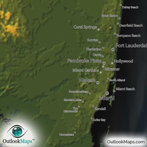
The colors used in this Florida Topographic Physical Map correspond to elevation. Green is the lowest elevation, which comprises of nearly all of Florida's coastal lands, especially near the southern tip of the Florida peninsula - the low swampy areas of the Everglades and the Big Cypress National Preserve. Many of Florida's largest cities lie at low elevation, including the Miami area, Jacksonville, and the Tampa Bay area.
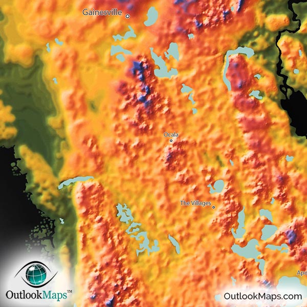
Yellow and orange represents mid-elevation portions of the state, such as much of the interior of the peninsula. Both Orlando and Tallahassee (Florida's capital) lie mostly in this mid-elevation range.
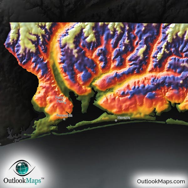
Relatively high elevations are colored with blue and purple with white representing the highest portions. In Florida, the highest lands are nearly all located in the Panhandle, especially the western part of the Panhandle which also includes Florida's highest point of Britton Hill with an elevation of 345 ft or 105 m.
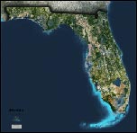
Learn how this Florida topographic image was created with digital elevation data.
Though Florida is among the flattest states in the USA, this map really accentuates the elevation changes that do exist, to create an almost mountainous appearance, especially in the Panhandle of Florida. The most significant specific physical features that are visible in the map are the many inland lakes, such as Lake Okeechobee, Lake Istokpoga, Lake Kissimmee, Lake Apopka, Lake George, and the wide slowly flowing river of St. Johns. The Suwannee River Valley and Perdido River valley are also very prominent. Of course the various capes, islands, keys, and lagoons around the state's coast are also visible in the map.
Another stunning aspect of this map is the visualization of the ocean floor, both on the Atlantic side to the east and the Gulf of Mexico side to the west. The contours of the sea floor are clearly visible and extremely interesting. The floor extends at shallow depths away from the coast, and suddenly "drops off" into the deeper ocean...almost as though there is a peninsula in the sea floor underneath the land peninsula of Florida above sea level.
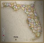
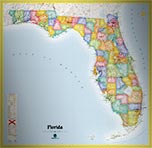
102 Florida cities and towns are labeled.
All major cities like Tallahassee, Jacksonville, Miami, Tampa, Orlando, Fort Lauderdale, West Palm Beach, Hialeah, Cape Coral, and Ocala are shown.
Some of the medium and smaller towns on the map include Sarasota, Fort Pierce, Miramar, Brandon, Spring Hill, Miami Beach, Plantation, Town 'n' Country, Melbourne, Deerfield Beach, Daytona Beach, Pine Hills, Palm Harbor, Kendale Lakes, Port Charlotte, The Hammocks, Wesley Chapel, Altamonte Springs, North Fort Myers, Greenacres City, Saint Cloud, Plant City, Winter Haven, Riviera Beach, University, Fruit Cove, Fleming Island, Meadow Woods, and many others.
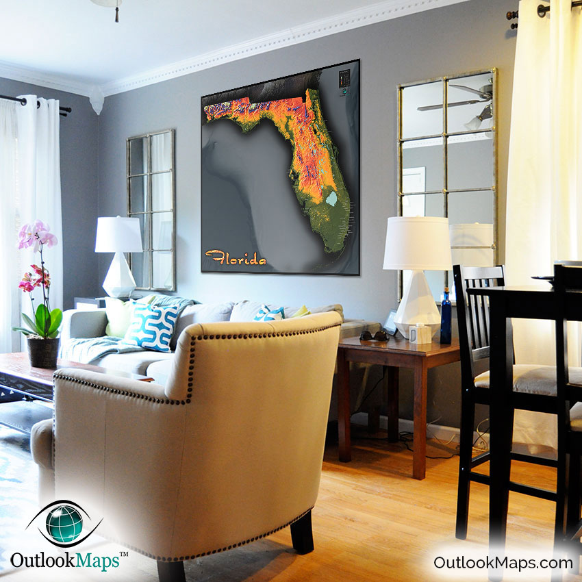
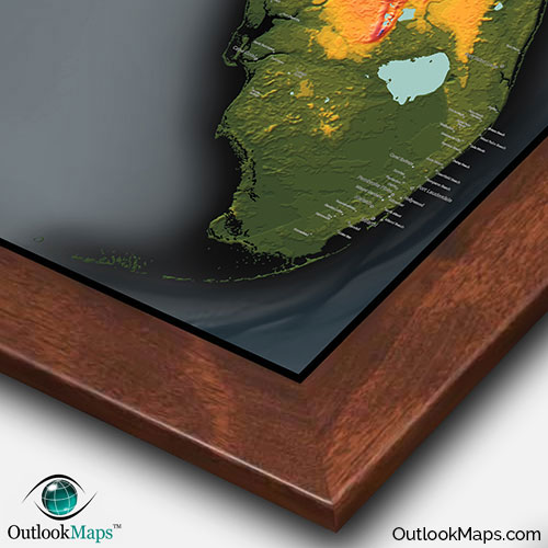
Florida is clearly not known for an abundance of physical landforms, but that doesn't prevent this physical map of Florida from looking absolutely amazing. The coloration throughout the map, combined with the shading and exaggeration of the elevation contours, create a stunning visual image that will look spectacular on any wall: in your home, work place, or even a classroom as children especially will appreciate the colorful and sleek design. The map also contains just the right amount of information (names and locations of Florida's towns and cities) to be a useful reference without detracting from the artistic image.
Sure to inspire any viewers, this Florida Topographic Map will bring a colorful and unique image and look great on display.