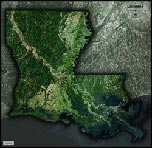
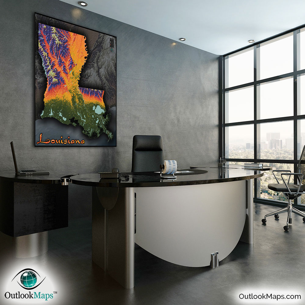
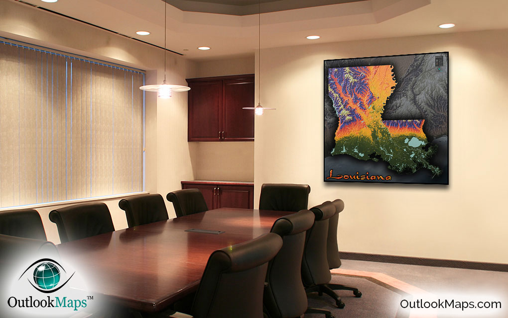
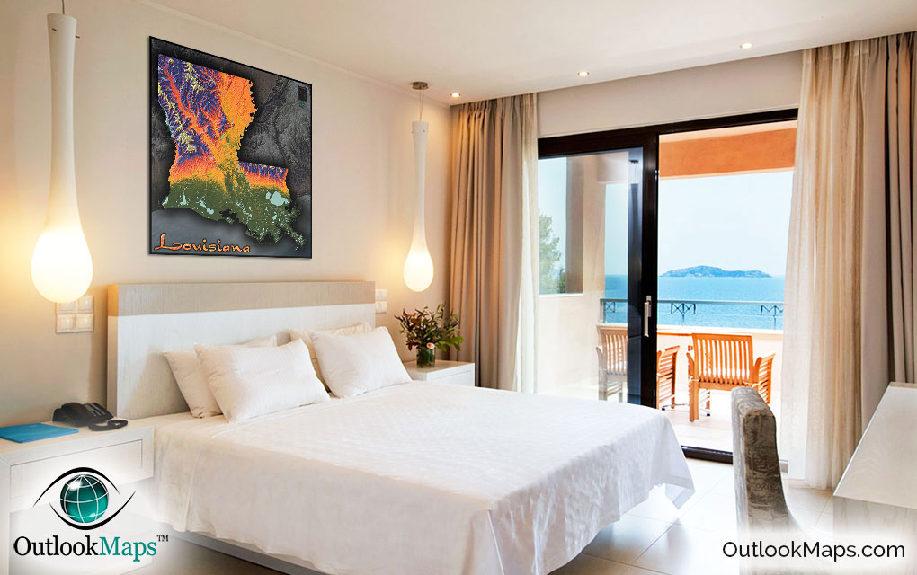
Louisiana Topography Physical Wall Map


(Click images to see full-size)
Note: This map is an artistic representation of Louisiana's terrain. Text labels are intentionally limited.

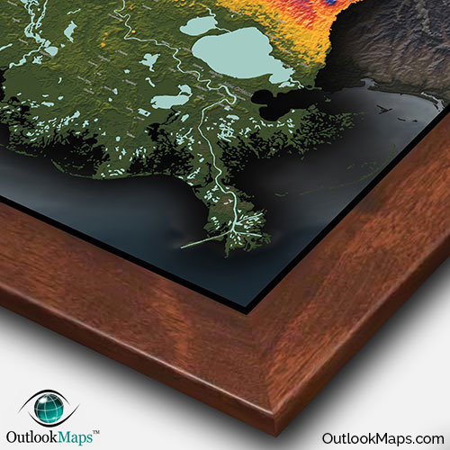
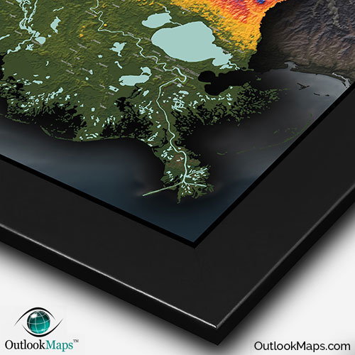
Green represents Louisiana's lowest elevation. This land is the southern portion of Louisiana along the Gulf of Mexico. This part of Louisiana (the Louisiana Bayou) is characterized by wet and swampy lands. New Orleans (Louisiana's largest city) and the city of Lake Charles are both located in this low elevation area.
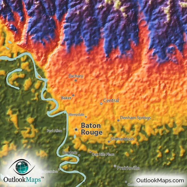
As elevation increases toward central Louisiana, colors transition to a golden yellow, orange, and red, which all represent mid-level elevation. The vast Mississippi River Alluvial Plain is included in this mid-elevation range. Cities found in this mid-elevation range include Baton Rouge (Louisiana's capital), Shreveport, and Lafayette.
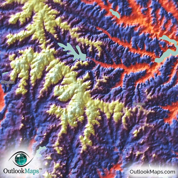
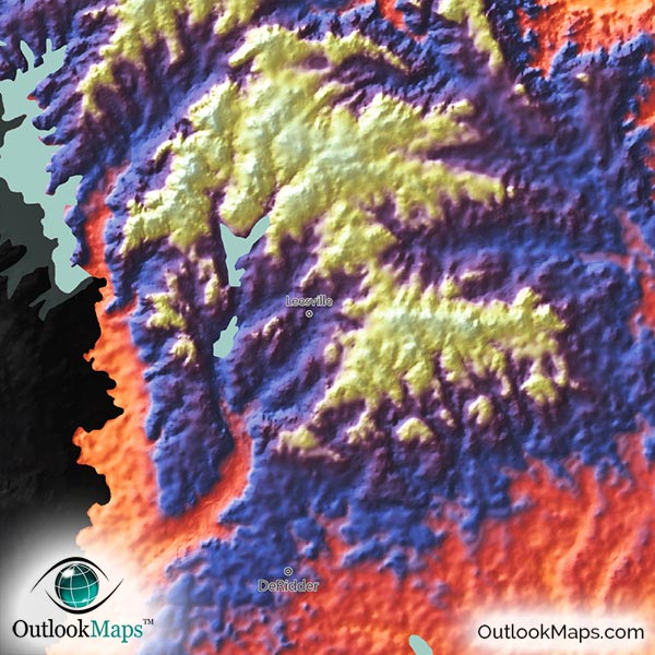
The higher elevated parts of Louisiana are colored in blue, purple, and white being the used for the highest elevation. Driskill Mountain, in northwest Louisiana, is Louisiana's highest point at 163 m (535 ft).
Learn how this Louisiana topographic image was created with digital elevation data.
The main physical features that can be seen in the map are the Mississippi River, the low coastal plain and swamps of southern Louisiana, the vast Mississippi River Plain throughout northeast Louisiana, and the rolling hills of northwest Louisiana, which look like rugged mountains in this map.
Many of the lakes and swamps of Louisiana are also shown. Lake Pontchartrain is the largest and most visible, but many smaller lakes are also included, such as Lake Salvador, Maurepas Lake, White Lake, Grand Lake, Calcasieu Lake, the Toledo Bend Reservoir along the Texas border, Catahoula Lake, and many smaller lakes in the northwest, such as Bayou D'Arbonne Lake, Lake Claiborne, Caddo Lake, Lake Bistineau, and more.
86 Louisiana cities and towns are labeled.
Major cities like New Orleans, Baton Rouge, Shreveport, Lafayette, Lake Charles, Monroe, and Kenner are all shown.
Some of the labeled medium and smaller towns include Houma, Natchitoches, Opelousas, Minden, DeRidder, Franklin, Tallulah, Saint Martinville, Mansfield, Prairieville, Hammond, Estelle, Baker, Belle Chasse, Bogalusa, Moss Bluff, Eunice, Gonzales, Lacombe, Oak Hills Place, Rayne, Galliano, Eden Isle, Patterson, Jeanerette, and many others.
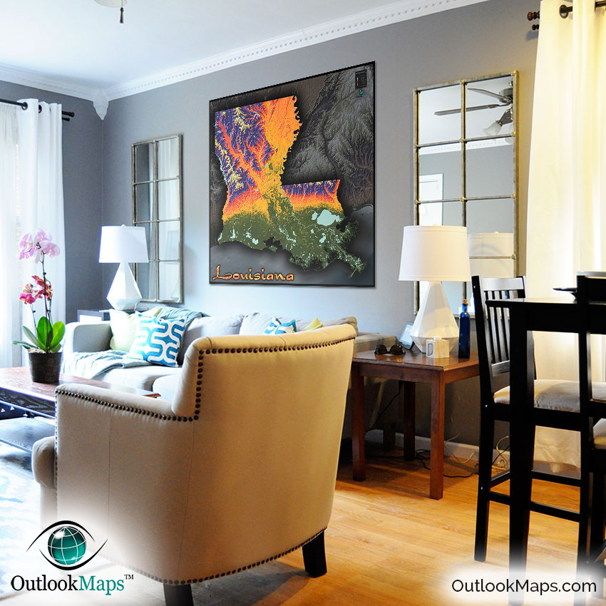
We're certain that this Louisiana map will make an eye-catching addition to any room. The bright colors and bold shading produce and image that makes the Louisiana terrain appear rugged. You'll definitely have a new appreciation for the Louisiana landscape. The map also serves as a useful general reference map for the state of Louisiana, as the location of towns and cities are included.
But at the end of the day, it's certainly the stunning artistic appearance of the map that makes the map unique and special. Great for homes, offices, or classrooms this map will certainly have Louisianans or anyone else asking you "where did you find that map?!"