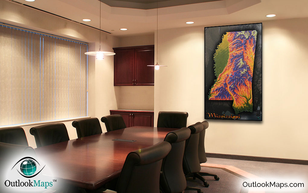
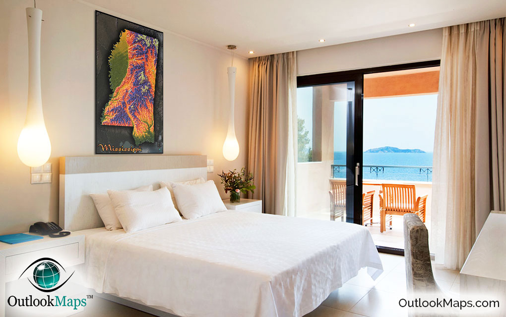
Mississippi Topographic State Wall Map


(Click images to see full-size)
Note: This map is an artistic representation of Mississippi's terrain. Text labels are intentionally limited.
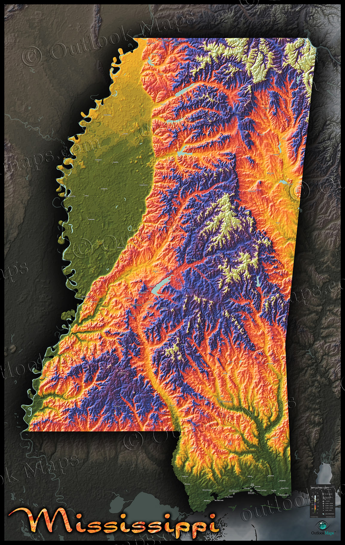
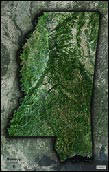
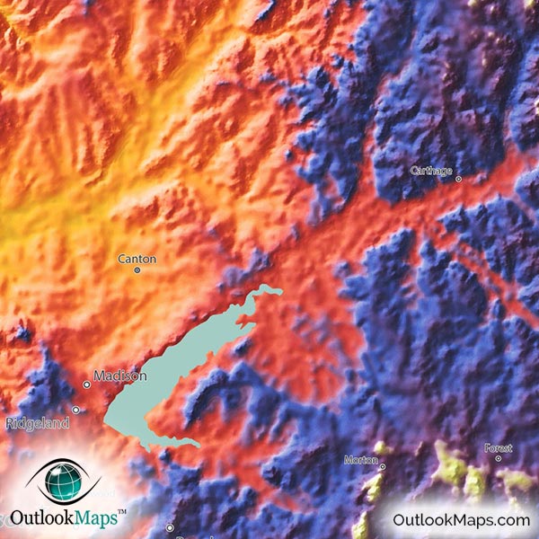
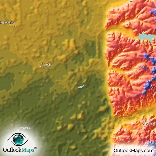
Green areas of the map are Mississippi's lowest elevation. This includes the Gulf Coast at the southern tip of Mississippi and also the vast Mississippi River Alluvial plain along the western edge of the state. The Pascagoula River valley is also among the lower elevations of the state. Large Mississippi cities such as Gulfport, Hattiesburg, and Biloxi are all located in the various low elevation portions of Mississippi.
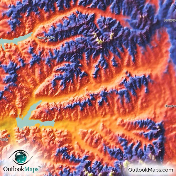
Mid-elevation is colored with warm colors (golden yellow, orange, and red). This land includes much of the inland parts of Mississippi and even the very north art of the Mississippi River Plain. Jackson, Mississippi's capital and largest city, and the city of Southaven are located in this mid-elevation range.High elevation is shown with blue and purple and white for the absolute highest places. While much of this relatively high elevation runs throughout central Mississippi, the highest point is Woodall Mountain, in the northeast corner of the state. The elevation of Woodall Mountain is 246 m or 807 ft.
Learn how this Mississippi topographic image was created with digital elevation data.
Though Mississippi does not contain any major mountains or physical landforms, this physical map still accentuates the elevation changes and terrain contours that do exist. The river plains and valleys are very visible, as are the various hilly regions such as the Pontotoc Ridge and Fall Line Hills in the northeast, the North Central Hills, and the Pine Hills in the south.
Mississippi's bodies of water are also shown. In addition to the Mississippi River and Gulf of Mexico, the map also includes many of Mississippi's lakes and reservoirs. Arkabutla Lake, Sardis Lake, Enid Lake, Grenada Lake, Ross Barnett Reservoir, Okatibbee Reservoir, and many smaller lakes are shown in this Mississippi Map.
101 Mississippi cities and towns are labeled on the map.
Major cities like Jackson, Gulfport, Hattiesburg, Biloxi, Meridian, Tupelo, and Vicksburg are all shown.
Some of the labeled medium and smaller towns include Horn Lake, Columbus, Oxford, Natchez, Hernando, Brookhaven, West Point, Booneville, Holly Springs, Kosciusko, Forest, Ripley, Waynesboro, Hazlehurst, Water Valley, Poplarville, Collins, Ridgeland, Long Beach, Byram, D'Iberville, Saint Martin, Richland, West Hattiesburg, Saltillo, University, Pearl River, Beechwood, New Hope, Verona, and many others.

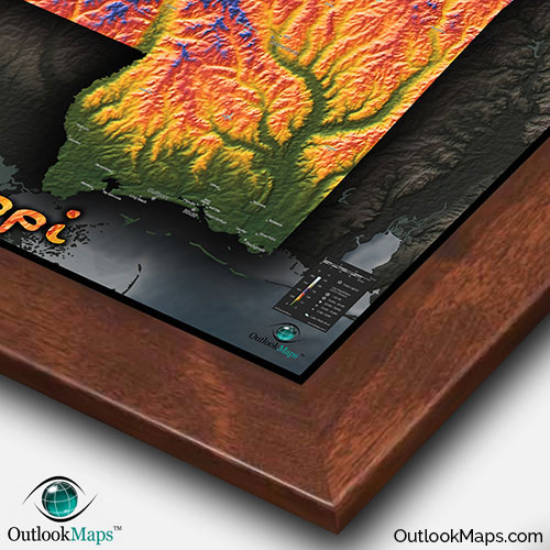
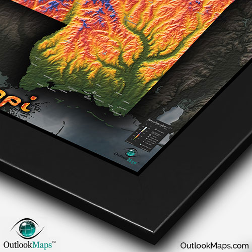
We're sure this Mississippi Topographical Map will look spectacular on your wall. Colors are bold and vibrant and the 3-D shading and lighting of the map really accentuates the contours of the terrain.
The map also serves a useful reference map of Mississippi's towns and cities...though the real value of the map is it's artistic and stylish appearance.
If you're looking for a map to add some pizzazz and style to your wall (whether in your home, office space, or classroom), this Mississippi physical wall map is just for you.