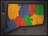
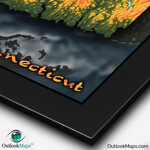
Connecticut Physical Topography Wall Map


(Click images to see full-size)
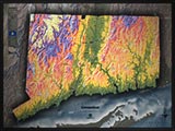
Note: This map is an artistic representation of Connecticut's terrain. Text labels are intentionally limited.

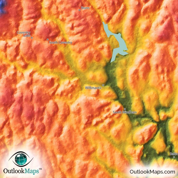
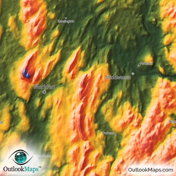
The lowest elevation portions of Connecticut are shown in Green. This includes the Atlantic Ocean coastal regions along the southern parts of Connecticut and also the Connecticut River Valley that runs through the center of the state. Most of Connecticut's largest cities lie in this low elevation level: Bridgeport, New Haven, Hartford (the capital) and Stamford. /p>
As elevation increases, color changes to yellow, then orange, then pink which all identify the mid-elevations portions throughout the majority of the state. Waterbury is the largest city located in this mid-elevation range.
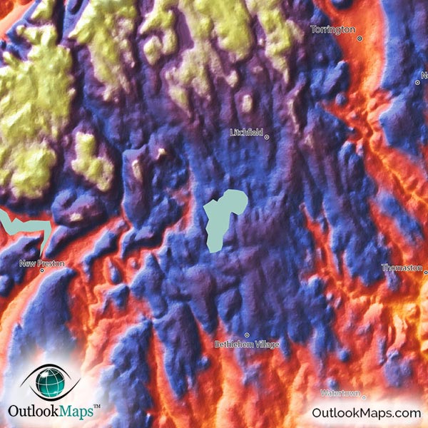
Then in the high areas of the Litchfield Hills or the lower Appalachian Mountains in the northern parts of Connecticut, especially in the west, the colors change to blues and purples, with whites signifying the highest parts in the northwest, including Connecticut's highest point of Mount Frissell along the Massachusetts border in the northwest corner with an elevation of 2,379 feet or 725 meters.
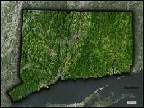
Learn how this Connecticut topographic image was created with digital elevation data.
The Connecticut landscape, though lacking many famous specific physical features, is extremely interesting in this map. The style accentuates the hilly regions of the Appalachian foot hills throughout the state. Also, the numerous river valleys that cut through the terrain are very visible, especially the valleys of the Connecticut River, Housatonic River, Thames River, Shetucket River, and Quinebaug River. Connecticut's lakes and reservoirs are also shown in the map, including Lake Candlewood, Easton Reservoir, Saugatuck Reservoir, Barkhamsted Reservoir, Gaillard Lake, Nepaug Reservoir, Shenipsit Lake, Pachaug Pond, and several others.
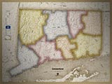
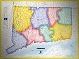
A total of 127 Connecticut cities and towns are labeled.
All major cities like Hartford, Bridgeport, New Haven, Stamford, Waterbury, Norwalk, West Hartford, West Haven, East Hartford, Shelton, Naugatuck, and East Haven are shown.
Some of the labeled medium and smaller towns include Westport, Ansonia, Storrs, Derby, Bethel, Kensington, Southwood Acres, Glastonbury Center, Old Greenwich, Simsbury Center, Pawcatuck, Stafford Springs, Long Hill, Broad Brook, Heritage Village, Old Mystic, Clinton, Oxoboxo River, Durham, Weatogue, Plainfield Village, West Simsbury, Salmon Brook, Bethlehem Village, Newtown, Noank, Higganum, Canton Valley, Woodmont, Moodus, Tariffville, Litchfield, Wauregan, Quinebaug, and many others.

While this Connecticut Physical Map can be used as a general reference map with the names and locations of Towns and Cities, the primary function of this map is to illustrate the natural beauty of Connecticut's geography. The rolling mountains and hills throughout the state look absolutely amazing when displayed in this colorful topographic style. The vibrant colors of the map and vivid shading of mountains and terrain ensure it will look splendid when displayed on any wall in your home, office, or even a classroom. Children, especially, will love the cool colors and style of the map, which truely display Connecticut's natural beauty like no other map out there.