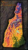
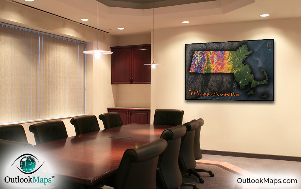
Massachusetts Topography Wall Map


(Click images to see full-size)
Note: Minimal text labels are included in order to preserve the artistic style of Massachusetts's terrain.
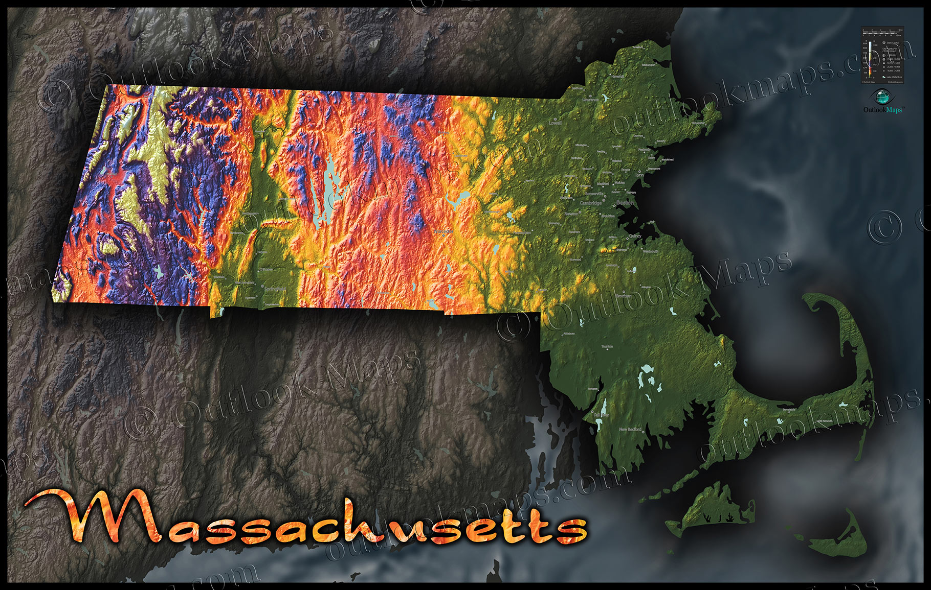
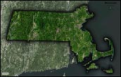
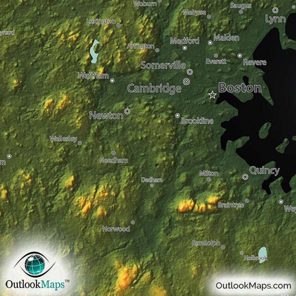
The low areas of Massachusetts are shown in green. This includes the coastal regions on the eastern coast of the Atlantic ocean and throughout the Cape Cod region. Also but also the central valley, sometimes called Pioneer Valley, created by the Connecticut River. Most of Massachusetts' large cities are found in the low elevation areas, including Boston, Springfield, Lowell, and Cambridge.
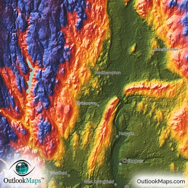
Medium elevation is shown in colors yellow, gold, orange, and red. This mostly includes central Massachusetts. The city of Worcester is located in this mid-elevation range.
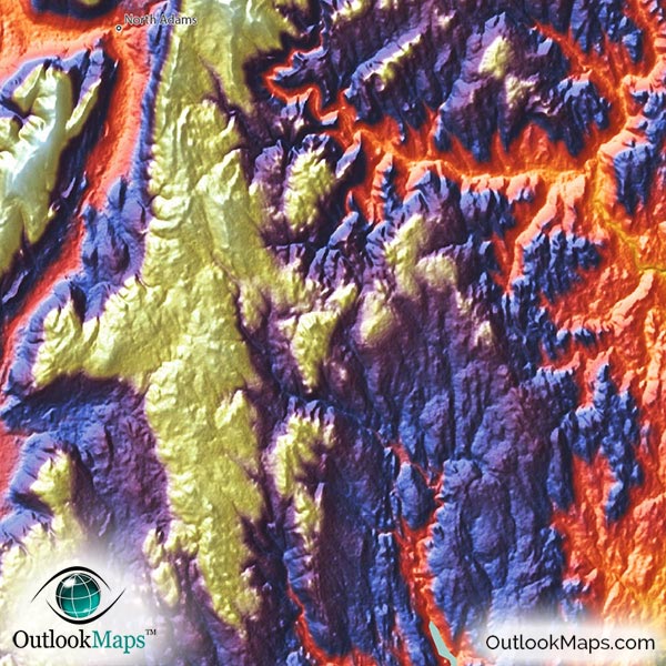
The highest elevation is colored blue, purple, and white representing the highest point. This high area is almost exclusively in the western portion of Massachusetts, in the Berkshire Hills and the Taconic Mountains near the New York border to the east. Massachusetts highest point is Mt. Greylock in the northwest corner of the state (3,489 ft / 1063 m).
Learn how this Massachusetts topographic image was created with digital elevation data.
Massachusetts contains several distinctly different topographical regions, and these regions are all very distinct in the map. Near the coast in the east, land is low and flat. Central Massachusetts (near Worcester), the land becomes much more rolling and hilly. Slightly further west, the Connecticut River carves out a low-lying fertile valley, which includes the Springfield Area. And the far east is more mountainous and rugged from the Berkshire Hills and Taconic Mountains.
The map also includes major Massachusetts bodies of water, including Quabbin Reservoir, and smaller lakes such as Silver Lake, Assawompset Pond, Long Pond, Sudbury Reservoir, Wachusett Reservoir, Knightville Reservoir, and Cobble Mountain Reservoir.
Islands just off Massachusetts coast, including Martha's Vineyard, Nantucket Island, and Elizabeth Islands are also shown
80 Massachusetts cities and towns are labeled.
Major cities like Boston, Worcester, Springfield, Lowell, Cambridge, Brockton, and Lynn are all shown.
Some of the labeled medium and smaller towns include Somerville, Barnstable, Northampton, Framingham, Malden, Chicopee, Peabody, Arlington, Leominster, Beverly, Braintree, Lexington, Norwood, Wellesley, Saugus, Wakefield, Wilmington, Amherst Center, Southbridge, Abington, Swampscott, Lynnfield, Holbrook, and many others.

Rest assured that this Massachusetts physical map will look great on your wall. The colors of the map are bold and brilliant and the shading of the terrain adds a 3-D depth that is almost surreal. You'll be finding all sorts of hills, river valleys, and other interesting landforms you never knew existed.
The map also contains useful geographic information like the locations of Massachusetts towns and cities - making it a useful geographic reference of the commonwealth.
Of course, the real value of the map is it's vibrant and interesting image of the terrain. Whether you display the map in your home, or office, or even in a classroom, this Massachusetts map will certainly elicit excitement and wonder from anyone who views it.