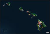
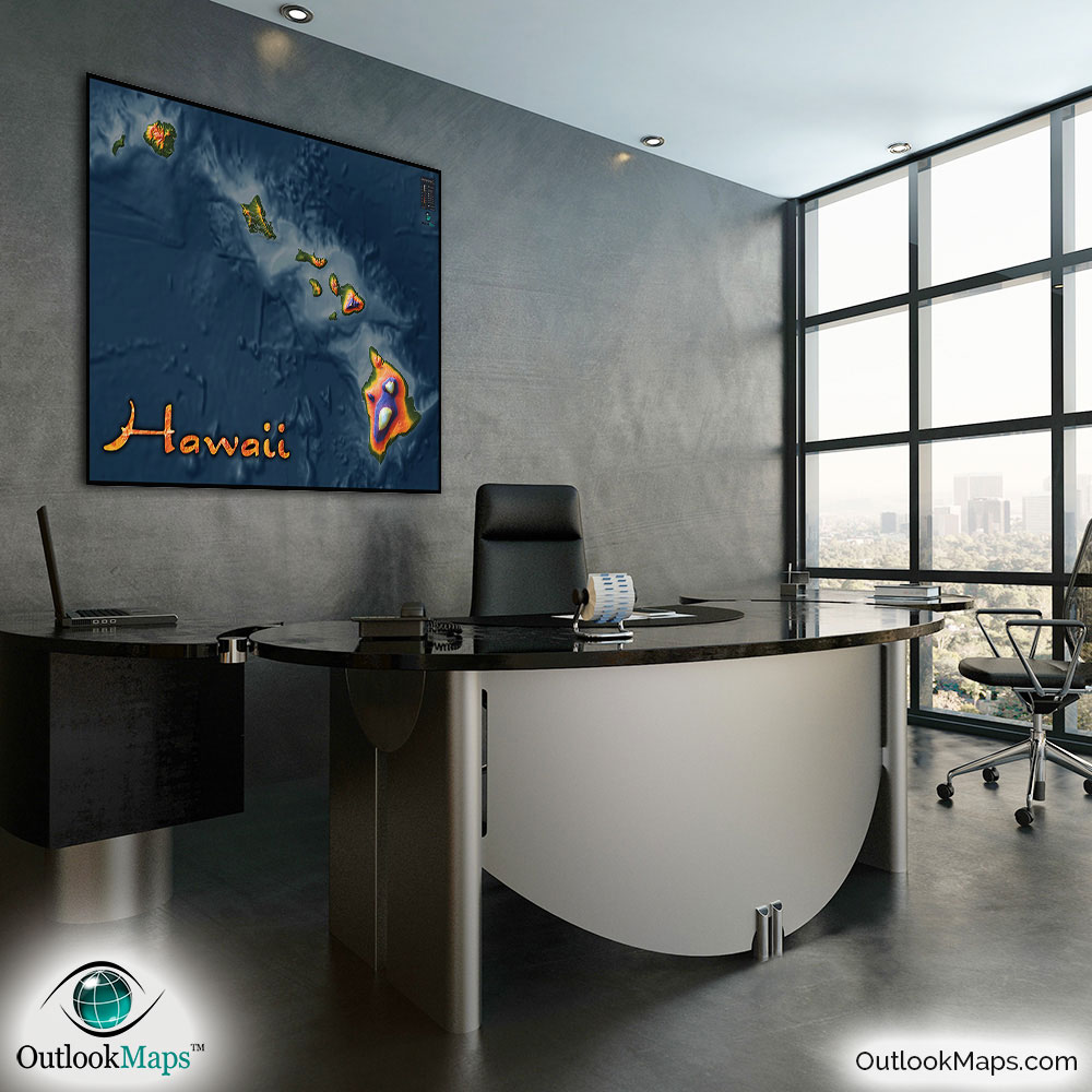
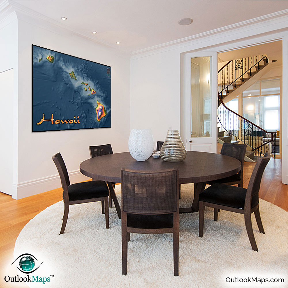
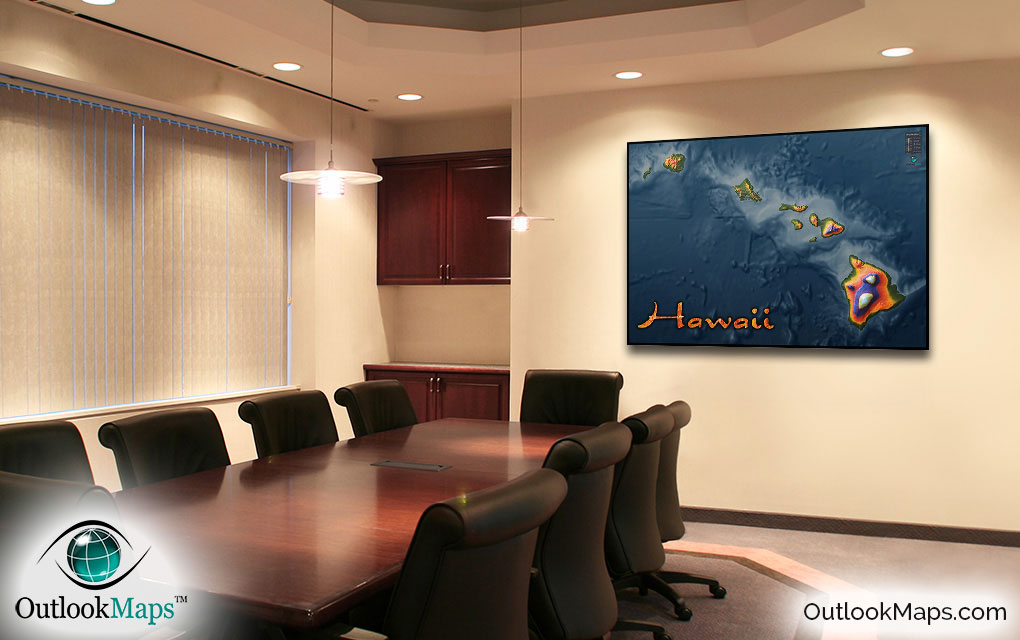
Hawaii Wall Map - Topographic Physical Features


(Click images to see full-size)
Note: The focus of this map is Hawaii's physical terrain. To maintain the artistic appearance, text labels are minimal.
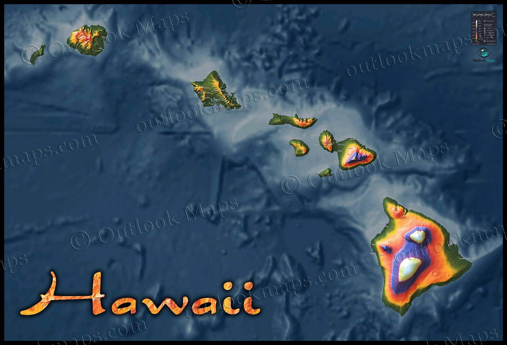
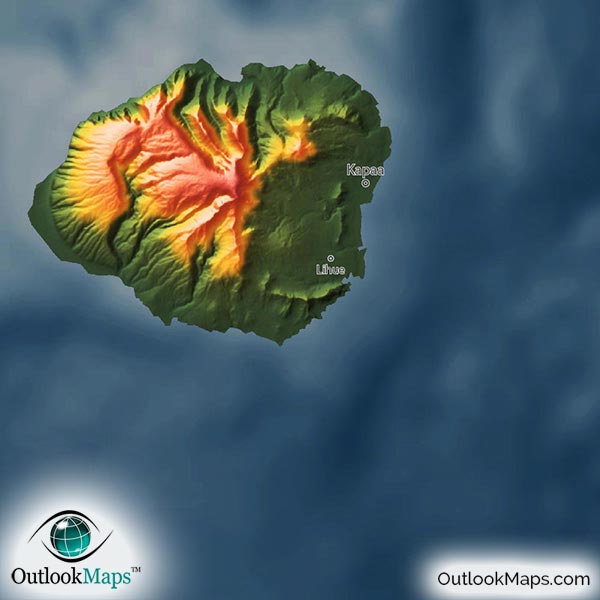
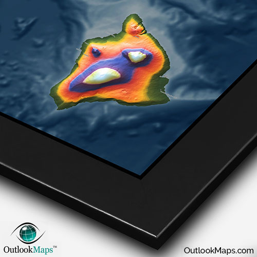
Different colors are used on the map to represent elevation.
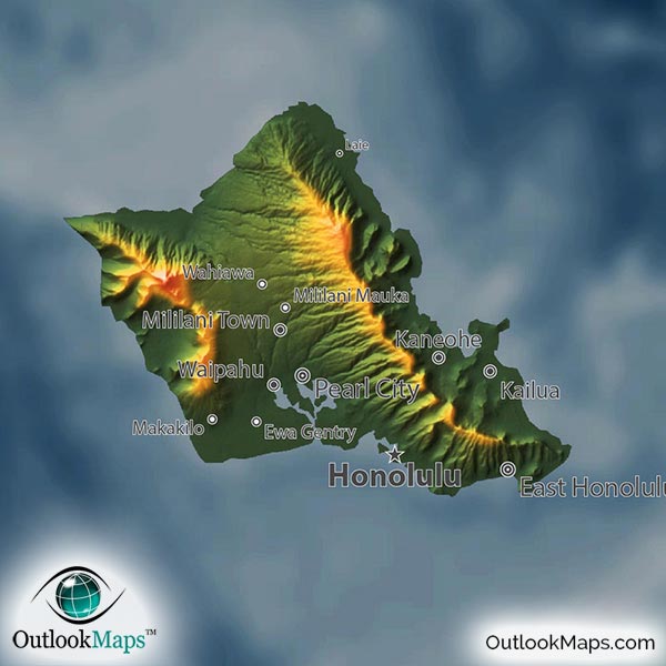
Lowest lands are shown in green, such as coastal lands and valleys. Most of Hawaii's population resides in the low elevation lands, including Hawaii's two largest cities Honolulu (the capital) and Hilo (the largest city on the big island).
Mid-elevation is shown in yellow and orange.
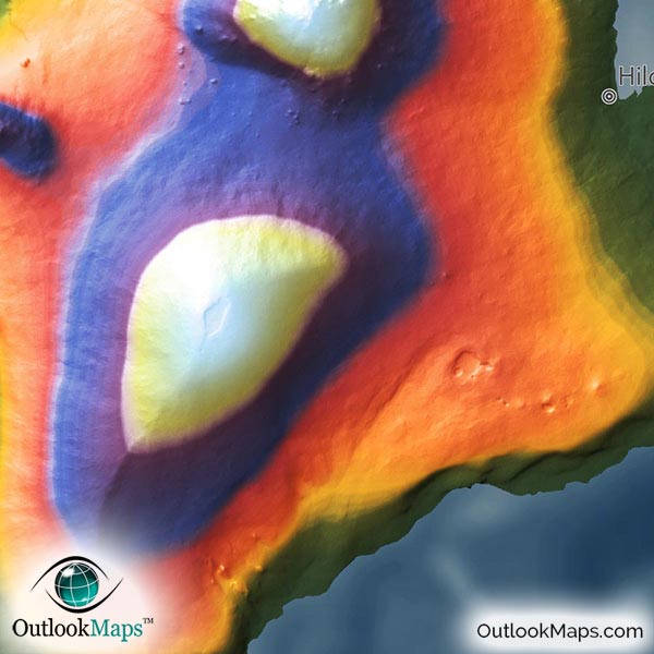
High elevation lands, such as the Red Hill mountain on Maui or the two main mountains on the big island of Hawaii (Mauna Loa and Mauna Kea) are shown in blue, purple, and white at the peak.
Learn how this Hawaii topographic image was created with digital elevation data.
The map includes all 8 of Hawaii's major islands: Niihau, Kauai, Oahu, Molokai, Lanai, Maui, Kahoolawe, and of course the Big Island of Hawaii. Many of the island's various peaks and mountains are clearly visible, such as Paniau Peak on Niihau, Kawaikini on Kawai, Kaala Peak and Diamond Head on Oahu, Kamakou Mountain on Molokai, Mt. Lanaihale on Lanai, and the major mountains of Red Hill on Maui and Mauna Loa and Mauna Kea (Hawaii's highest point at 13,803 ft or 4207 m) on the big island.
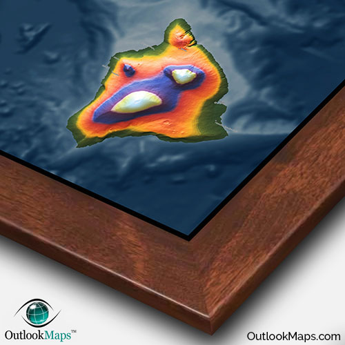
Another aspect of this map which is unique and revealing is the view of the ocean floor around the islands (bathymetry). Coloration is such that the shallow parts of the ocean (parts that immediately surround the islands) are shown with a light blue while deeper parts are shown with a darker blue, with a smooth transition. 3-D shading is also provided of the contours of the ocean floor. This rarely seen view of the islands really illustrates how the base of the islands is actually far below the sea floor, and the islands almost literally shoot up from the otherwise flat ocean bottom.
31 Hawaii cities and towns are labeled on the map.
All major cities like Honolulu, Hilo, Pearl City, Wailuku, Lihue, and East Honolulu are shown.
Some of the medium and smaller towns on the map include Kaneohe, Ewa Gentry, Makakilo, Lahaina, Kalaoa, Holualoa, Napili-Honokowai, Laie, and many others.
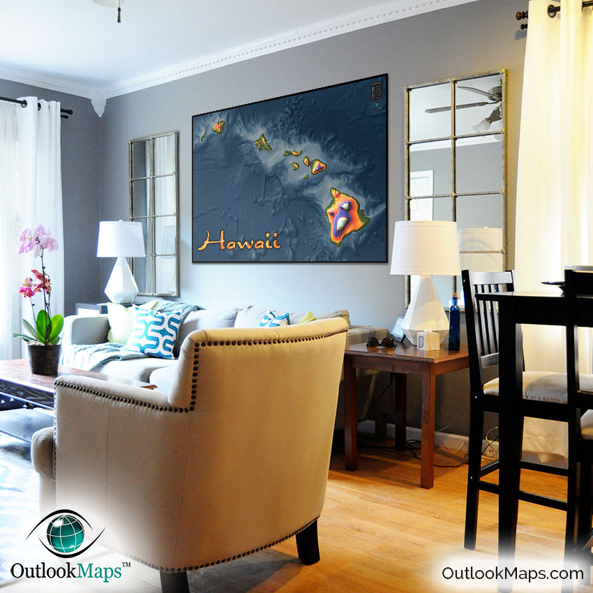
This map is probably the only map available to let you really appreciate the entire Hawaiian Islands, including the part of the islands beneath the sea. The coloration of the land and sea combined with the intense 3-D shading creates one of the most unique and amazing images of Hawaii, almost a surreal appearance. This striking Hawaii map will look absolutely sensational on your wall, and is sure to garner interest and fascination from anyone who sees it. It's an excellent choice for display in your home, office, or especially classrooms to get students excited about Hawaii geography.
In our opinion, a place as wonderful and magical and beautiful as Hawaii (like no place on earth) really needs to be displayed by map unlike any other to give the natural beauty justice...and this Hawaii Topographic Map does exactly that.