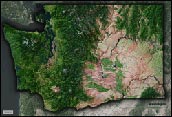
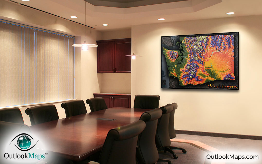
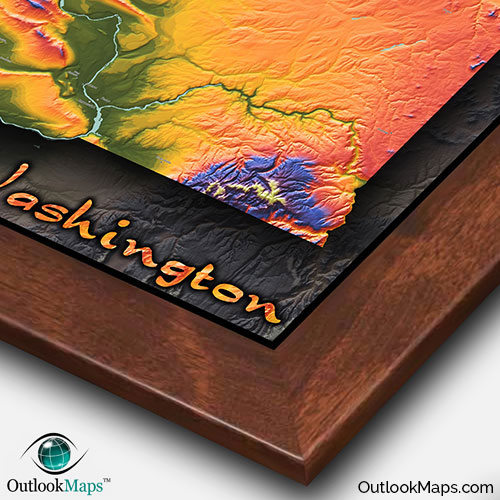
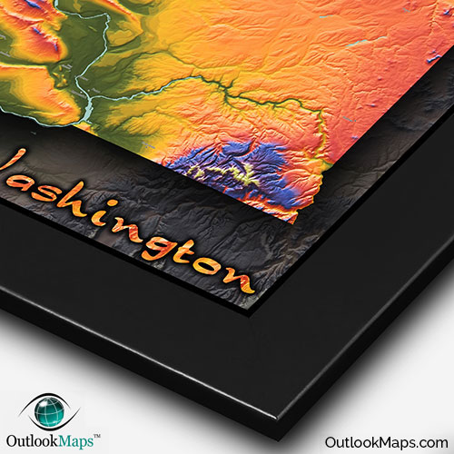
Washington State Topography Wall Map


(Click images to see full-size)
Note: This map is an artistic representation of Washington's terrain. Text labels are intentionally limited.

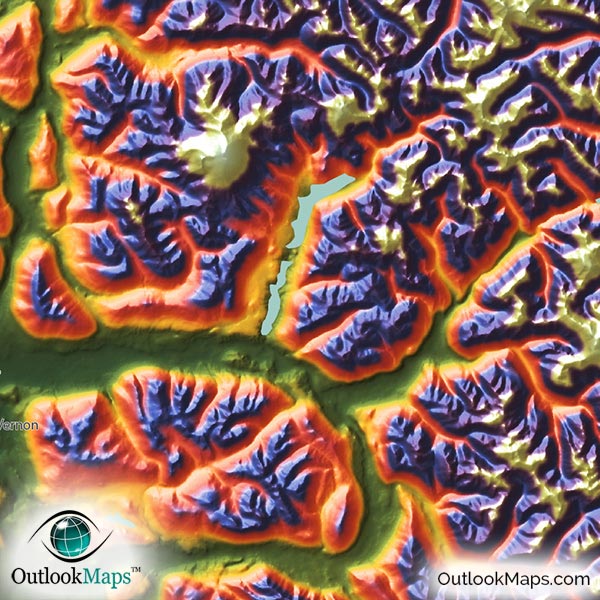
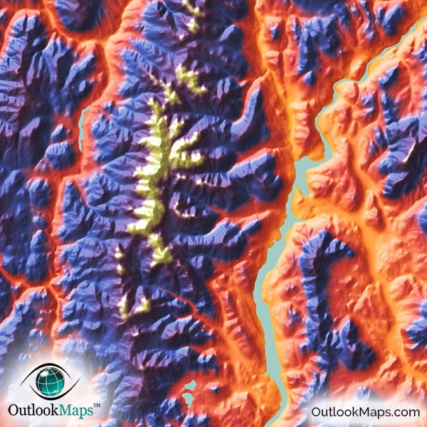
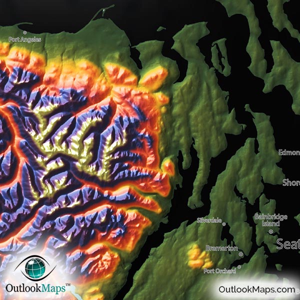
Low elevation is indicated with the color green. In Washington, low elevation lands are primarily in the west due to close proximity of the Pacific Ocean coast. The river valley from the Columbia River across southern Washington and parts of central Washington are also at relatively low elevation. Much of Washington's population lives in this low elevation region, particularly the Seattle metro area near the Puget Sound in northwest Washington.
Mid level elevation lands are shown in warm colors: orange, yellow, and red. In Washington, much of the mid-level elevation is in the east and central portions of the state, especially the broad and flat Columbia River Basin. Spokane, Washington's second largest city, lies in this mid-level elevation.
High elevation land are shown in the colors blue and purple, and the highest mountain peaks are shown in white. High elevation can be found throughout most of the state, but mostly in the Cascade Range which runs north and south through the center of Washington.
Washington's highest point is the peak of Mount Rainier, which reaches a height of 14,417 ft or 4394 meters.
Learn how this Washington topographic image was created with digital elevation data.
The majestic mountain ranges of Washington state are the most prominent features visible in this map. The Cascade range is the most prominent and contains Washington's highest peaks. Other ranges that can clearly be identified are the Coast Ranges and the Olympic Mountains in the west; Okanogan Range, Wenatchee Mountains, and Saddle Mountains in central Washington; and Kettle River Range and the Blue Mountains in the east.
Also, Washington is home to some of the most prominent mountain peaks (which are actually Volcanoes), and they are very easy to find in this map as they stick up much higher than neighboring mountains. Mt. Rainier is the most visible, but additional peaks that can be clearly seen are Mt. Adams and Mt. St. Helens in the south Cascades and Mount Baker and Glacier Peak in the north Cascades.
River valleys from major rivers like the Columbia River, Snake River, and Spokane River are also visible.
This Washington physical map also shows lakes and reservoirs and wide portions of rivers. Potholes Reservoir, Lake Chelan, Banks Lake, and Franklin D. Roosevelt Lake are all shown, along with many smaller lakes and reservoirs, are included in the map.
85 Washington cities and towns are labeled.
Major cities like Seattle, Spokane, Olympia, Tacoma, Vancouver, Everett, and Renton are all shown.
Some of the medium and smaller towns on the map include Bellingham, Mount Vernon, Ellensburg, Federal Way, Marysville, Shoreline, Richland, Edmonds, Longview, Bothell, Issaquah, Des Moines, SeaTac, Mercer Island, Oak Harbor, Moses Lake, Salmon Creek, Camas, Five Corners, Bonney Lake, Aberdeen, Anacortes, East Wenatchee, West Richland, Cheney, as well as many others.

One of the most natural beautiful and diverse places in the world, Washington looks absolutely breathtaking in this map. The vibrant colors and distinct artistic style will have this map turning any wall into a work of art, when on display.
Whether you display it in your home, office, classroom, business, or anywhere else, this Washington topographic physical map is guaranteed to capture attention and inspire curiosity from everyone who sees it.