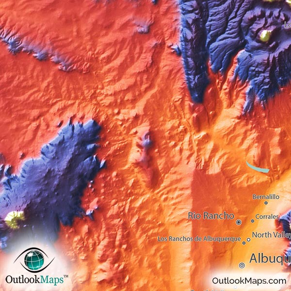
New Mexico Topographical Wall Map


(Click images to see full-size)
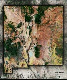
Note: The focus of this map is New Mexico's physical terrain. To maintain the artistic appearance, text labels are minimal.

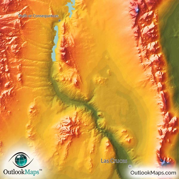
The color green represents the lowest elevation in New Mexico. This includes three New Mexico river valleys: The Pecos River valley in south east New Mexico; The southern part of the Rio Grande which runs through central New Mexico; and the eastern part of the Canadian River as it flows across the border into Texas. The urban areas of Las Cruces and Roswell are both located in these low-elevation areas.
As elevation rises, the colors of the map change to Yellow, Orange, and Red. These mid-elevation levels include most of New Mexico's land in central, northern, and western New Mexico. Unlike many states, New Mexico's most major population center is in this mid-level elevation (usually populations centers are in the lowest parts of states). Albuquerque and the capital city, Santa Fe, are both in this mid-level range.
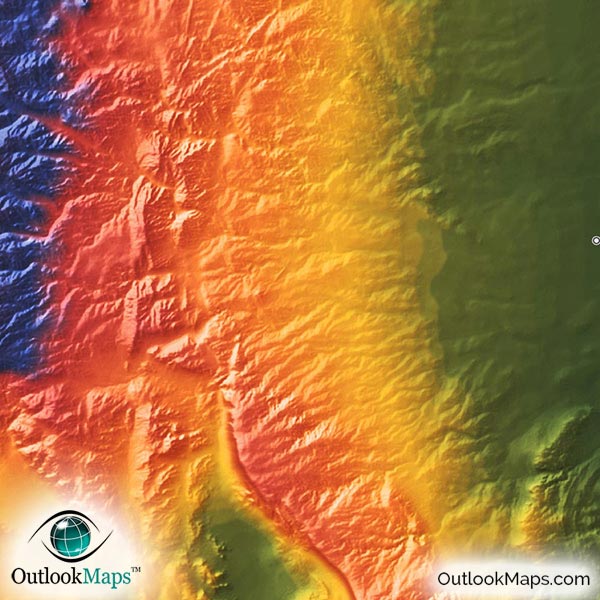
The high lands of New Mexico are shown in blue and purple, with white being used for the highest peaks. High areas (mountains and high plateaus) exist throughout the state, but most prominently in the Sangre De Cristo Mountains, the most southern part of the Rockies, in north central New Mexico. New Mexico's highest point of Wheeler Peak (13,167 ft / 4013 m) is located in these mountains.
Learn how this New Mexico topographic image was created with digital elevation data.
This physical map shows all of New Mexico's many mountains, plateaus, canyons, river valleys, and other unique and interesting landforms.
Specific mountain ranges that can be seen include the Sangre De Cristo Mountains, Magdalena Mountains, Mogollon Mountains, San Andres Mountains, Sacramento Mountains, Capitan Mountains, Zuni Mountains, and the Guadalupe Mountains.
Major rivers in New Mexico can also be seen by the river valleys they carve out of the landscape. The Rio Grande river valley is especially noticeable, as it cuts through the center of New Mexico from north to south.
Major lakes and reservoirs are also shown, including Elephant Butte Reservoir, Conchas Lake, Navajo Reservoir, and several others.
A total of 69 New Mexico cities and towns are labeled.
Major cities like Albuquerque, Santa Fe, Las Cruces, Roswell, Clovis, and Alamogordo are all shown.
Some of the labeled medium and smaller towns include Deming, Farmington, Las Vegas, Lovington, Socorro, Aztec, Tucumcari, Lordsburg, North Valley, Anthony, Bloomfield, Belen, Los Ranchos de Albuquerque, Los Chaves, Rio Communities, Santa Teresa, Edgewood, Chimayo, Ruidoso Downs, Ranchos de Taos, Jal, and many others.

New Mexico's landscape is like none other in the world, and this topographic physical map displays that natural beauty with a completely unique style, sure to look amazing on display.
More than a useful reference map of New Mexico (which it is), this map's main value is from it's gorgeous style. The bright and vibrant color changes, combined with bold 3D shading absolutely brings the terrain to life.
Whether displayed in your home, office, or in a classroom (students will love the colors and cool style), this New Mexico topographic map is guaranteed to awe and impress anyone who views it.