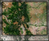
Colorado Topographic Colorful Wall Map


(Click images to see full-size)
Note: To keep an uncluttered and artistic style of Colorado's landscape, minimal text labels are included.

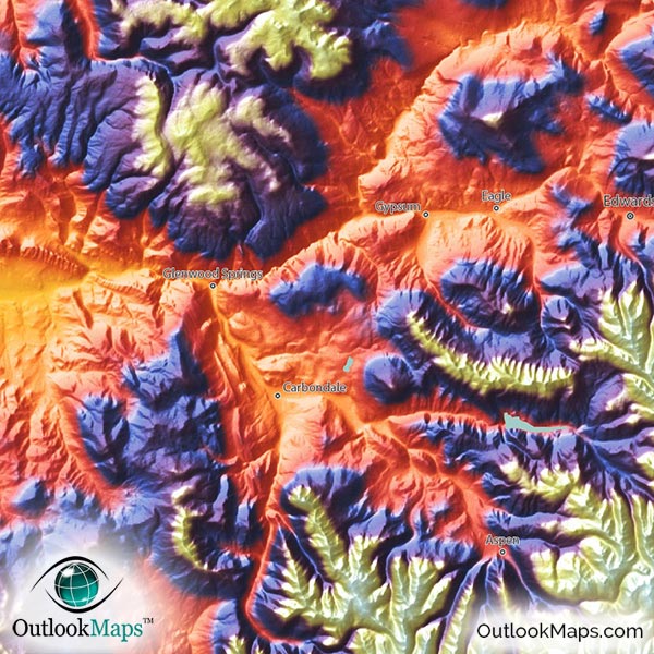
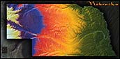
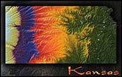
Green represents the lowest elevation in Colorado - mostly the eastern side of the state, especially in the Arkansas River Valley and the South Platte River Valley, but also the Colorado River Valley in the far western side of Colorado.
As elevation increases, colors transition from green to yellow, then to orange, then to a rust color. These mid-elevation lands lie throughout the state in various plateaus and foot hills. Most of Colorado's population lives in this mid-elevation range, including the major cities of Denver, Fort Collins, Colorado Springs, Aurora, and Lakewood, and many others in the greater Denver area.
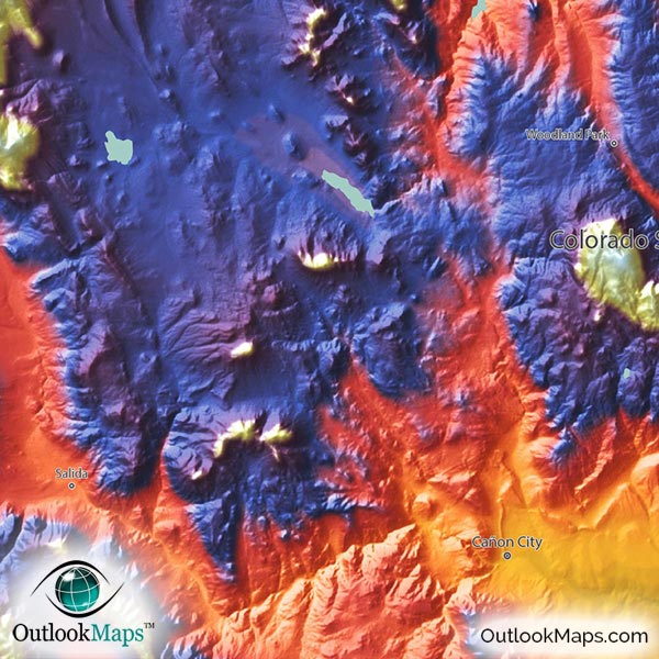
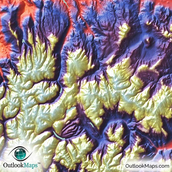
The color then changes to blues and purples in the highest portions, and white at the Rocky Mountains that run from north to south throughout the central and west-central parts of Colorado.
Because Colorado is such a mountainous state, especially the western and central parts, it is a sensational looking image, when displayed with this elevation-colored topographical style. The ruggedness of the Rocky Mountains, plateaus, and interesting landforms really stands out in the map.
Learn how this Colorado topographic image was created with digital elevation data.
Many of Colorado's physical features are very prominently displayed in this map. The most prominent features are the many mountain ranges within the Colorado Rockies, such as the Front Range, Park Range, Sawatch Range, Sangre de Cristo Mountains, and San Juan Mountains. Other physical features like the Roan Plateau, Uncompahgre Plateau, San Luis Valley, Grand Mesa, White River Plateau, and of course the Great Plains in the east are also very visible in the map. Major mountain peaks are also visible, such as Mt Elbert (Colorado's highest point at 14,440 feet or 4401 meters), Pikes Peak, Longs Peak, Mt. Evans, Castle Peak, Mt Wilson, Windom Peak, and San Luis Peak are also visible. The physical map also shows major Colorado Lakes and Reservoirs, such as Blue Mesa Reservoir, John Martin Reservoir, Lake Granby, and many others.
A total of 83 Colorado cities and towns are labeled.
Major cities like Denver, Colorado Springs, Fort Collins, Pueblo, Boulder, Greeley, and Aurora are all shown.
Some of the labeled medium and smaller towns include Arvada, Littleton, Golden, Sterling, Glenwood Springs, Delta, Lamar, Eagle, Centennial, Loveland, Northglenn, Dakota Ridge, Pueblo West, Columbine, Evans, Cimarron Hills, Fruita, Edwards, Gunbarrel, Evergreen, Fruitvale, Gleneagle, Carbondale, Brush, and many others.

As you no doubt already know, Colorado's natural beauty is truly special…if not the most natural beautiful state in the U.S., certainly among the top. Because of the variation of terrain throughout the state, Colorado looks absolutely amazing when displayed in this colorful topographical physical map style. The stylish appearance of the map insures it will look splendid wherever you want to display it: in your home, your place of work, or even get students excited about Colorado's geography by displaying it in a classroom. The map is also useful, as it includes Colorado's towns and cities. But what sets this map apart from all other Colorado maps, is the spectafular appearance: sure to captivate viewers of any age for years to come!