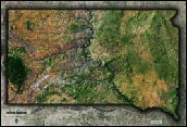
South Dakota Topography Wall Map


(Click images to see full-size)
Note: The focus of this map is South Dakota's physical terrain. To maintain the artistic appearance, text labels are minimal.
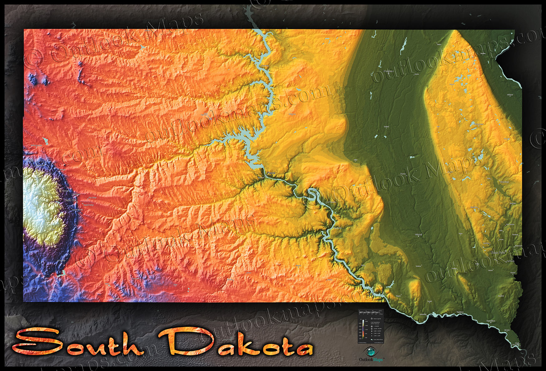
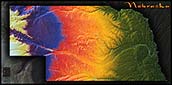
Green represents the lowest elevation in South Dakota. This low-lying land is found in the eastern parts of the state in several areas: The broad and flat James River valley, the lands adjacent to the Missouri River, and both the Southeast and Northeast corners of the state. Sioux Falls, the largest city in South Dakota, lies in this relatively low-elevation level.
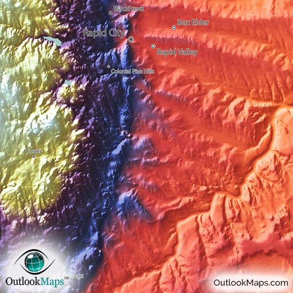
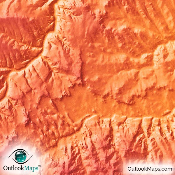
As land becomes more elevated, colors change to warm colors of yellow, orange, and red. Much of South Dakota is shown in this elevation range. In the east, both the Coteau Des Prairies and the Missouri Plateau rise to this mid-elevation level. Furthermore, the Great Plains in western South Dakota also lie in this mid-elevation level, and include the second most populous city, Rapid City.
The major exception to the mid-elevation land in the west is the Black Hills. This small mountain region in the far west sticks out like a sore thumb in the map, as the colors change from warm colors to blue, purple, and white, which indicates the highest elevation of the state. South Dakota's highest point is Harney Peak (7,244 ft / 2208 m). Harney Peak is located in the Black Hills and is the highest point in the United States east of the Rocky Mountains.
Learn how this South Dakota topographic image was created with digital elevation data.
All of South Dakota's main physical features are clearly visible in the map: The Black Hills, Great Plains, Till Plains, Missouri Plateau, and Coteau des Prairies. The rugged and sharp cliffs of the Badlands are also evident in the map.
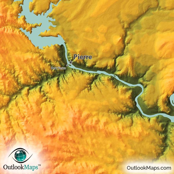
The main rivers are also visible, either by the river itself (which is the case for the Missouri River), or by the valleys carved out by the rivers, like the James River, Big Sioux River, Cheyenne River, and White River.
Lakes and Reservoirs are also shown in the map. The major reservoirs that are dammed portions of the Missouri include Lewis and Clark Lake, Lake Francis Case, Lake Oahe, and Lake Sharpe. Other smaller lakes in Eastern South Dakota are also visible: Lake Traverse, Big Stone Lake, Waubay Lake, and many others.
A total of 73 South Dakota cities and towns are labeled.
Major cities like Sioux Falls, Rapid City, Pierre, Aberdeen, Brookings, Watertown, and Huron are all shown.
Some of the labeled medium and smaller towns include Brandon, Harrisburg, Madison, Milbank, Sisseton, Redfield, Elk Point, Salem, Britton, De Smet, Parker, Pine Ridge, Hartford, North Spearfish, Springfield, Volga, Parkston, Freeman, Fort Thompson, Lemmon, Baltic, as well as many others.

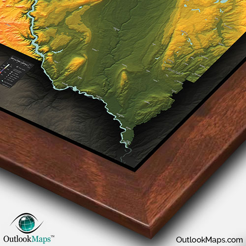
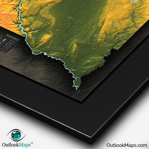
At Outlook Maps, we take pride in designing the most beautiful maps that will make a statement on your wall, and this South Dakota topographic physical map is no exception. The vibrant colors and bold 3D shading almost bring South Dakota's unique terrain to life.
This South Dakota map will look great on any wall: in your home, your place of work, a classroom, or anywhere else you would like to celebrate the natural beauty of South Dakota.
Unlike any other South Dakota map you've ever seen, this topographical physical map is guaranteed to attract attention and inspire curiosity from any viewer, South Dakotan or otherwise.