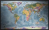
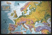
World Natural Environments Physical Map


(Click images to see full-size)
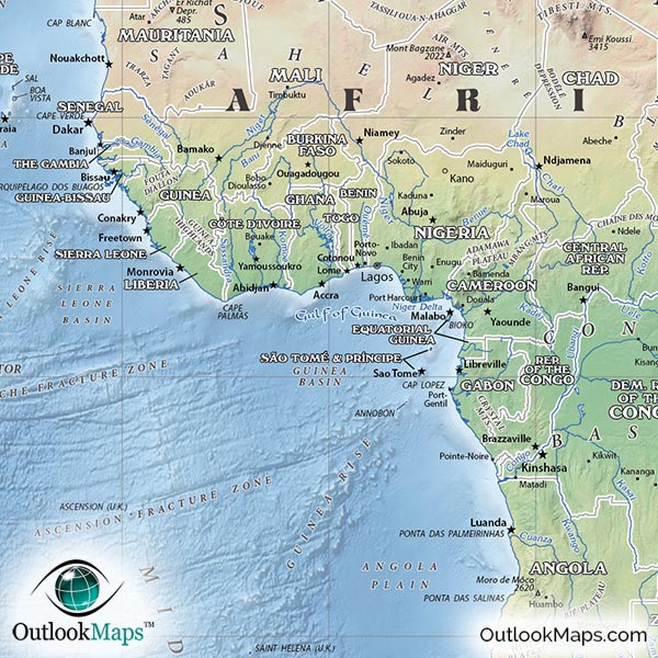
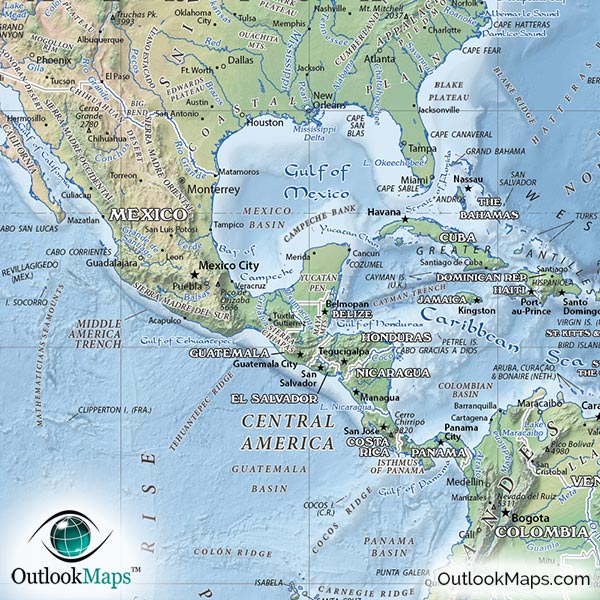
This map combines natural and environmental information with general political information - making it an extremely popular physical world map.
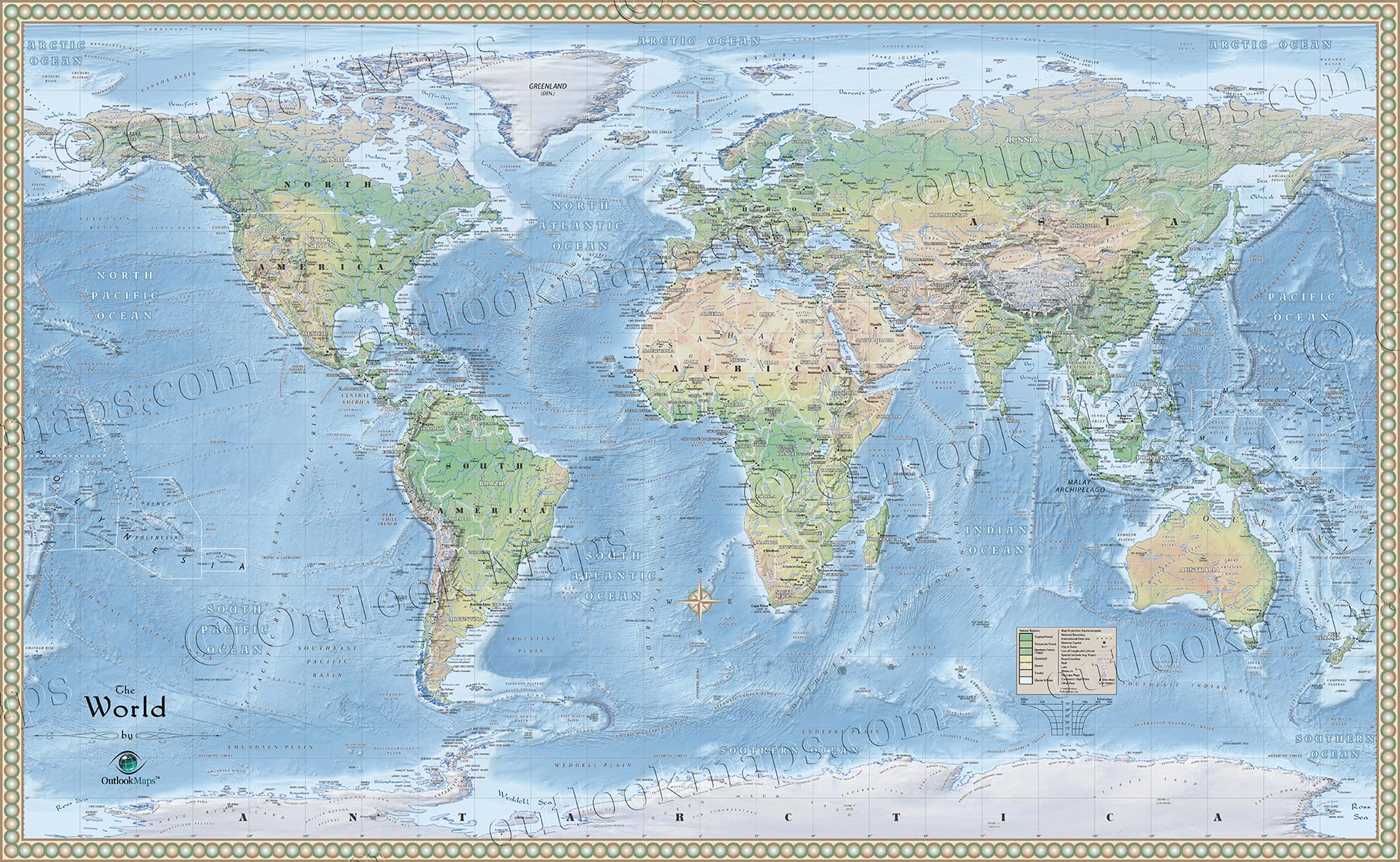
The map uses different colors to represent the following environmental regions of the earth:
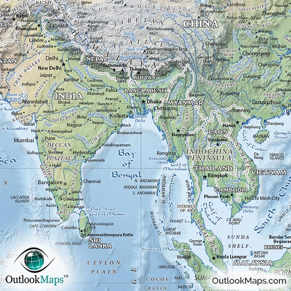
1. Tropical Forests: Tropical forests are lush and densely vegetated areas with high amounts of precipitation. In the physical map, they are colored with a deep green, and found within the tropics (near the equator) in South America, Central Africa, and much of Southeastern Asia.
2. Temperate Forests: Temperate forests exist throughout much of Europe, North America, and portions of Asia and South America. They receive less precipitation with less dense vegetation than Tropical Forests. Temperate Forests are colored slightly lighter green in the map.
3. Northern Forests (Taiga): The Northern forests are coniferous forests that exist in the northern hemisphere in Russia, Northern Europe, and northern parts of North America. These vast forests are colored forest green.
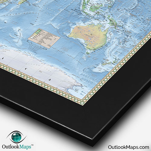
4. Grasslands: All continents (except Antarctica, of course) contain grasslands or prairies, relatively flat and open areas with few trees. The grasslands of the world are colored yellow in the physical map.
5. Deserts: Deserts are mostly characterized by lack of precipitation and often experience high temperatures. Deserts are sparsely vegetated. All continents contain portions of deserts and they are colored a rusty brown in the map.
6. Tundra: Tundra areas are mostly frozen lands with short growing seasons and vegetation limited to grasses and shrubs. Tundra primarily exists in northern edges of Asia, Europe, and North America. Tundra is colored gray in the map.
7. Glaciers and Poles: This region is characterized by permanent snow and ice. The primary location for these icy areas is Antarctica, but glaciers also exist on high elevation mountains throughout the world. They are colored white in the map.
8. Water: All lakes, seas, and oceans are colored with shades of blue in the map, with darker blue used for deep water and lighter blue for shallow water. Additionally, the map shows the terrain of the ocean floor including ridges, plains, basins, and underwater mountains (seamounts).

In addition to the environmental regions shown by color, this physical map also showcases three dimensional shading (called "shaded relief").
This shaded relief helps dramatically to visualize the contours of terrain on the earth. Mountain ranges are especially vivid with the 3D shading, but you'll also be able to easily see other features in the terrain like valleys, plateaus, and flat plains.
The shaded relief was generated digitally from actual elevation data, so the terrain is also perfectly accurate.
This natural physical map makes an excellent reference map.
The map includes many labels of geographic information. Emphasis has been placed on the physical information (mountains, natural features, rivers, lakes, etc.), but the map also includes useful political information including country boundaries, names of all countries, capital cities, and other major cities of the world.
Also, special effort has been made to preserve the natural aspects of earth depicted in this physical map, so the map is uncluttered and very easy to read - making it an especially great learning tool for younger students of geography (or students of any age for that matter).
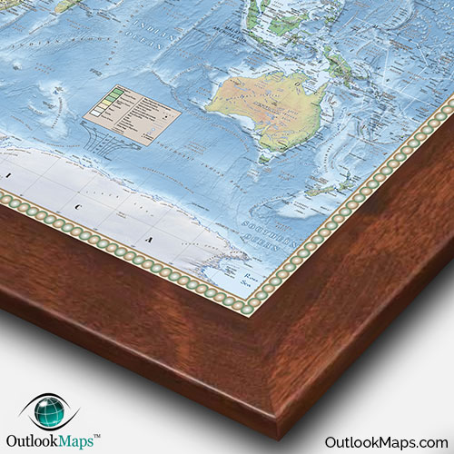
Lastly, this natural physical map of the world's environments makes a wonderful map for display. The coloration of the land and oceans is subtle and attractive and the border around the edge of the map is sophisticated and elegant.
For an even more upscale display, consider having the map mounted and framed. That option, along with other finishing options, is available in the Purchase section of this page.