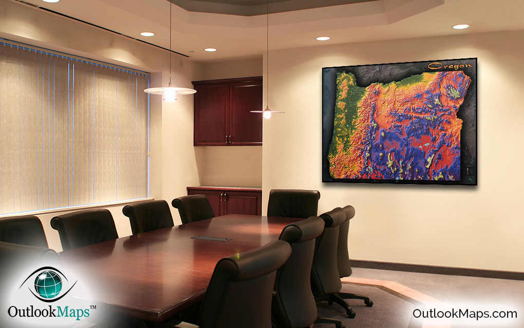
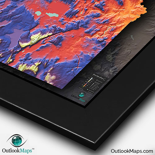
Oregon Colorful Physical Topography Wall Map


(Click images to see full-size)
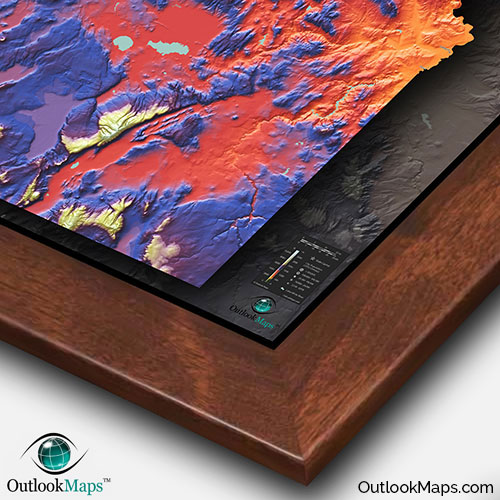
Note: This map is an artistic representation of Oregon's terrain. Text labels are intentionally limited.

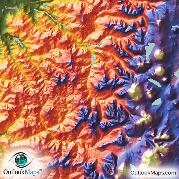
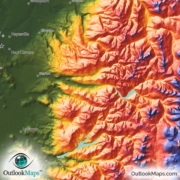
Oregon's lowest elevation is shown in green. This includes the broad and highly populated Willamette Valley, lands adjacent to the Columbia River in the north, and, of course, all coastal land next to the Pacific Ocean in the west. All five of Oregon's most populated cities lie in this low-elevation region: Portland, Eugene, Salem (Oregon's capital), Gresham, and Hillsboro.
Mid level elevation is colored with warm colors: yellow, orange, and red. Much of Oregon's interior land is in the mid-level elevation range. The relatively low elevated Coast Range mountains in western Oregon also fall in this mid-level range.
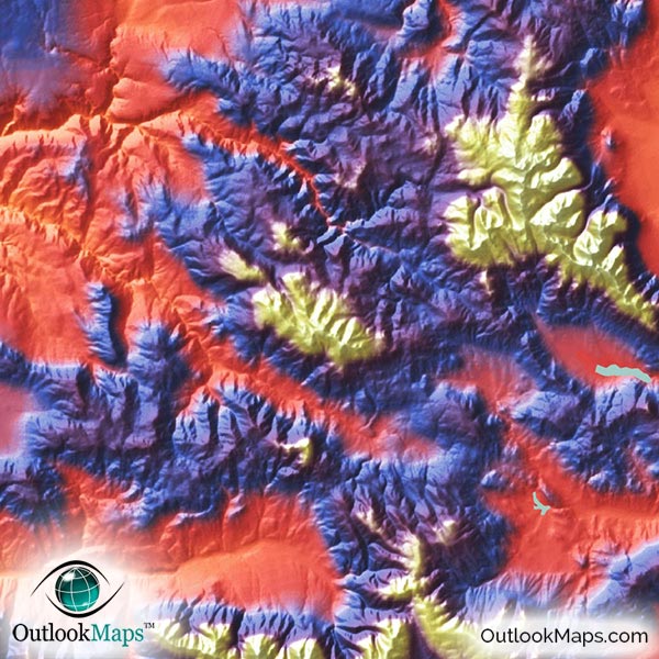
High elevation is indicated with blue and purple, and white is used for Oregon's highest points. Much of the Oregon Outback in southeastern Oregon is in this high area. Many peaks and mountain ranges in the highest range (white color) are scattered throughout the state, including the peaks of the Cascade range, Steens Mountains, Wallowa Mountains, and more.
Oregon's highest point is Mount Hood in northern Oregon. It's elevation reaches 11,249 ft or 3429 meters.
Learn how this Oregon topographic image was created with digital elevation data.
All of Oregon's most prominent mountain ranges and valleys are easily visible within this physical map.
The Cascade Range, Coast Ranges, Columbia Plateau, Blue Mountains, Wallowa Mountains, Great Basin, Klamath Mountains, and Harney Basin are all clearly visible.
Oregon has a number of very prominent peaks that are also very clearly seen. Mount Hood, is probably the most dramatic, but others are also visible, including Mt. Jefferson, Mt. McLoughlin, Three Sisters, and Sacajawea Peak.
Oregon's many lakes are also shown in the map, including Harney Lake, Upper Klamath Lake, Malheur Lake, Goose Lake, Fern Ridge Reservoir, and many others.
Crater Lake is not only visible, but looks absolutely spectacular and extremely unique.
99 Oregon cities and towns are labeled on the map.
All major cities like Portland, Eugene, Salem, Hillsboro, Bend, Medford, and Gresham are shown.
Some of the medium and smaller towns on the map include Aloha, Grants Pass, Roseburg, Dallas, Saint Helens, Astoria, Madras, Burns, Tualatin, Newberg, Ashland, Altamont, Hermiston, Four Corners, Ontario, Sandy, Sweet Home, Florence, Lincoln City, Green, Scappoose, Sheridan, Junction City, Creswell, Philomath, Reedsport, Toledo, Boardman, Three Rivers, Myrtle Point, as well as many others.
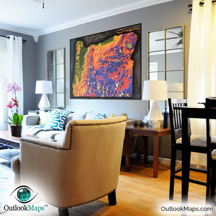
Simply stated, this Oregon map is probably the most unique and gorgeous (if not THE most) maps you'll ever find, and we're certain it will look sensational on any wall. The bold colors and distinctly modern stylish appearance will have everyone who sees this map asking about it.
More than just a useful reference of Oregon's geography and topography, this physical map is a work of art. It's sure to spice up the decor of any home or office, and is an especially cool map to display in a classroom to get students excited about Oregon geography.
Wherever you display it, you can rest assured this map will capture everyone's interest and curiosity.


