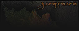
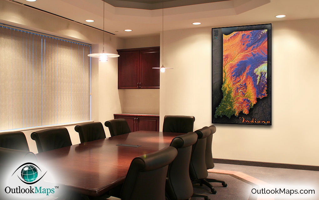
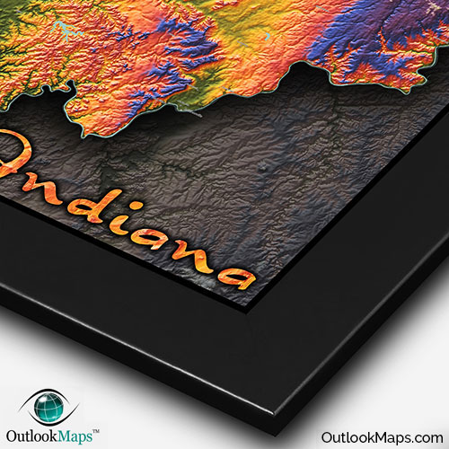
Indiana Topographic Physical State Wall Map


(Click images to see full-size)
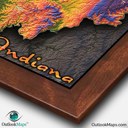
Note: Minimal text labels are included in order to preserve the artistic style of Indiana's terrain.

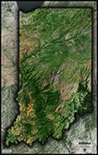
Green represents the lowest elevation. In Indiana, the lowest areas are in the southwest tip, where the Wabash River that makes Indiana's western border meets the Ohio River along it's southern border. The city of Evansville lies in this low elevation part of Indiana.
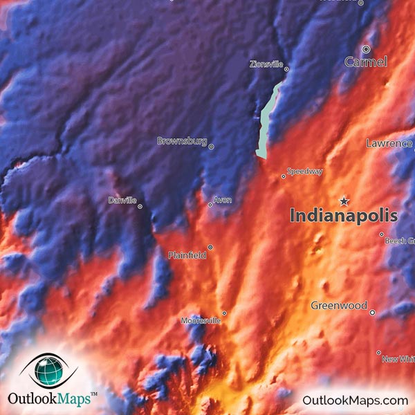
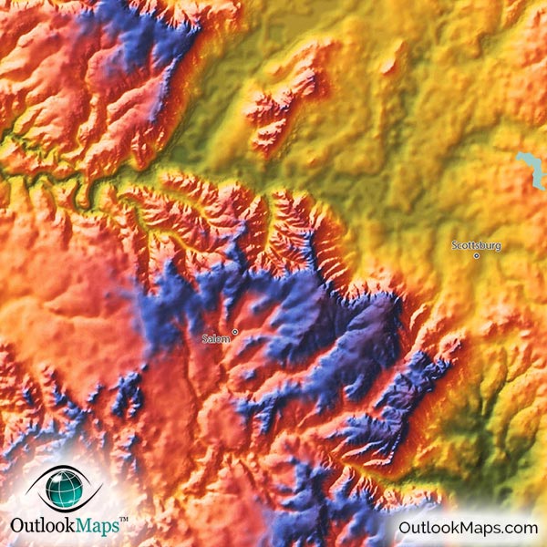
As land elevations rise toward the interior of the state, colors change from green to yellow, then to orange, then to red, which all signify relatively middle-elevation. Indianapolis, Fort Wayne, South Bend, and the population centers in northwest Indiana are all located in this mid-level elevation.
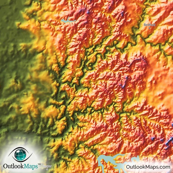
The highest lands are colored with blue and purple, and ultimately white. There are two distinct high areas of Indiana: the northeast corner of the state and the eastern edge of the state along the Ohio border which contains Indiana's highest point, Hoosier Hill at an elevation of 383 meters or 1,257 ft. These two high areas are separated by the Wabash river.
Learn how this Indiana topographic image was created with digital elevation data.
Though Indiana is void of any major mountain ranges, canyons, or other prominent physical features, the map still clearly shows that the Indiana landscape is full of variety and interesting topography: from the rugged hills in the southwest to the higher plains in the east and the numerous river valleys which cut through the landscape.
This topographic map does include Indiana's many lakes and reservoirs. Monroe Reservoir, Morse Reservoir, C.M. Harden Lake, Mississinewa Lake, Salamonie Lake, and Lake Wawasee (among many others) are all shown in the map.
A total of 117 Indiana cities and towns are labeled.
All major cities like Indianapolis, Fort Wayne, Evansville, South Bend, Bloomington, Muncie, Gary, Elkhart, Terre Haute, Kokomo, Richmond, and Goshen are shown.
Some of the labeled medium and smaller towns include Franklin, Shelbyville, New Castle, Crawfordsville, Warsaw, Auburn, Washington, Wabash, Bluffton, Columbia City, Brazil, Mount Vernon, Boonville, Rochester, Tipton, Portage, Granger, West Lafayette, Plainfield, Clarksville, Griffith, Beech Grove, Avon, Kendallville, Lowell, North Vernon, Ellettsville, Sellersburg, Gas City, Linton, Alexandria, as well as many others.

Seeing this map for the first time is no doubt surprising, as the Indiana landscape appears rugged and mountainous, when reality it's mostly comprised of gentle and rolling hills. The coloration of the map produces a striking image, that will no-doubt look great on display. The Indiana map is perfect for adding color and flavor to any decor, whether in your home or place of work. The map is also a great addition to any classroom, as students will surely find the map cool-looking and interest them in the topography and geography of Indiana.
Since the map also includes basic geographic information, such as the location of Indiana towns and cities, it can also used for a general Indiana reference map...though we all know the true value of this map is a spectacular artistic image that will look incredible and capture the amazement of anyone who views it.