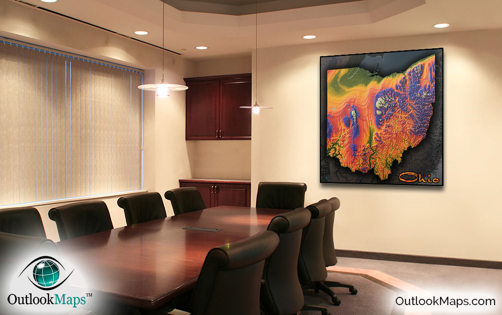
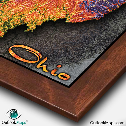
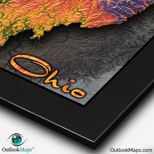
Ohio Colorful Topographic Wall Map


(Click images to see full-size)
Note: To keep an uncluttered and artistic style of Ohio's landscape, minimal text labels are included.

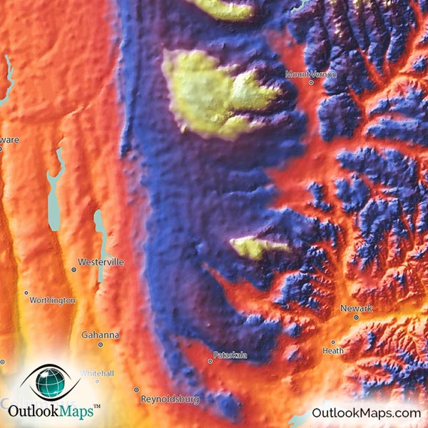
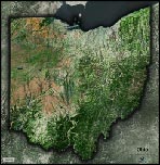
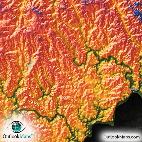
The lowest elevation is colored green. This includes the broad Lake Erie Plains in northern Ohio, the coastal areas around Lake Erie, and the river valleys carved out in southern Ohio by the Ohio River, Scioto River system, and the Great Miami Rivers. Many of Ohio's most populated cities lie in this low-elevation green area, including Cleveland, Cincinnati, and Toledo.
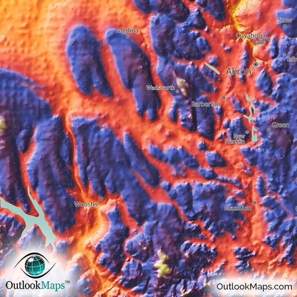
Mid elevation is colored with warmer colors: yellow, orange, and red. The majority of Ohio's land is colored within this range, including Ohio's central area which contains the capital city, Columbus. Akron, which is more inland than Cleveland, also falls in this mid-level elevation range.
The highest parts of Ohio are colored blue, purple, and white (which represents Ohio's highest points). Most of Ohio's highest land lies in the Appalachian Plateaus in eastern Ohio, especially in the Allegheny Plateau in the north-east. However, central Ohio, and even western Ohio also contain some relatively high spots, including Ohio's highest point of Campbell Hill (1,549 ft 472 m) in north central Ohio.
Learn how this Ohio topographic image was created with digital elevation data.
A clear contrast is visible in this Ohio map between the plains in the western and northern parts of Ohio, comprised mostly of agriculture land, and the much more hilly and rugged areas in the south and east.
Many major river valleys can also be clearly seen as they cut across the state mostly flowing south to the great Ohio River along Ohio's southern border, though some smaller rivers, including the Maumee, actually flow toward Lake Erie in the north.
This physical map also shows the many lakes and reservoirs throughout Ohio. From west to east, these lakes include Grand Lake St. Marys, Indian Lake, Rocky Fork Lake, Hoover Reservoir, Dillon Lake, Buckeye Lake, Senecaville Lake, Salt Fork Lake, Dover Lake, Piedmont Lake, Clendening Lake, Tappan Lake, Atwood Lake, Berlin Lake, Mosquito Creek Lake, and Pymatuning Reservoir.
A total of 149 Ohio cities and towns are labeled.
Major cities like Columbus, Cleveland, Cincinnati, Toledo, Akron, Dayton, Hamilton, Mansfield, Findlay, Marion, Parma, and Lakewood are all shown.
Some of the labeled medium and smaller towns include Sandusky, Troy, Chillicothe, Portsmouth, Steubenville, Norwalk, Defiance, Bellefontaine, Wilmington, Ravenna, Van Wert, Cuyahoga Falls, Mentor, Strongsville, Huber Heights, Grove City, Brunswick, Westlake, Massillon, Austintown, Garfield Heights, Barberton, Trotwood, Maple Heights, South Euclid, Wadsworth, Parma Heights, Oregon, Niles, Ashtabula, Forest Park, Whitehall, Springboro, Vandalia, Maumee, Worthington, Fostoria, Dover, as well as many others.
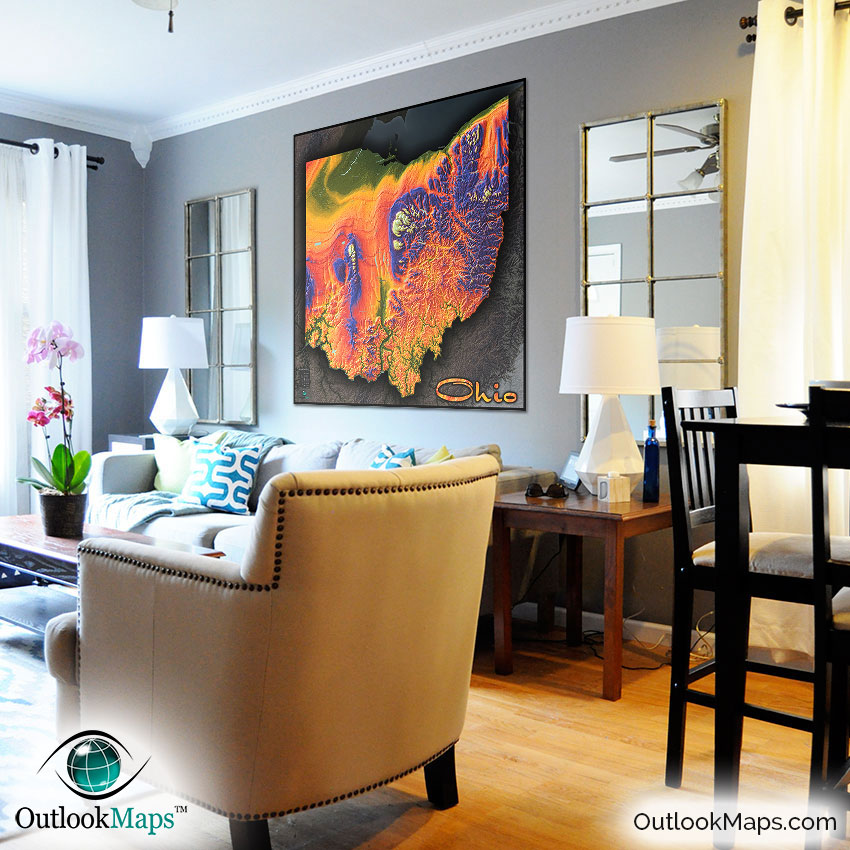
This Ohio topographic map is one of our favorite state physical maps we have created with this colored topographical style. The terrain, especially in the more rugged eastern portions of Ohio looks absolutely breathtaking.
However, even the western flatter parts of the state look interesting, as the layers and ridges carved out by past glaciers is clearly evident.
The main benefit of a map like this, is you get a useful reference of Ohio geography combined with a bold and bright piece of art sure to grab attention. It will look marvelous on display in any home, office, and will especially work well to capture the curiosity of students when displayed in a classroom.
Rest assured that this Ohio physical map is likely the most beautiful and stunning Ohio map you'll ever find.