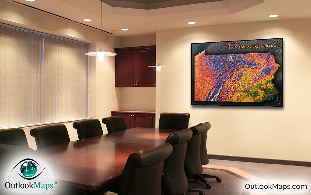
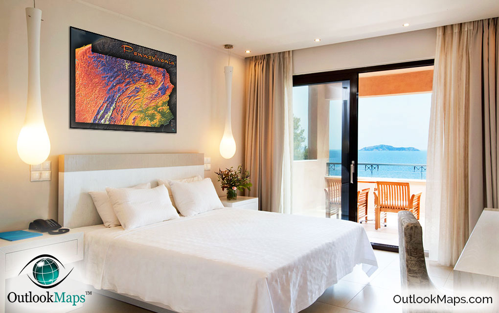
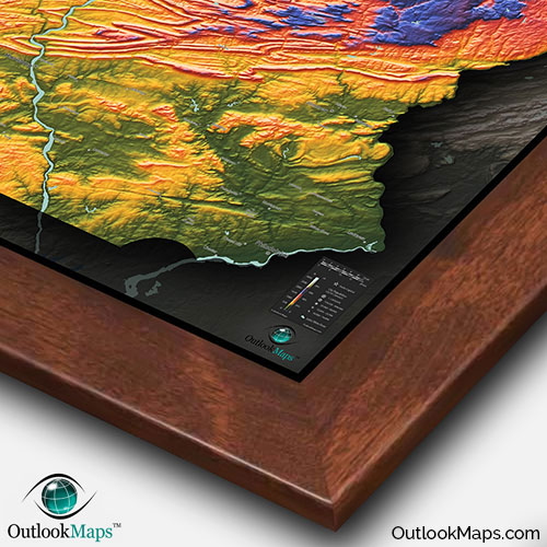
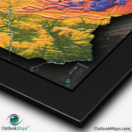
Pennsylvania Topography Features Wall Map


(Click images to see full-size)
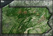
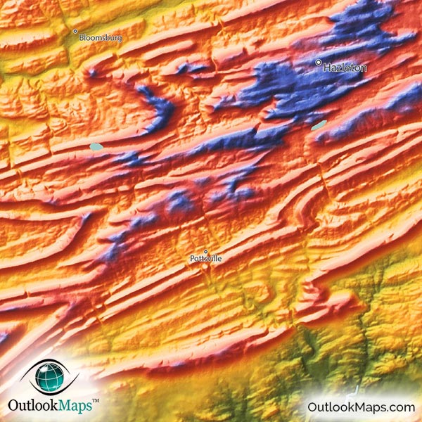
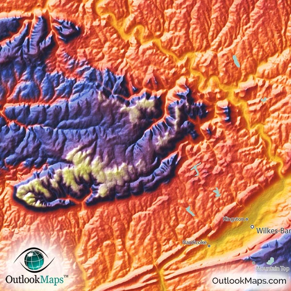
Note: This map is an artistic representation of Pennsylvania's terrain. Text labels are intentionally limited.

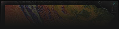
Low elevation in Pennsylvania is shown with the color green. This includes mostly land in southeast Pennsylvania in the valleys of the Delaware River, Susquehanna River, and Schuylkill River. The entire Philadelphia metro area is located in this low-elevation region.
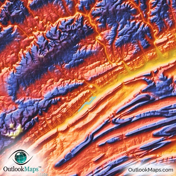
As elevation increases, colors change to yellow, orange, and red. These warm colors, representing mid-level elevation, are found throughout most of Pennsylvania and include most of the Allegheny Plateau in western Pennsylvania including the city of Pittsburgh.
High elevation is colored blue and purple; and white represents the highest elevation. The largest area of high lands is in north central Pennsylvania in the higher parts of the Allegheny Plateau. But the highest lands lie in south central Pennsylvania in the Allegheny Mountains of the greater Appalachian Mountains. Pennsylvania's highest point, Mount Davis (3,213 ft / 979 m) lies in these mountains in southern Pennsylvania.
Learn how this Pennsylvania topographic image was created with digital elevation data.
The most prominent physical feature in this physical map is the Ridge and Valley portions of the Appalachian Mountains across much of southern, central, and eastern Pennsylvania. The long ridges look amazing as the streak across the state.
Other mountain ranges within the Appalachians are also visible, like the Allegheny Mountains, Tuscarora Mountains, Blue Mountains, and the Pokono Mountains.
Throughout the entire state, river valleys can be seen as the rivers meander their way down from the high areas.
The map also shows many of Pennsylvania's lakes and reservoirs, including The Shenango River Lake, Raystown Lake, Pymatuning Reservoir, Tionesta Lake, and Lake Wallenpaupack.
77 Pennsylvania cities and towns are labeled.
Major cities like Philadelphia, Pittsburgh, Harrisburg, Allentown, Erie, Reading, and Bethlehem are all shown.
Some of the medium and smaller towns on the map include State College, Monroeville, Norristown, Lebanon, Carlisle, Bloomsburg, Butler, Uniontown, Hazleton, Johnstown, King of Prussia, Upper Saint Clair, Hermitage, Hanover, Hershey, Franklin Park, Kingston, Saint Marys, Fernway, Shiloh, Waynesboro, Nanticoke, and many others.
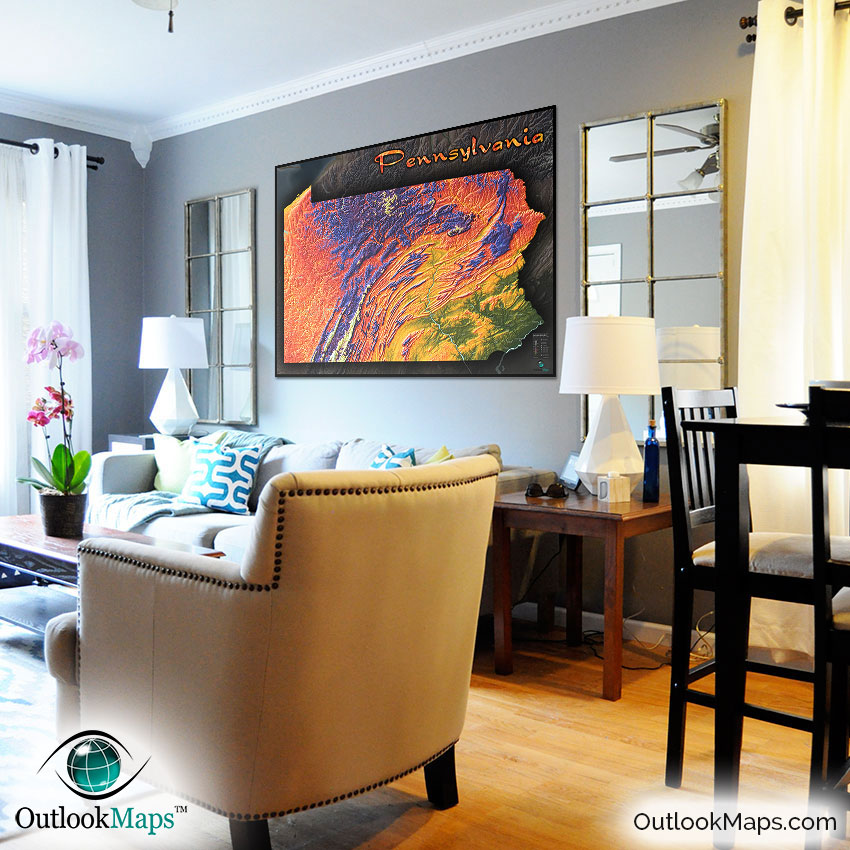
This Pennsylvania physical map is much more than a reference of Pennsylvania topography and geography…it's quite literally a work of art. Bright colors, bold 3D shading, and a sleek stylish appearance insure this map will look gorgeous on display.
Whether you're looking for a colorful decorative piece for your office or home, or you're looking for a cool looking map to display in a classroom and get kids excited about Pennsylvania geography, or even if you just want to celebrate the natural beauty of the Pennsylvania landscape, look no further than this Pennsylvania topographical wall map.