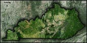
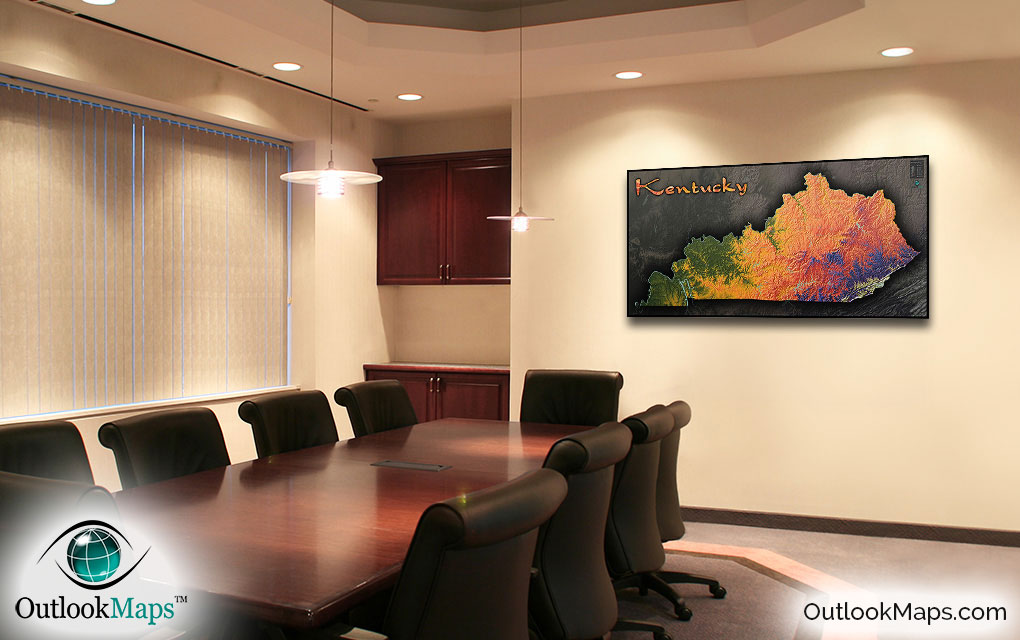
Kentucky Wall Map: Physical Topography


(Click images to see full-size)
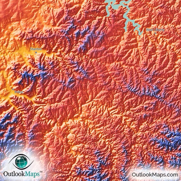
Note: Minimal text labels are included in order to preserve the artistic style of Kentucky's terrain.

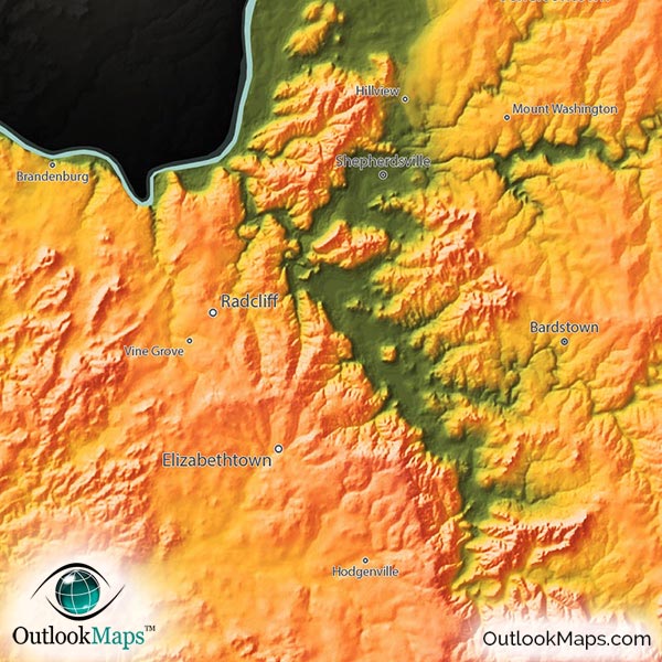
The lowest elevation portions of Kentucky are colored green. This mostly includes the western portions of the state within the Ohio River valley in the north. Major cities of Louisville (Kentucky's largest city) and Owensboro are located in the low elevation areas.
As land elevation increases, colors transition to golden yellow, orange, and red which all represent the mid-level elevation across much of the central parts of Kentucky. Cities located in this mid-elevation range include Lexington, Bowling Green, and Covington.
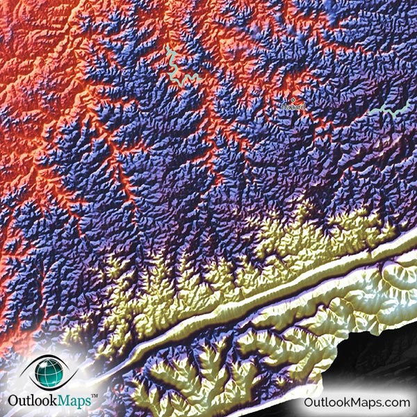
Kentucky's high areas are shown in blue and purple and white. This high portion is mostly comprised of the Appalachian mountains in the southeastern corner of Kentucky, with the highest point being Black Mountain (4,145 ft or 1263 m), just about one mile west of the North Carolina border.
Learn how this Kentucky topographic image was created with digital elevation data.
Known for fertile hills and horse farms, Kentucky's landscape is full of variation and interesting landforms - certainly one of the most interesting states to be viewed in this topographical style. Many mountains, hills, river valleys, and plateaus are clearly visible.
While nearly the entire state is marked with interesting land forms and elevation changes, the eastern portion really stands out, with literally hundreds of steep hills and valleys carving there way across the landscape. Because 3-D shading is applied to the many mountains and hills, the terrain almost looks like crinkled aluminum foil in the map, especially throughout the Cumberland Plateau east of the Appalachians.
Speaking of mountains, the Cumberland Mountains look absolutely amazing as the mountain ridges streak across southeastern Kentucky.
Even though the Mammoth Cave system is underground, the above ground terrain at the Mammoth Cave National Park also looks pretty interesting in the map.
Kentucky's many lakes and reservoirs are also visible in the map, including Lake Barkley and Kentucky Lake (the two largest man-made reservoirs east of the Mississippi River), Lake Cumberland, Green River Reservoir, Barren River Lake, Rough River Lake, and Cave Run Lake.
108 Kentucky cities and towns are labeled on the map.
Major cities like Louisville, Lexington, Frankfort, Bowling Green, Owensboro, Covington, Florence, Ashland, Henderson, and Paducah are all shown.
Some of the labeled medium and smaller towns include Winchester, Burlington, Glasgow, Somerset, Campbellsville, Paris, Harrodsburg, Russellville, Morehead, Princeton, Williamsburg, Benton, Grayson, Stanford, West Liberty, Hodgenville, Stanton, Flemingsburg, Eddyville, Fort Thomas, Lyndon, Oakbrook, Francisville, Corbin, Buckner, Prospect, Vine Grove, Crittenden, Beaver Dam, Calvert City, as well as many others.

One of our favorite states when displayed in this elevation-colored topographical style, Kentucky looks absolutely fascinating in this map. The combination of bright colors, 3-D shading, and really cool Kentucky topography make this map extremely eye-catching and fun to look at. We're sure that you'll enjoy the map as much as we do, and that it will look great on any wall. The wall map is also suitable to be a general Kentucky reference map, because it contains lots of good geographic information of towns and cities, not to mention a very visual depiction of the Kentucky landscape.
Truly a work of art, this Kentucky topographical map is sure to look great and inspire people of all ages, Kentuckian or otherwise, and have you seeing the natural beauty of the great commonwealth of Kentucky as if for the first time!