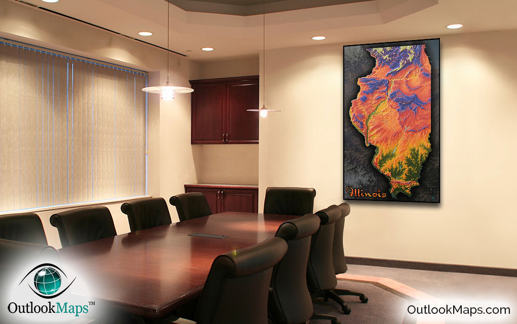
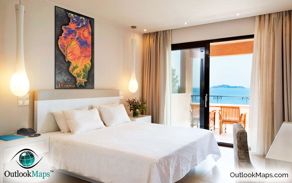
Illinois Topographical State Wall Map


(Click images to see full-size)
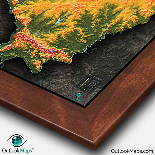
Note: The focus of this map is Illinois's physical terrain. To maintain the artistic appearance, text labels are minimal.
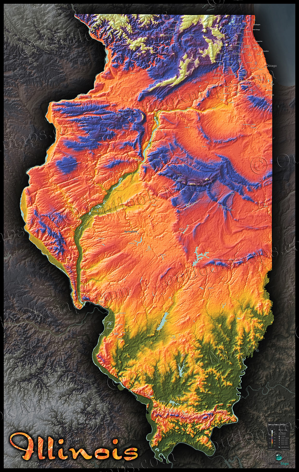
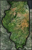
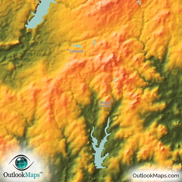
Lowest elevations in Illinois are shown in green. This includes much of southern Illinois, and the various valleys formed by Illinois' many rivers: Mississippi River on the west border, Ohio River on the south border, Wabash River on the east border, and the Illinois River which cuts through the heart of the state.
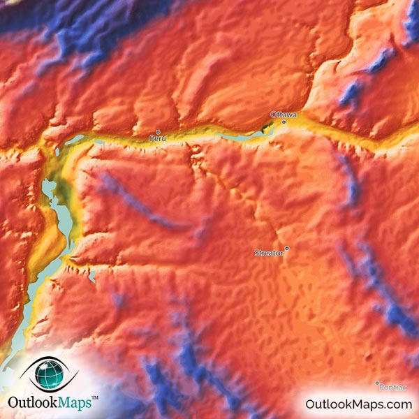
Mid elevation, including the majority of the interior of Illinois is shown with colors ranging from yellow, orange, and red. Most of the Chicago area, including Downtown Chicago, Aurora, Joliet, and Naperville, are located in this mid-level elevation range.
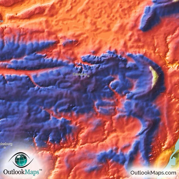
The highest land in Illinois is shown with blues and purples, with whites reserved for the peak elevations. Some blue and purple comes through in central Illinois, while the majority of the high-colors are in Illinois northern parts, especially near the Wisconsin border. Illinois' highest point is Charles Mound (1,235 ft 376 m) which is located in the north west corner of Illinois on the Wisconsin border and also close to Iowa.
Rockford, IL is the largest city located in Illinois' higher elevation lands.
Learn how this Illinois topographic image was created with digital elevation data.
Illinois really doesn't have many mountains to speak of, but that's not to say the topography isn't interesting in this map. In fact, even the flat portions of Illinois actually have interesting elevation contours that look really cool. The various bluffs and hills in the north and the Shawnee National Forest area in the south look especially interesting.
Lakes and reservoirs and wide portions of the major rivers are also shown in the map. Specific lakes included are Fox Lake, Lake Springfield, Lake Shelbyville, Carlyle Lake, and Rend Lake.
A total of 131 Illinois cities and towns are labeled.
All major cities like Chicago, Rockford, Springfield, Joliet, Peoria, Waukegan, Wheaton, Elgin, Arlington Heights, Bolingbrook, Des Plaines, and Quincy are shown.
Some of the medium and smaller towns on the map include Danville, Freeport, Edwardsville, Jacksonville, Sycamore, Dixon, Morris, Taylorville, Oak Lawn, Normal, Downers Grove, DeKalb, Buffalo Grove, Carol Stream, Carpentersville, Northbrook, North Chicago, Oswego, Granite City, Burbank, Round Lake Beach, East Saint Louis, Collinsville, Zion, Machesney Park, East Moline, Lake Zurich, Montgomery, Godfrey, Bradley, Cahokia, Antioch, Rantoul, Herrin, Plano, as well as many others.
Our cartography team was quite stunned when this image of Illinois was produced, as we were expecting the image to appear flat with little elevation change. To our surprise, this map image of Illinois turned out to be one of our favorite states when displayed with this topographic style. The coloration and texture of the plains doesn't appear flat at all, but rugged and harsh, while the hills look like majestic mountains.
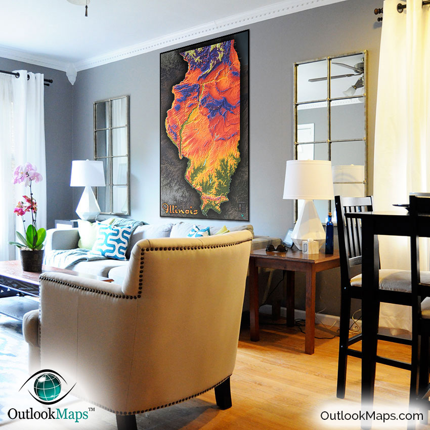
We're sure that you'll find this map to be a stellar addition to any wall. Not only will it provide basic Illinois geographic reference of towns and cities, but the artistic style will bring color and pizzazz to any room. Great for a decorative wall map in an office or Home, but the map also makes a great addition to any classroom as the bright and vivid colors are sure to get students excited about Illinois geography.
Wherever the map ends up being displayed, we're certain it will inspire and interest viewers and help them have a whole new appreciation for the natural beauty of Illinois.