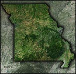
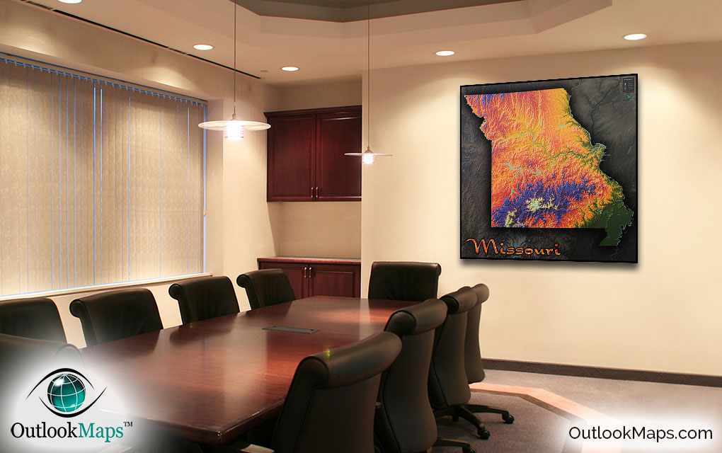
Missouri Colorful Topography Wall Map


(Click images to see full-size)
Note: Minimal text labels are included in order to preserve the artistic style of Missouri's terrain.

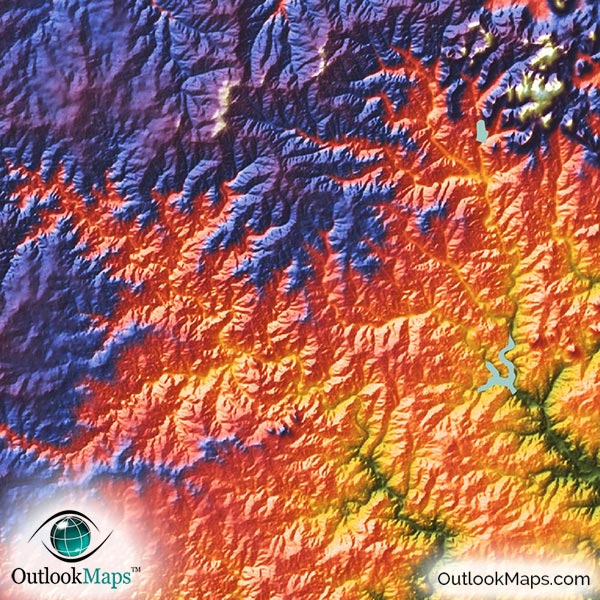
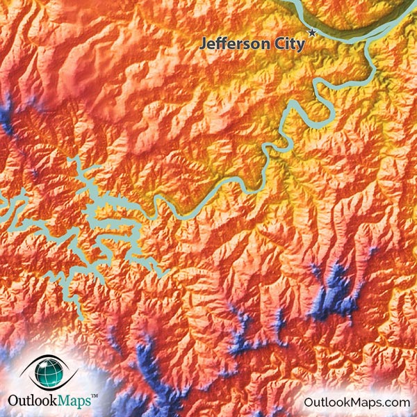
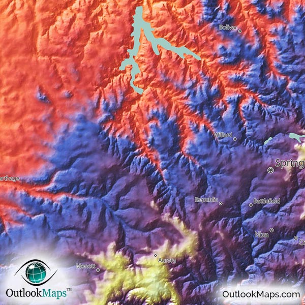
The color coordinates to elevation as follows: green is the lowest elevation, warm colors (yellow, orange, and red) are mid-elevation, and blues and purples are high, with white being the highest elevation.
In Missouri, the lowest elevation is along the Mississippi River, especially in the Mississippi Alluvial Plain in the southeast corner of Missouri. The Missouri River also reaches relative low elevation as it reaches Saint Louis.
The medium elevation levels exist throughout most of central and northern Missouri. Most of the upper part of the Missouri River falls in this mid-level range, as does the Kansas City metro area. Much of this mid-level elevation is composed of plains that extend northward into Iowa and westward into Kansas.
The highest elevation exists in the Ozark Plateau in south-central Missouri, and southwest Missouri along the Arkansas border.
The highest point in Missouri, however, is Taum Sauk Mountain which is located at the eastern edge of the Ozark Plateau, and fairly isolated from much of the rest of Missouri's highest lands. The elevation of Taum Sauk Mountain is 1,772 ft, or 540 meters.
Learn how this Missouri topographic image was created with digital elevation data.
The most visible landforms in this physical map are the river valleys from the Missouri and Mississippi Rivers and the rugged Ozark Plateau, including the Saint Francois Mountains. The rolling Northern Plains are also characterized with many rivers and streams carving out the landscape.
Missouri's bodies of water are also shown in the map. In addition to the major rivers (Mississippi River and Missouri River), lakes and reservoirs can also be viewed. Lake of the Ozarks, Harry S. Truman Reservoir, Stockton Lake, Table Rock Lake, Bull Shoals Lake, Lake Wappepello, Clearwater Lake, Thomas Hill Reservoir, and many others are visible in this physical map.
A total of 103 Missouri cities and towns are labeled.
Major cities like Kansas City, Saint Louis, Jefferson City, Springfield, Independence, Columbia, Liberty, O'Fallon, Rolla, and Kirksville are all shown.
Some of the medium and smaller towns on the map include Clayton, Jackson, West Plains, Mexico, Bolivar, Chillicothe, Boonville, Marshfield, Charleston, Bowling Green, Joplin, Oakville, Ballwin, Mehlville, Hazelwood, Belton, Spanish Lake, Nixa, Republic, Grain Valley, Webb City, Cameron, Smithville, Dexter, Sullivan, De Soto, Parkville, Willard, as well as many others.
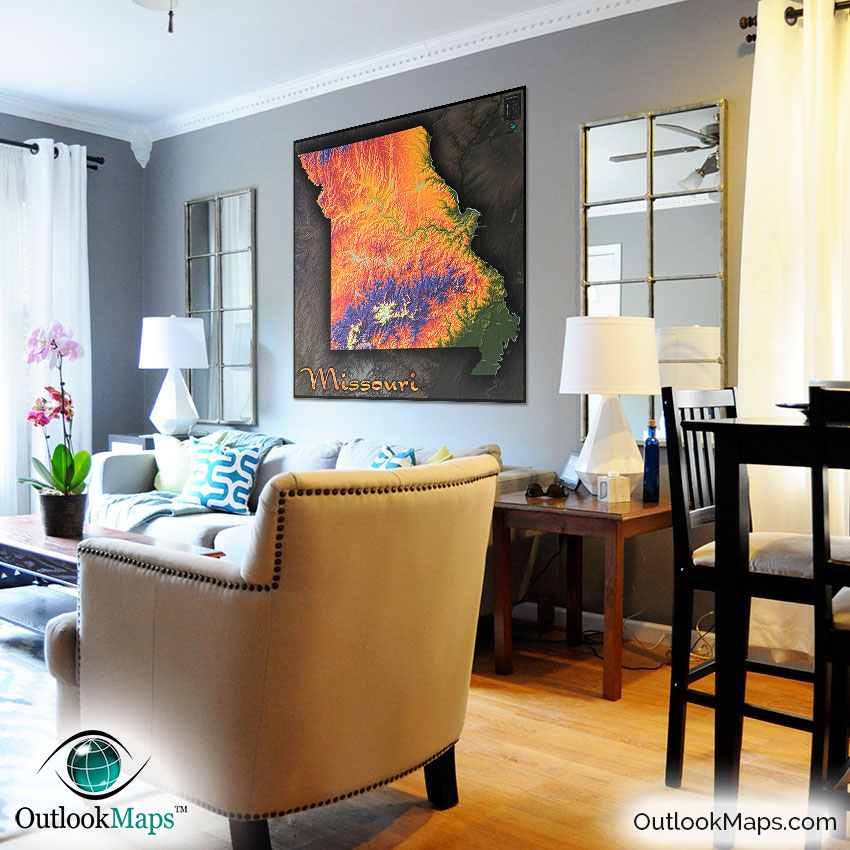
Even though we've produced many topographical maps, even we were impressed with how interesting the Missouri landscape came out in this map. The Ozark area looks absolutely magnificent, and even the other flatter portions of Missouri still look interesting and full of elevation changes and landforms.
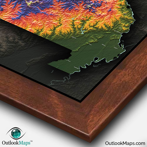
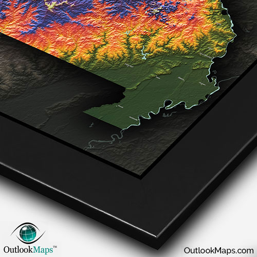
The bold colors and 3-D shading help to give the map a "wow factor", certain to draw attention when displayed on any wall. The Missouri physical map will look great in your home, place of work, and especially a classroom as the bright colors and cool style are bound to draw the liking from children (or students of any age).
This map not only provides a useful geography reference for Missouri, but also serves as a decorative work of art.