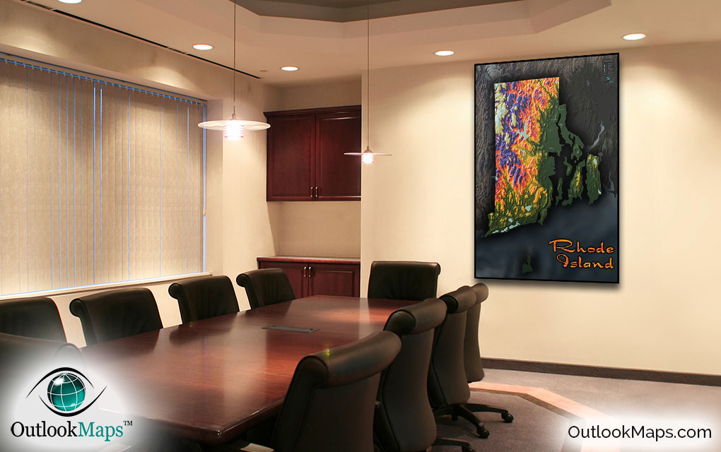
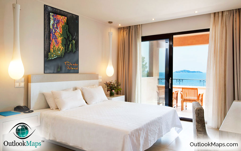
Rhode Island Topography Wall Map


(Click images to see full-size)
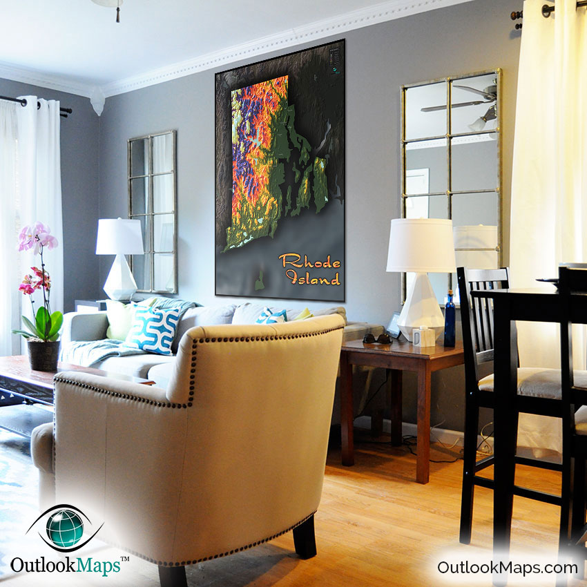
Note: Minimal text labels are included in order to preserve the artistic style of Rhode Island's terrain.
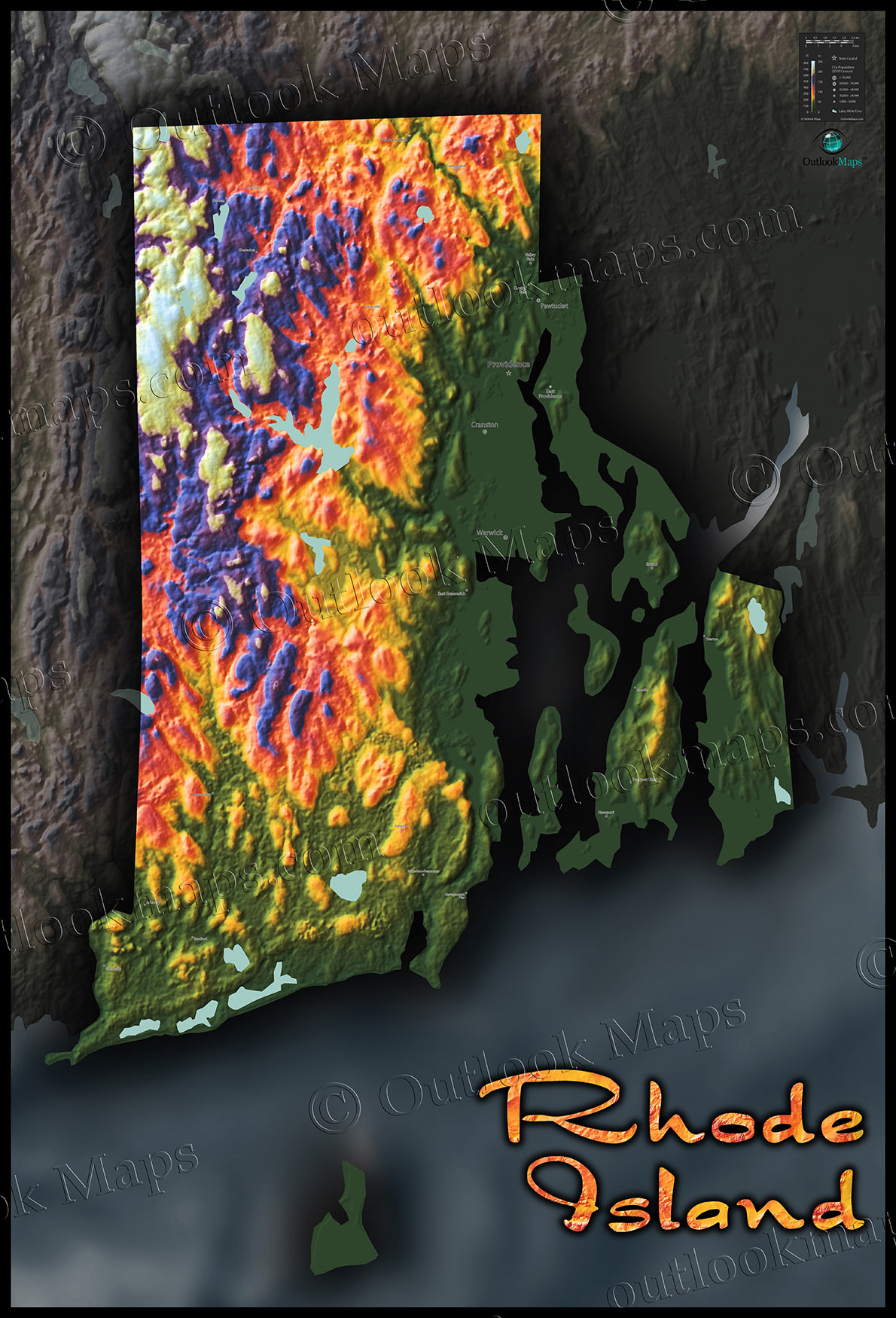
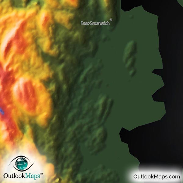
Low elevation is represented by green color land. In Rhode Island, the lowest elevation is obviously along the many coastal lands, including land adjacent to Narragansett Bay. The five most populated cities in Rhode Island all fall in this low-elevation region: Providence, Warwick, Cranston, Pawtucket, and East Providence.
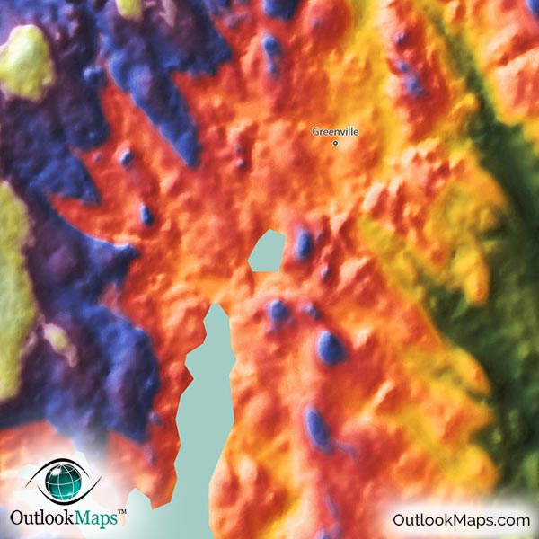
Mid-level elevation is colored orange, yellow, and red. Much of central Rhode Island falls in this mid-elevation range.
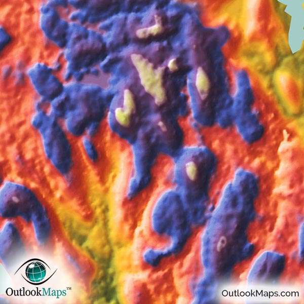
High elevation is colored blue and purple, and white is used to represent the highest points. Rhode Island's highest elevation is all found in the northwest corner, along the Connecticut and Massachusetts borders. The highest point in Rhode Island is Jerimoth Hill, close to the Connecticut border, with an elevation of 811 feet (247 meters).
Learn how this Rhode Island topographic image was created with digital elevation data.
Being the smallest state in the United States, Rhode Island lacks many of the prominent physical features found in other states. That doesn't mean the topography is boring, by any means. The hilly and elevated lands in the northwest are very prominently displayed and visible in this map, and are a stark contrast to the low-lying coastal flat areas that hold much of the state's population.
The many islands along Rhode Island's coast are also shown, including Aquidneck Island (the largest), Conanicut, and Prudence. Block Island, which lies several miles south of the mainland Rhode Island, is also included in the map.
The map also shows lakes and reservoirs of Rhode Island, including Scituate Reservoir, Great Swamp, Watchaug Pond, Ninigret Pong, and many others.
A total of 26 Rhode Island cities and towns are labeled.
All major cities like Providence, Newport, Bristol, Warwick, Cranston, and Pawtucket are shown.
Some of the labeled medium and smaller towns include Wakefield-Peacedale, Westerly, Greenville, Kingston, Chepachet, Ashaway, as well as many others.
The colors and style of this map ensure it will look spectacular when on display on any wall. It will make a fine artistic addition to any house or office, and makes an especially interesting map to display in a classroom to get kids excited about geography.
Serving as both a useful reference of Rhode Island geography and a stylish piece of art, this colorful Rhode Island topographical physical map is a must have for any Rhode Island map enthusiast.


