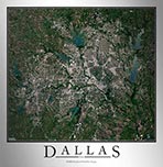
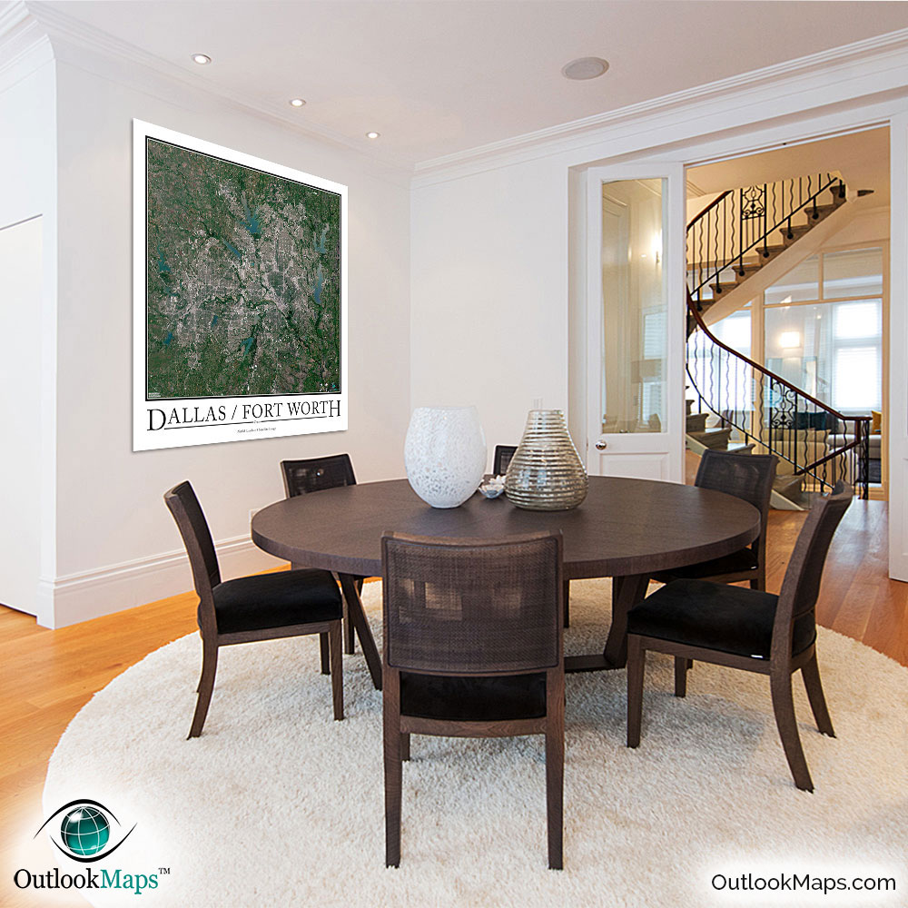
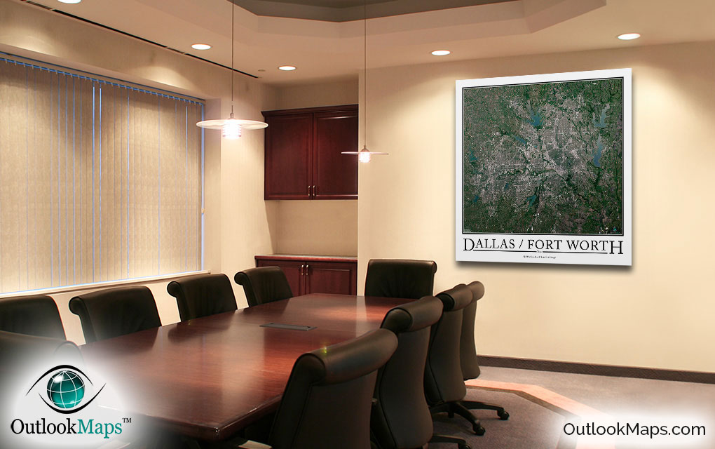
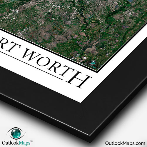
Dallas / Ft. Worth Aerial Satellite Map Poster

An aerial view of the Dallas-Ft. Worth area taken by NASA satellites. The image is current, high-detailed, and makes a gorgeous poster for display.

Features

  • NASA Landsat 8 Image
  • Current Image
  • High Resolution: 1 pixel = 15 meters
  • Month of Image: May
  • Minimal to No Cloud Cover
  • No Text Labels
  • Either White or Black Background
  • Includes Entire Dallas-Ft. Worth Area
  • Stylish Poster Layout - Looks great framed

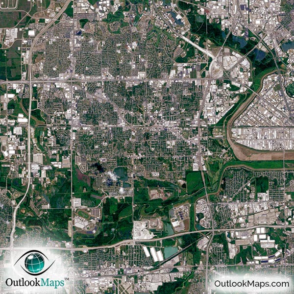
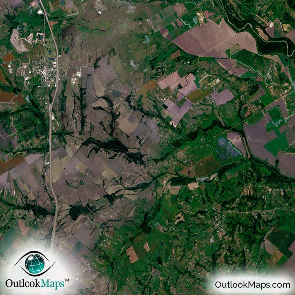
This satellite print of the Dallas-Ft. Worth area does not include any additional text or line layers - it is a clean and uncluttered image of Dallas as seen from Space.

Product Information

Map Name:
Model Number:
DALFW991
Product Image:
DALFW991 - Dallas Fort Worth Satellite Map
Map Type:
Wall Map (not folded)
Description:
High resolution print of Dallas-Fort Worth satellite Image. Poster can be laminated, mounted, and framed. Aerial image taken from NASA Landsat 8 Satellites.
Publisher/Brand:
Outlook Maps
Price:
starting at $19
Availability:
In Stock

What's Visible in the Satellite Image?

Dallas Ft Worth Aerial Map Detail

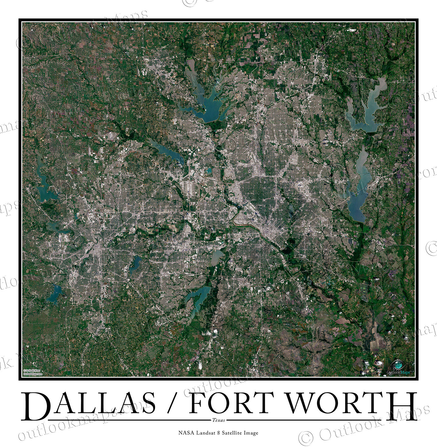
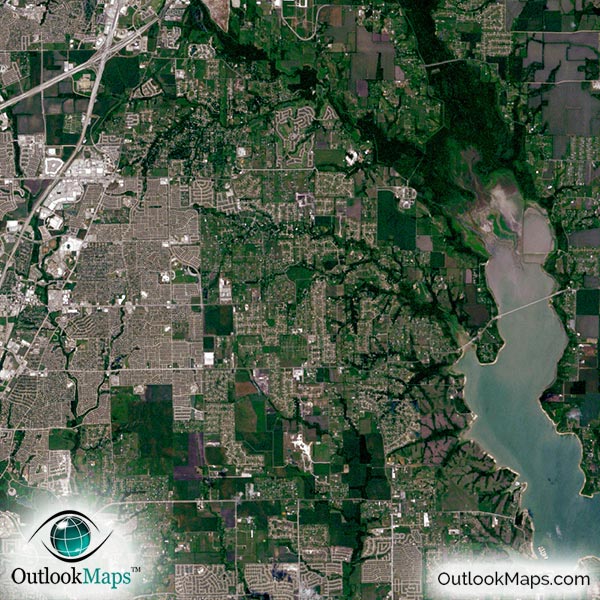
Since this satellite map is so detailed (one pixel represents just 15 meters), you'll be able to see a whole host of details in the print: roads, ponds, large buildings, parks, neighborhoods, and more.

Some specific Dallas landmarks and attractions that you can see in this map include Six Flags, Dallas Zoo, AT&T Stadium (Cowboys Stadium), Ft. Worth Zoo, the Cotton Bowl, and many others.

You'll also find numerous airports, including Dallas/Fort Worth International, Love Field, and Dallas Executive Airport.

Several universities campuses are also visible, including Southern Methodist University, UT at Dallas, University of North Texas, and Texas Christian University.

Dallas is home to many large buildings and skyscrapers that are visible in this map: Bank of America Building, Renaissance Tower, Comerica Bank Tower, JPMorgan Chase Tower, Fountain Place, and the Trammell Crow Center.

Satellite Map for Decoration

Dallas Ft Worth Aerial Map as Home Decor

This Dallas-Fort Worth satellite map is styled with the classic poster appearance - a tasteful border around the map and the classic text used for the name "DALLAS / FORT WORTH". The print is also available with the text DALLAS.

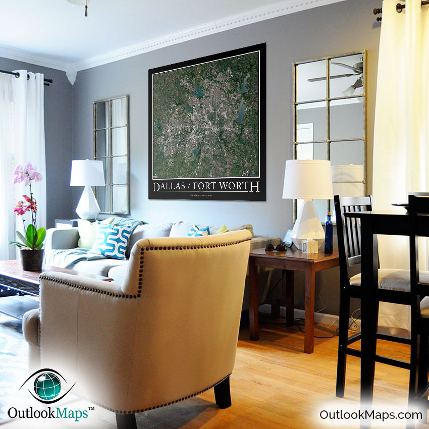
With such a high-detailed image, it can be printed up to huge sizes and still look crisp and sharp.

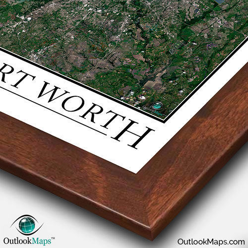
We also offer framing of the image, making at a perfect piece to display on your home or office wall for either functional use or an artistic decoration, or likely both!

Purchase


product ordering options image
Large - 36.0 in. x 36.9 in. (standard)
$49
$69
$79
$149
$249
Small - 16.4 in. x 16.8 in.
$19
$25
$29
$49
$79
Medium - 25.8 in. x 26.5 in.
$29
$39
$49
$89
$149
Huge - 48.0 in. x 49.2 in.
$99
$129
$159
$649
$849
Mural - 60.0 in. x 61.5 in.
$199
$249
$279

Frame Options

Map Frame Styles: Canadian Walnut, Black Wood, Birch, Old World Silver, and Brushed Aluminum


Other City Maps

Aerial Image Satellite Map of Dallas Area Poster
Dallas Satellite Map

Starting at $19
Aerial Image Satellite Map of Houston Area Poster
Houston Satellite Map

Starting at $19
Aerial Image Satellite Map of Chicago Area Poster
Chicago Satellite Map

Starting at $19
All City Maps

Other Satellite Image Maps

Satellite Image Map of the World
World Satellite Map

Starting at $29
All Satellite Image Maps

Further Questions?

Don't worry, we're here to help!

>> contact us

Customer Reviews

>> Back to Top