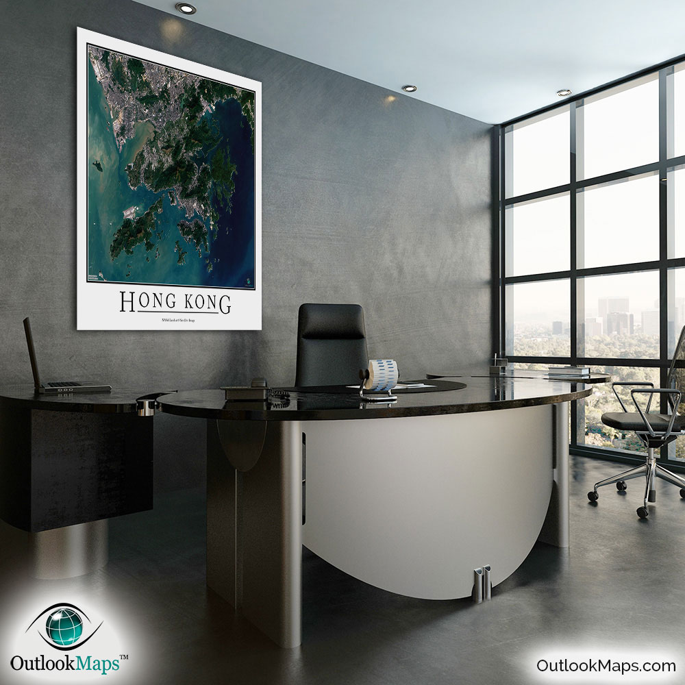
Hong Kong Aerial Satellite Map Poster


(Click images to see full-size)
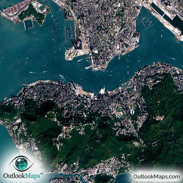
This satellite print of the Hong Kong area does not include any additional text or line layers - it is a clean and uncluttered image of Hong Kong as seen from space.
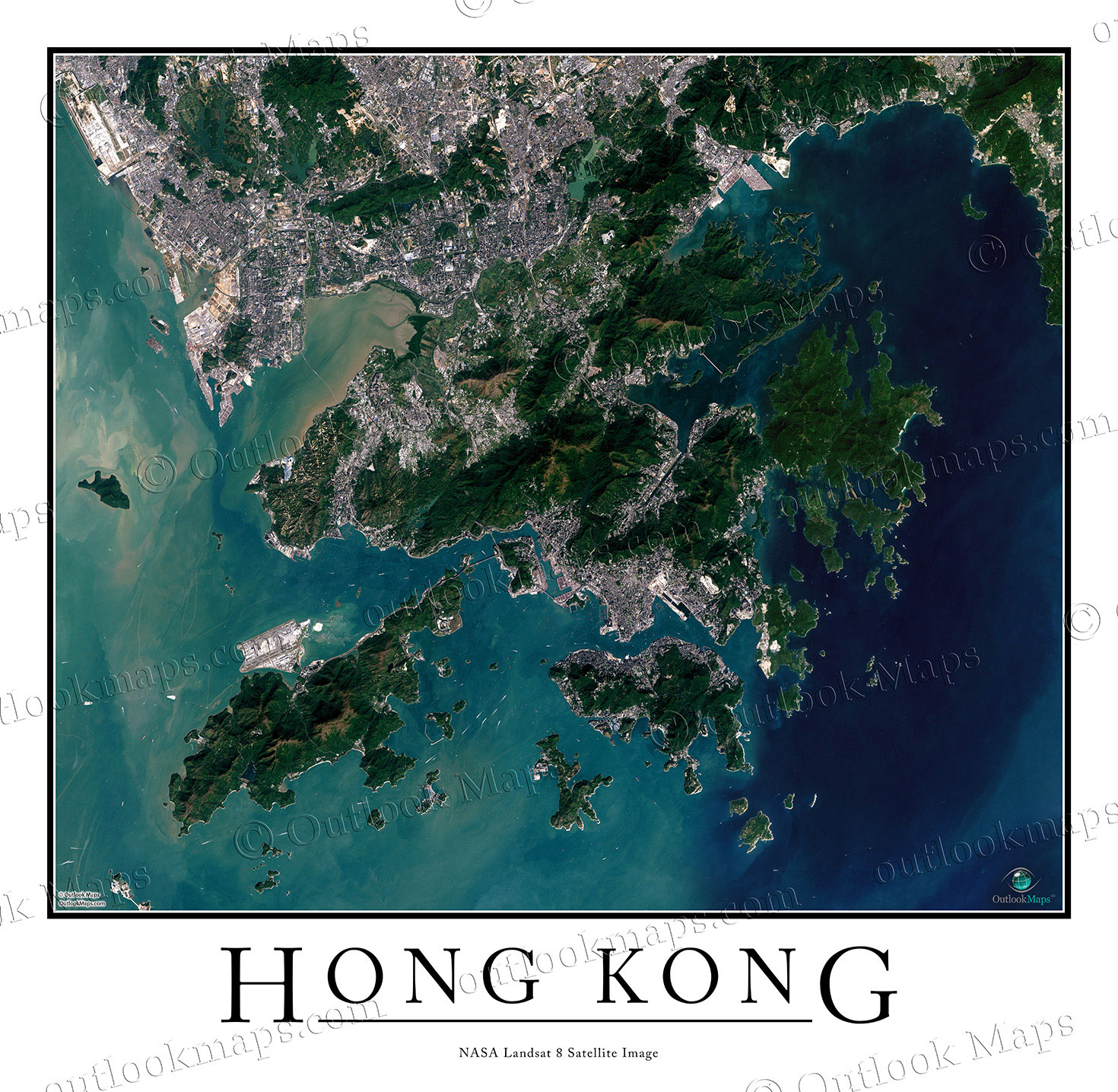
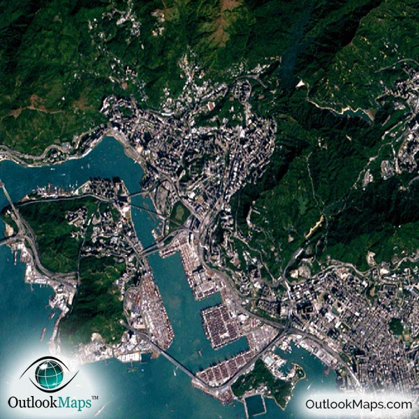
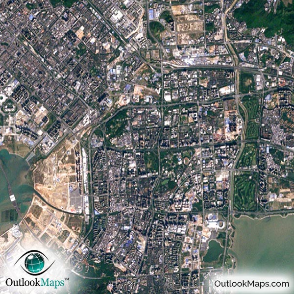
This image includes the entire Hong Kong Special Administrative Region. Neighboring portions of Shenzhen, Bao'an, and Yantian are also shown. All areas within the Hong Kong SAR, including the New Territories, Kowloon, Hong Kong Island, and Lantau Island are included in the aerial map.
The native resolution of the satellite imagery is 1 px = about 15 meters, which is detailed enough to see large buildings, parks, neighborhoods, major streets, golf courses, and many other features of the city.
Both the Hong Kong International Airport and Shenzhen Bao'an International Airport are shown.
Hong Kong has a greater concentration of skyscrapers than any city in the world, and those skyscrapers are all visible in this satellite image. The most famous skyscrapers are International Commerce Centre, Two International Finance Centre, Central Plaza, Bank of China Tower, and HSBS Tower.
Other sites you can see are Harbour City, Hong Kong Stadium, Victoria Harbour, University of Hong Kong, Ocean Park, and Hong Kong Disneyland.
Hong Kong's many islands and natural areas are also clearly shown in the image. The forested and rugged areas make up a majority of the Hong Kong area.
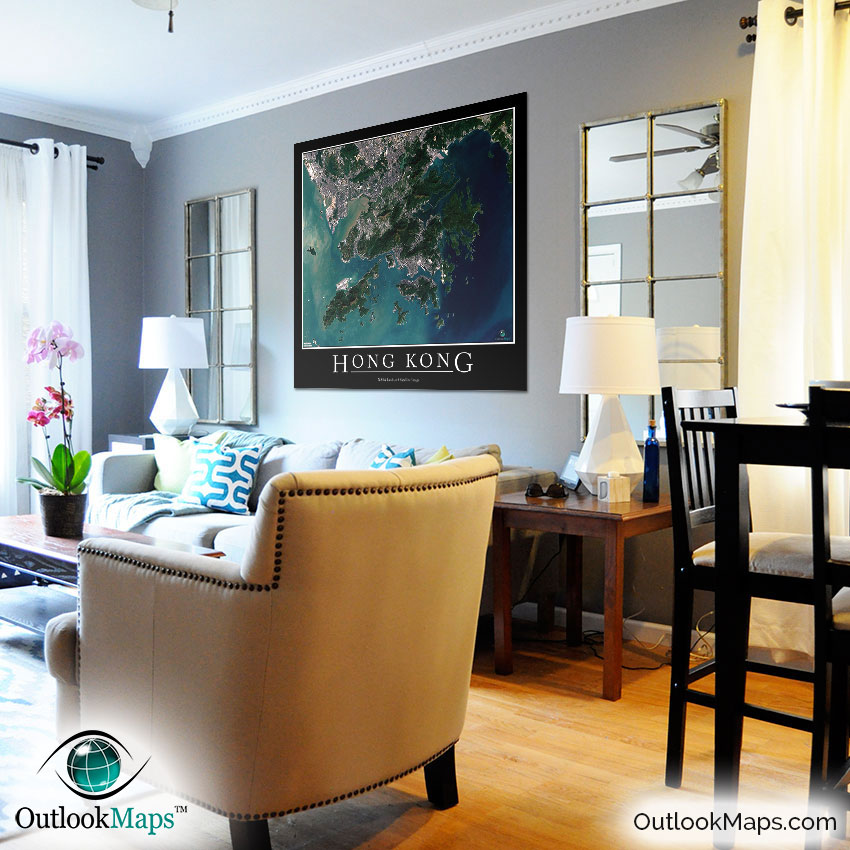
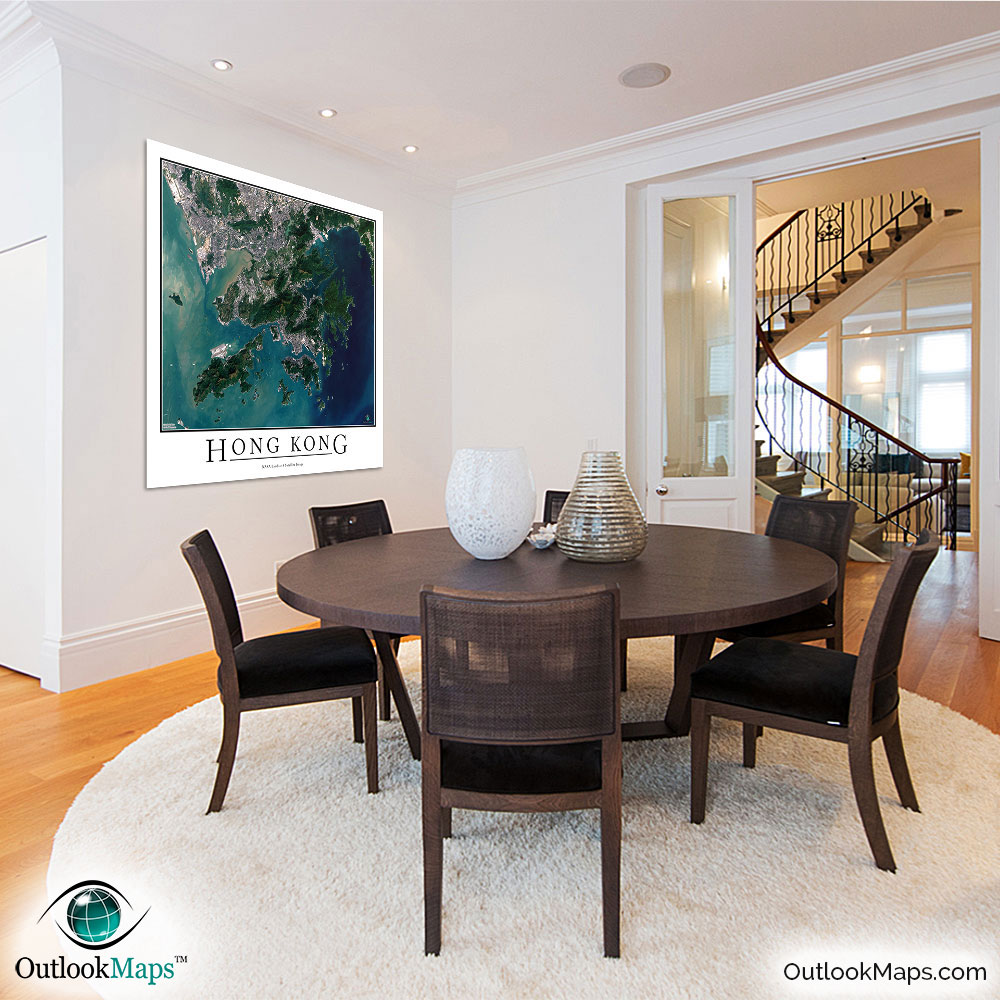
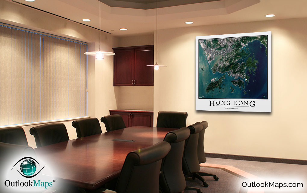
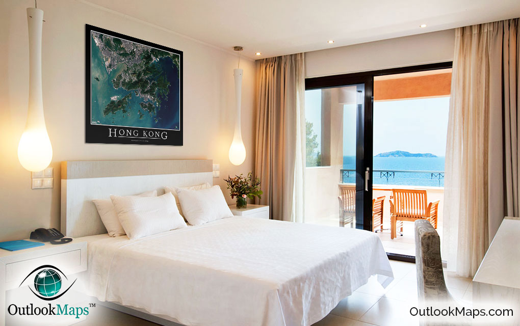
This Hong Kong satellite map is styled with a classic poster appearance - a tasteful border around the map and the title ''HONG KONG'' printed at the bottom with traditional poster font. The print is available with either a white or black background.
The aerial image is detailed enough to look crisp and sharp even when printed at large sizes.
We also offer several framing options, making the map a perfect piece to display on your home, office, or business wall for both functional use and artistic decoration.