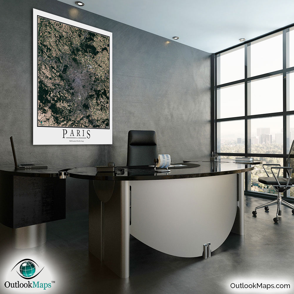
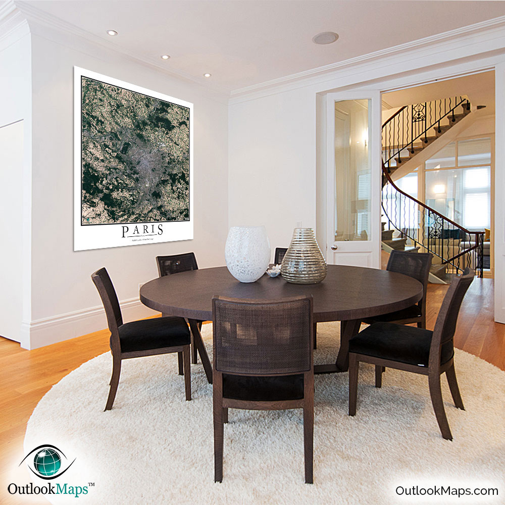
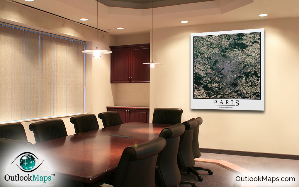
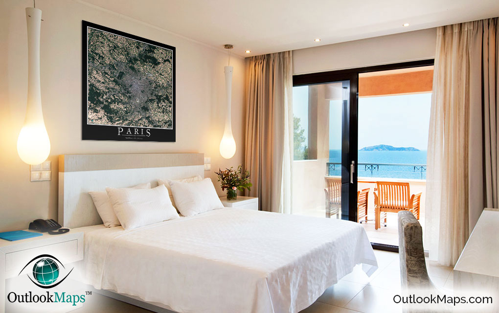
Paris Aerial Satellite Map Poster

An aerial view of Paris, France taken by NASA satellites. The image is current, high-detailed, and makes a gorgeous poster for display.

Features

  • NASA Landsat 8 Image
  • Current Image
  • High Resolution: 1 pixel = 15 meters
  • Month of Image: September
  • Minimal to No Cloud Cover
  • No Text Labels
  • Either White or Black Background
  • Includes Entire Paris Area
  • Stylish Poster Layout - Looks great framed

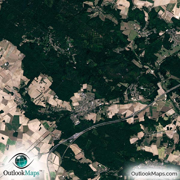
This satellite print of the Paris area does not include any additional text or line layers - it is a clean and uncluttered image of Paris as seen from space.

Product Information

Map Name:
Model Number:
PARIS991
Product Image:
PARIS991 - Paris Satellite Map
Map Type:
Wall Map (not folded)
Description:
High resolution print of Paris satellite Image. Poster can be laminated, mounted, and framed. Aerial image taken from NASA Landsat 8 satellites.
Publisher/Brand:
Outlook Maps
Price:
starting at $19
Availability:
In Stock

What's Visible in the Satellite Image?

Paris Aerial Map Detail

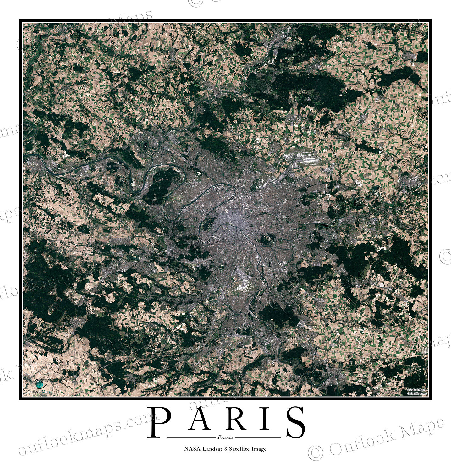
This aerial image includes the entire Paris region, including smaller cities and suburbs like Versailles, Evry, Nanterre, Creil, Melun, Antony, Sarcelles, and Boulogne-Billancourt.

The native resolution of the satellite imagery is 1 px = about 15 meters, which is detailed enough to see large buildings, parks, neighborhoods, major streets, golf courses, and many other features of the city.

You'll be able to find several airports and runways in the image. The larges airports are Charles de Gaulle Airport and Orly Airport, both of which are visible.

You'll also be able to find iconic landmarks and buildings like the Eiffel Tower, Arc de Triomphe, Notre Dame, and the Louvre.

The map also shows Paris' more modern side, as large buildings and tall skyscrapers like Tour First, Tour Maine Montparnasse, Tour Total, and Tour T1 can be found in the map.

The areas surrounding Paris are primarily agriculture lands, and the individual fields of crops can clearly be seen in the image.

Satellite Map for Decoration

Paris Aerial Map as Home Decor

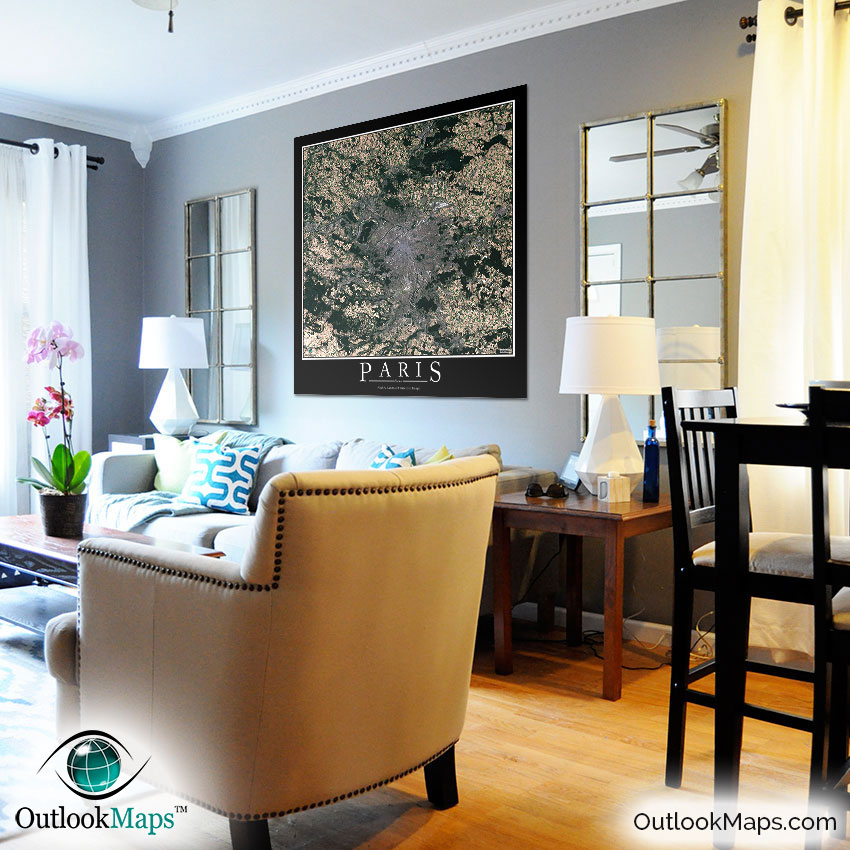
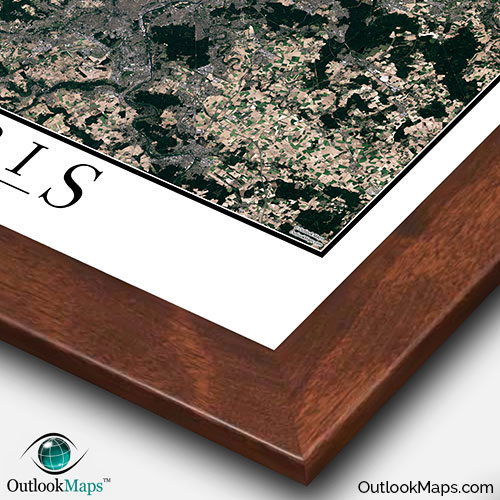
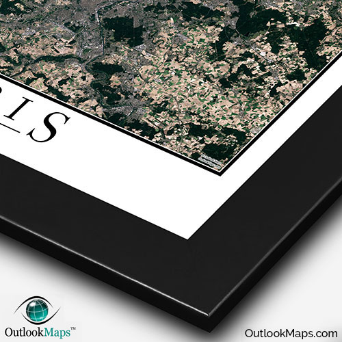
This Paris satellite map is styled with a classic poster appearance - a tasteful border around the map and the title ''PARIS'' printed at the bottom with traditional poster font. The print is available with either a white or black background.

The aerial image is detailed enough to look crisp and sharp even when printed at large sizes.

We also offer several framing options, making the map a perfect piece to display on your home, office, or business wall for both functional use and artistic decoration.

Purchase


product ordering options image
Large - 36.0 in. x 36.9 in. (standard)
$49
$69
$79
$149
$249
Small - 16.4 in. x 16.8 in.
$19
$25
$29
$49
$79
Medium - 25.8 in. x 26.5 in.
$29
$39
$49
$89
$149
Huge - 48.0 in. x 49.2 in.
$99
$129
$159
$649
$849
Mural - 60.0 in. x 61.5 in.
$199
$249
$279

Frame Options

Map Frame Styles: Canadian Walnut, Black Wood, Birch, Old World Silver, and Brushed Aluminum


Other City Maps

Aerial Image Satellite Map of London Poster
London Satellite Map

Starting at $19
Aerial Image Satellite Map of Rome Poster
Rome Satellite Map

Starting at $19
Aerial Image Satellite Map of Moscow Poster
Moscow Satellite Map

Starting at $19
All City Maps

Other Satellite Image Maps

Satellite Image Map of the World
World Satellite Map

Starting at $29
All Satellite Image Maps

Further Questions?

Don't worry, we're here to help!

>> contact us

Customer Reviews

>> Back to Top