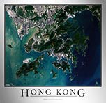
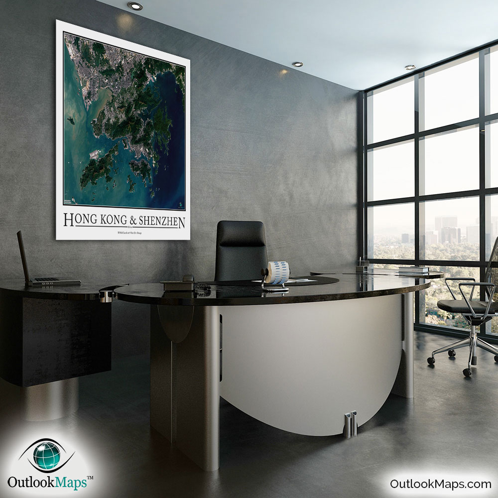
Hong Kong-Shenzhen Aerial Satellite Map Poster

An aerial view of Hong Kong and Shenzhen taken by NASA satellites. The image is current, high-detailed, and makes a gorgeous poster for display.

Features

  • NASA Landsat 8 Image
  • Current Image
  • High Resolution: 1 pixel = 15 meters
  • Month of Image: October
  • Minimal to No Cloud Cover
  • No Text Labels
  • Either White or Black Background
  • Includes Entire Hong Kong-Shenzhen Area
  • Stylish Poster Layout - Looks great framed

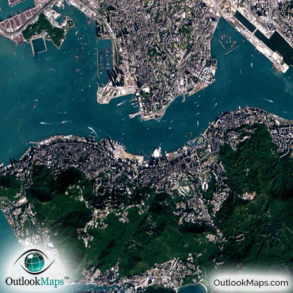
This satellite print of the Hong Kong-Shenzhen area does not include any additional text or line layers - it is a clean and uncluttered image of Hong Kong and Shenzhen as seen from space.

Product Information

Map Name:
Model Number:
HKSHZ991
Product Image:
HKSHZ991 - Hong Kong Shenzhen Satellite Map
Map Type:
Wall Map (not folded)
Description:
High resolution print of Hong Kong Shenzhen satellite Image. Poster can be laminated, mounted, and framed. Aerial image taken from NASA Landsat 8 satellites.
Publisher/Brand:
Outlook Maps
Price:
starting at $19
Availability:
In Stock

What's Visible in the Satellite Image?

Hong Kong Shenzhen Aerial Map Detail

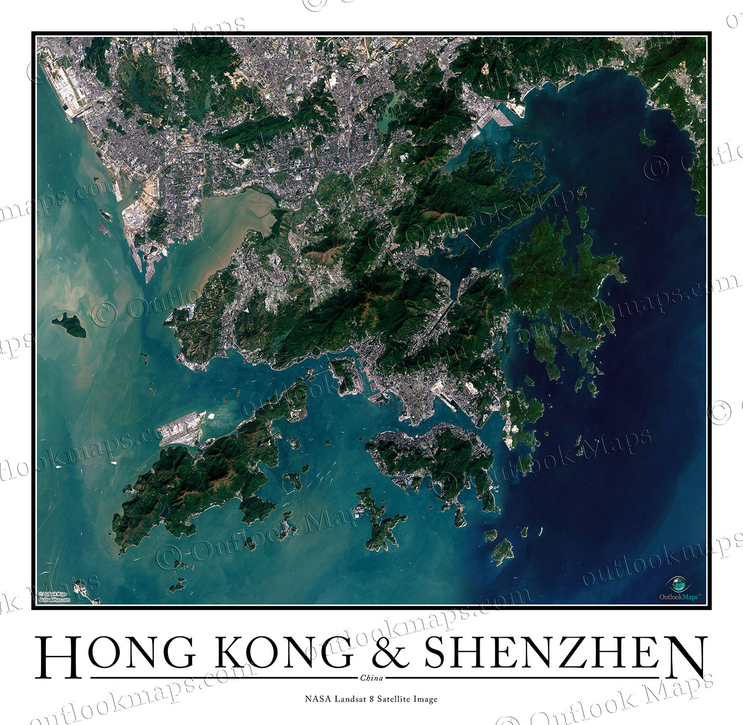
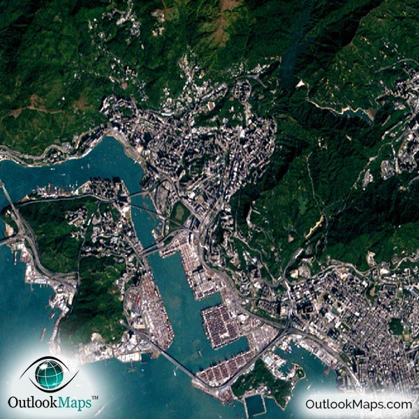
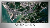
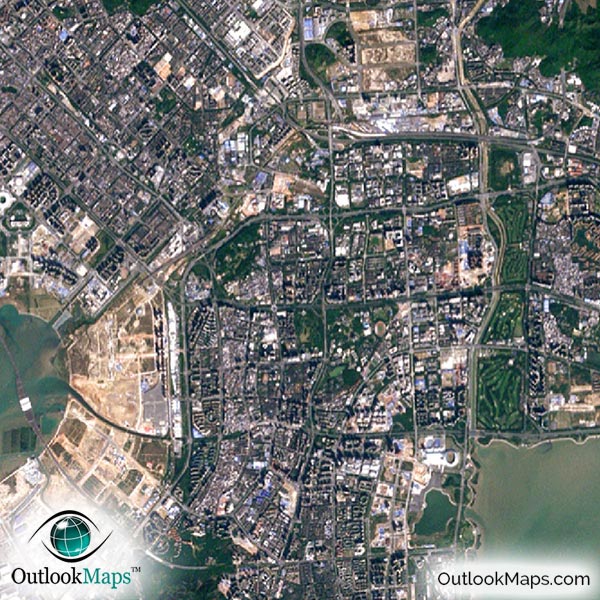
This satellite image shows the entire Hong Kong Special Administrative Region and the neighboring China city of Shenzhen, one of the fastest growing cities in China. Bao'an and Yantian are also shown.

The native resolution of the satellite imagery is 1 px = about 15 meters, which is detailed enough to see large buildings, parks, neighborhoods, major streets, golf courses, and many other features of the city.

Both the Hong Kong International Airport and Shenzhen Bao'an International Airport are shown.

You'll find many skyscrapers in both downtown Hong Kong and downtown Shenzhen. Hong Kong has the greatest concentration of skyscrapers of all cities in the world.

In both cities, you'll see many specific buildings and regions. Large neighborhoods or clusters of buildings are very pronounced in the satellite image.

The many islands of Hong Kong are also shown and look very interesting. The ocean has a very attractive blue-green tint that varies throughout the image.

Satellite Map for Decoration

Hong Kong Shenzhen Aerial Map as Home Decor

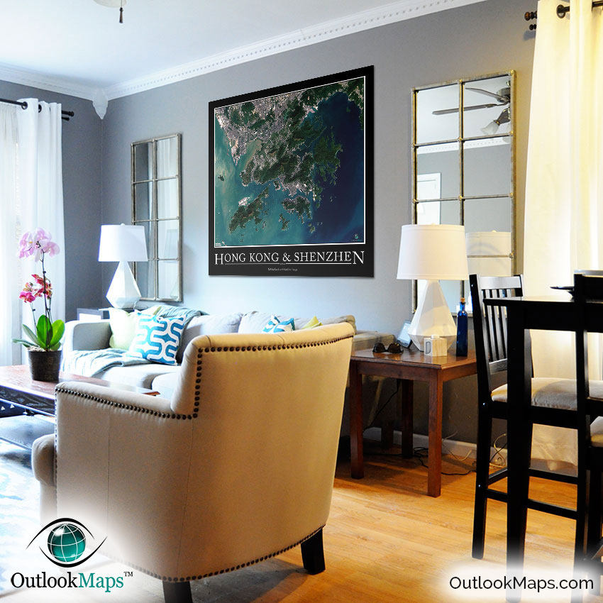
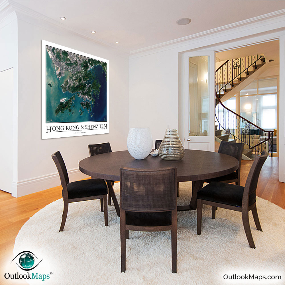
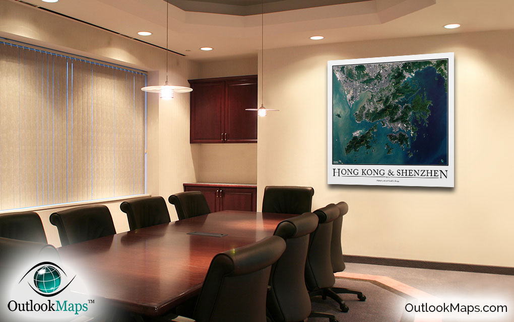
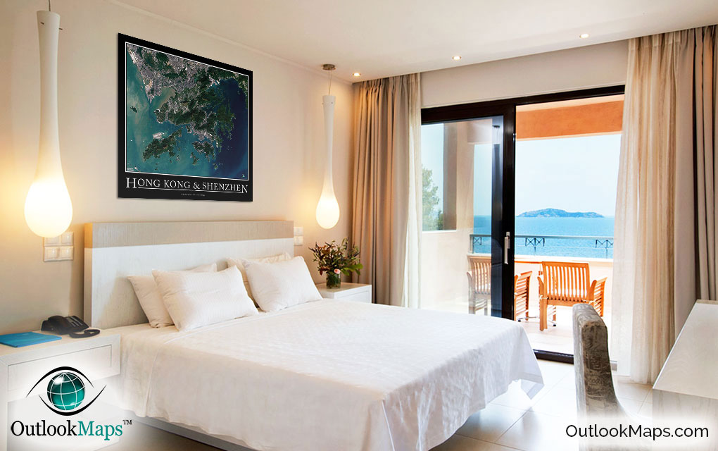
This Hong Kong-Shenzhen satellite map is styled with a classic poster appearance - a tasteful border around the map and the title ''HONG KONG & SHENZHEN'' printed at the bottom with traditional poster font. The print is available with either a white or black background.

The aerial image is detailed enough to look crisp and sharp even when printed at large sizes.

We also offer several framing options, making the map a perfect piece to display on your home, office, or business wall for both functional use and artistic decoration.

Purchase


product ordering options image
Large - 36.9 in. x 36.0 in. (standard)
$49
$69
$79
$149
$249
Small - 16.8 in. x 16.4 in.
$19
$25
$29
$49
$79
Medium - 26.5 in. x 25.8 in.
$29
$39
$49
$89
$149
Huge - 49.2 in. x 48.0 in.
$99
$129
$159
$649
$849
Mural - 61.5 in. x 60.0 in.
$199
$249
$279

Frame Options

Map Frame Styles: Canadian Walnut, Black Wood, Birch, Old World Silver, and Brushed Aluminum


Other City Maps

Aerial Image Satellite Map of Shenzhen Poster
Shenzhen Satellite Map

Starting at $19
Aerial Image Satellite Map of Shanghai Poster
Shanghai Satellite Map

Starting at $19
Aerial Image Satellite Map of Beijing Poster
Beijing Satellite Map

Starting at $19
All City Maps

Other Satellite Image Maps

Satellite Image Map of the World
World Satellite Map

Starting at $29
All Satellite Image Maps

Further Questions?

Don't worry, we're here to help!

>> contact us

Customer Reviews

>> Back to Top