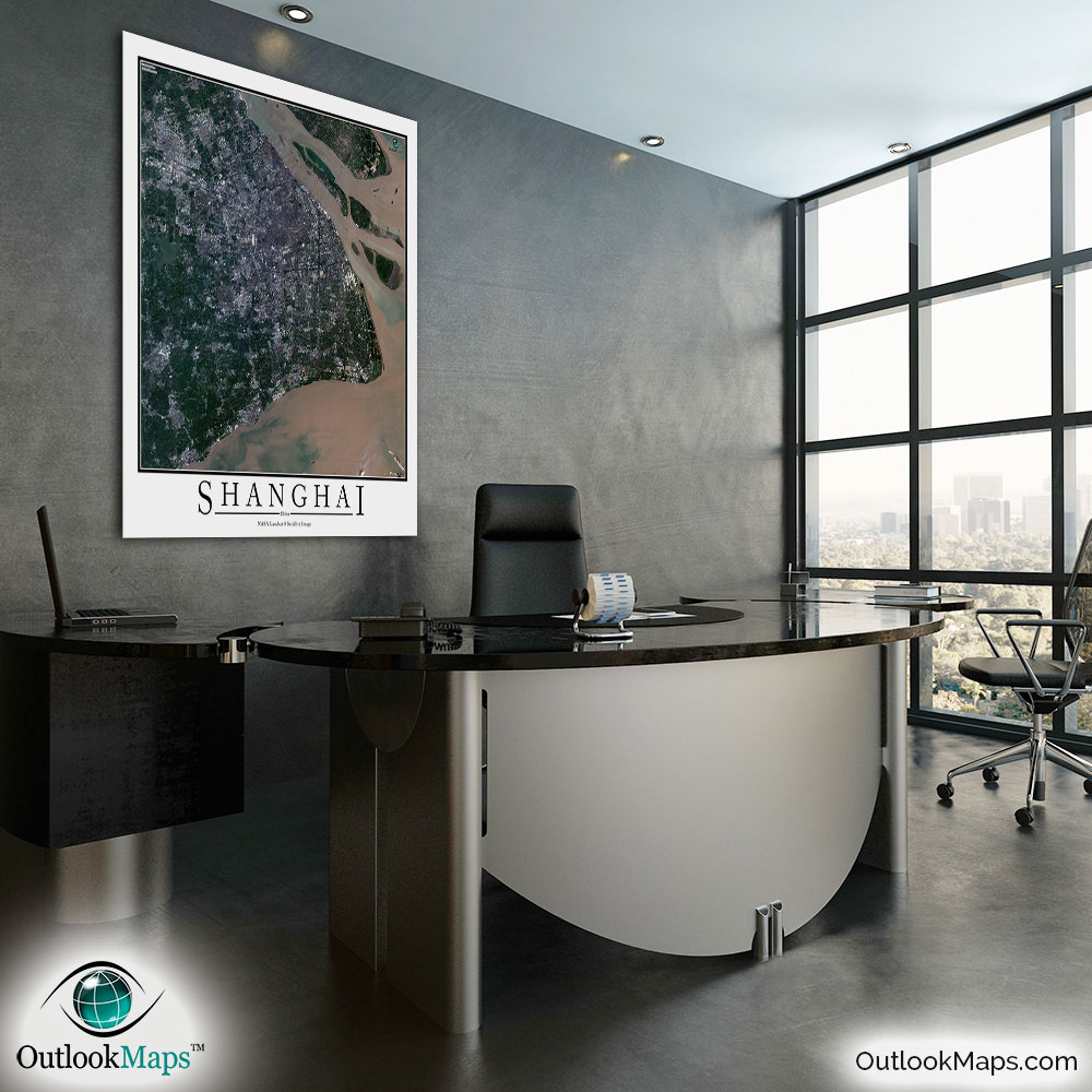
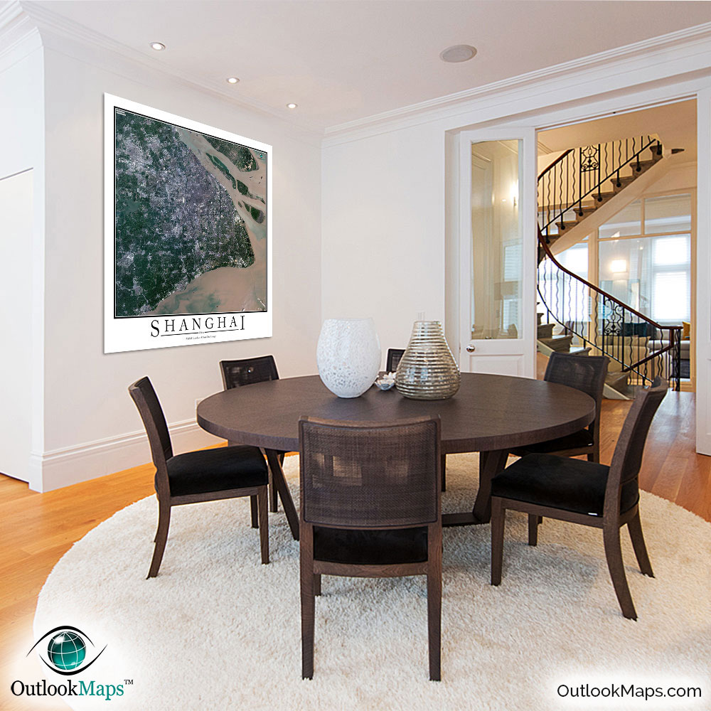
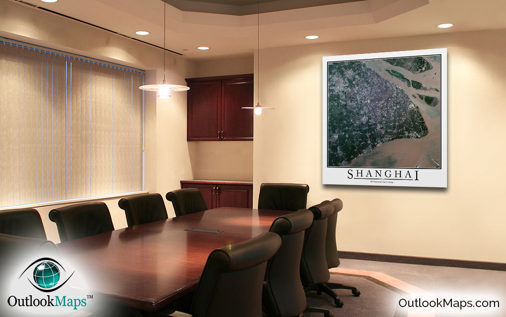
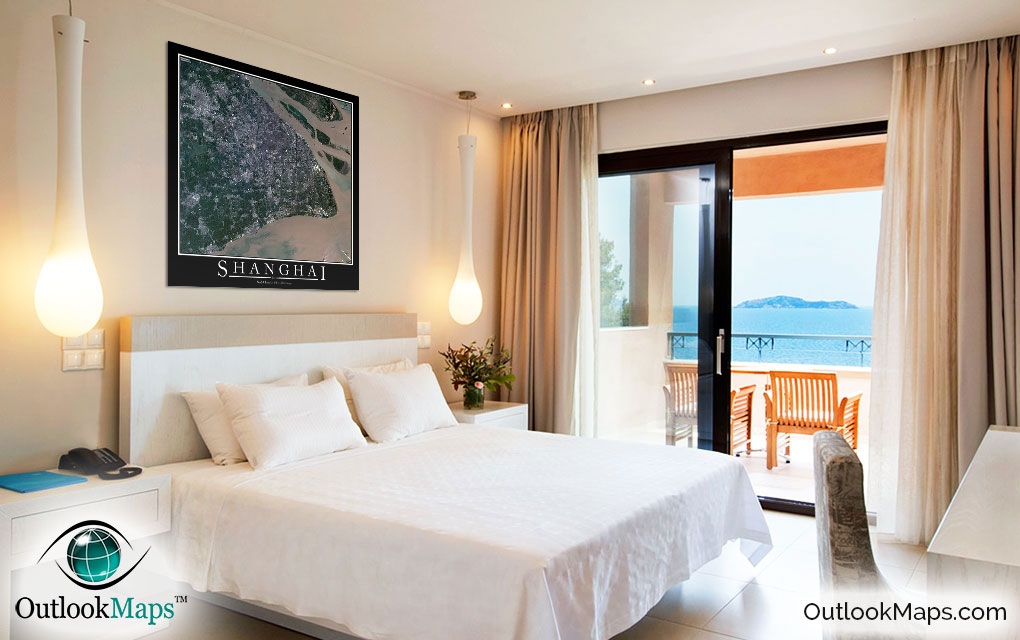
Shanghai Aerial Satellite Map Poster


(Click images to see full-size)
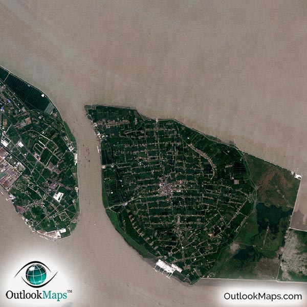
This satellite print of the Shanghai area does not include any additional text or line layers - it is a clean and uncluttered image of Shanghai as seen from space.
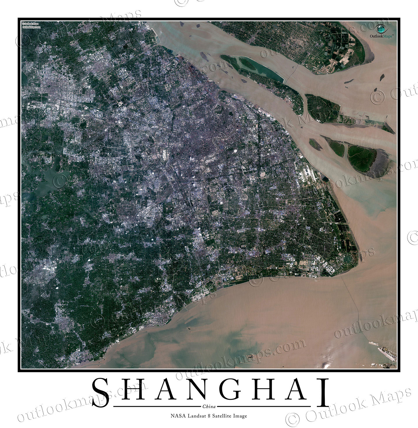
This aerial map of Shanghai includes the entire Shanghai area. Smaller cities, suburbs, and districts like Kunshan, Qingpu, Songjiang, Fengxian, Minhang, and Jinshan are also shown in the image.
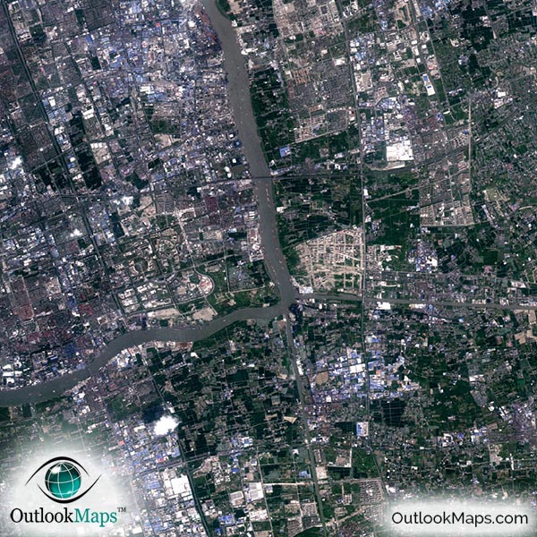
The native resolution of the satellite imagery is 1 px = about 15 meters, which is detailed enough to see large buildings, parks, neighborhoods, major streets, golf courses, and many other features of the city.
Shanghai is served by two major airports and both are visible in the map. The largest airport is Pudong International Airport in the western edge of the city, and the smaller of the two is Hongqiao International Airport located closer to central Shanghai.
In the downtown area to the east of the Huangpu River, you'll find the highest concentration of large buildings and skyscrapers. The Shanghai Tower and Shanghai World Financial Center are the tallest skyscrapers in Shanghai. The iconic Oriental Pearl Tower is also located in this region. To the west of the Huangpu River you'll find the Bund Area with many historic buildings.
Throughout the satellite image, you'll find landmarks and attractions like the Shanghai Expo Center, People's Square, Nanjing Road, Shanghai Grand Theater, Nanpu Bridge, Jing'an Temple, and many other sites. You can also see the Hangzhou Bay Bridge to the south of Shanghai, which spans the Hangzhou Bay and connects the city of Ningbo to Shanghai.
The map also shows the natural features in the Shanghai Area. The water border to the north and east is the lower part of the Yangtze River (Chang Jiang) Delta. The waterway to the south is the Hangzhou Bay.
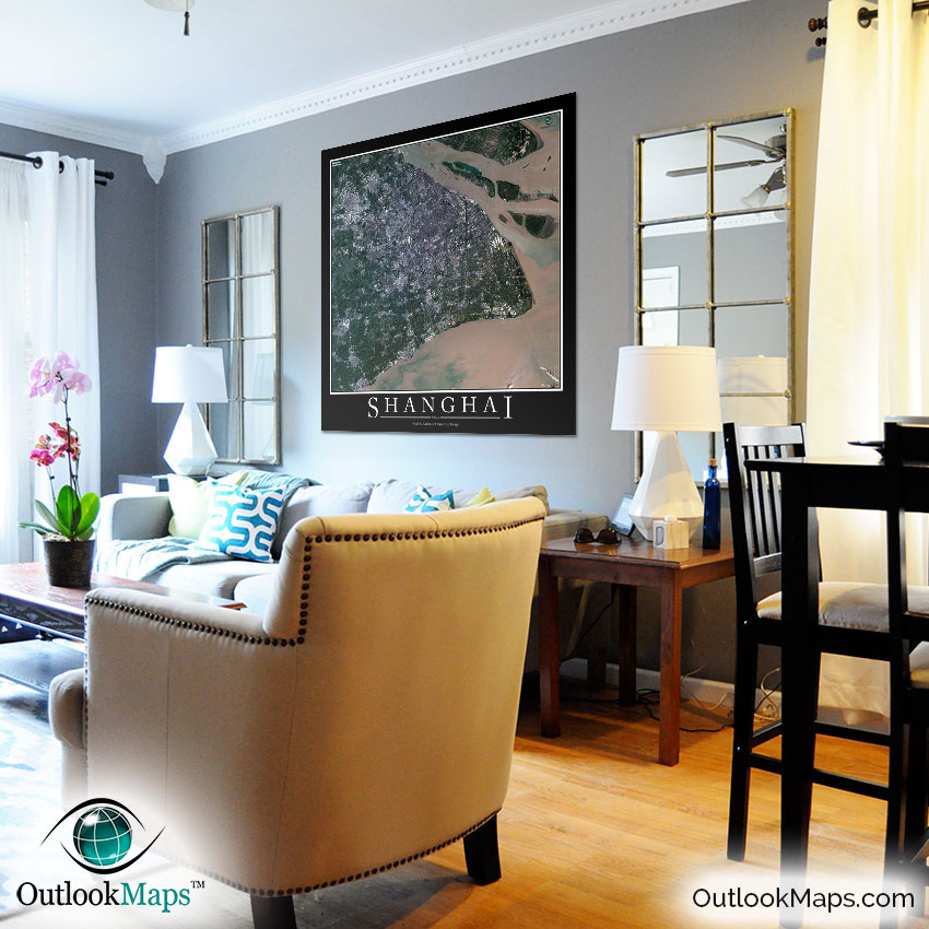
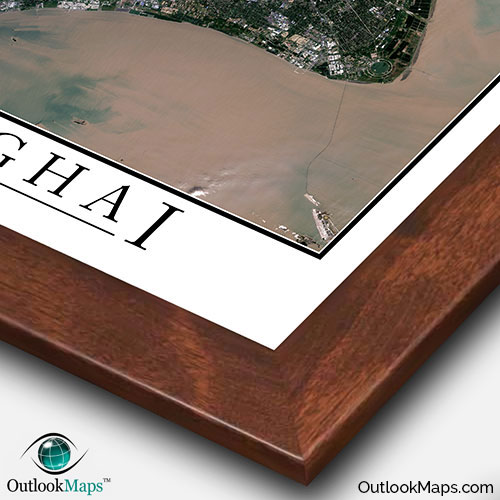
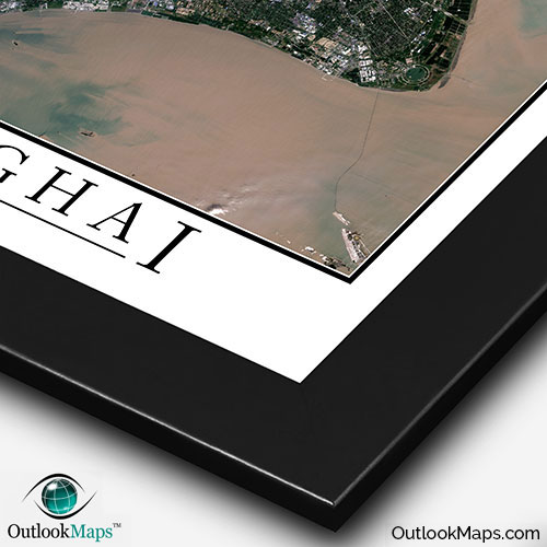
This Shanghai satellite map is styled with a classic poster appearance - a tasteful border around the map and the title ''SHANGHAI'' printed at the bottom with traditional poster font. The print is available with either a white or black background.
The aerial image is detailed enough to look crisp and sharp even when printed at large sizes.
We also offer several framing options, making the map a perfect piece to display on your home, office, or business wall for both functional use and artistic decoration.