City Maps

Collection of City Maps and City Aerial View Maps and Imagery
These city maps are high-detailed aerial view images and make great posters. Framing available.

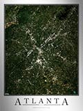
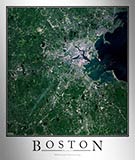
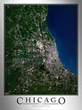
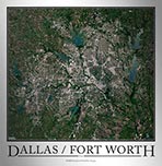
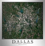
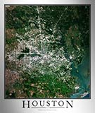
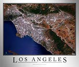
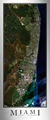
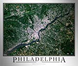
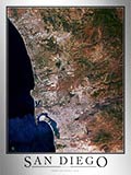
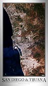
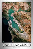
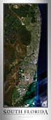
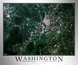
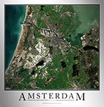
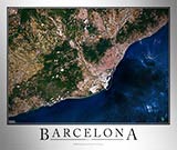
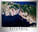
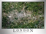
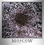
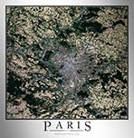
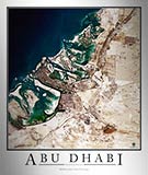
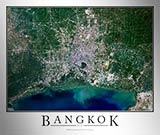
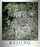
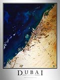
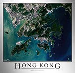
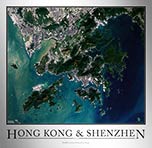
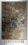
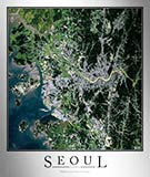
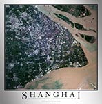
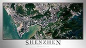
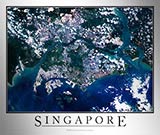
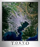
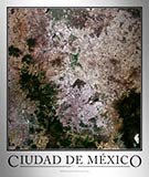
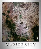
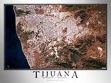
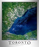
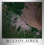
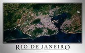
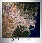
Our aerial view city maps and posters are produced from high resolution NASA satellite imagery and/or aerial photography (orthoimagery).

The aerial city images are current and high-detailed. You'll be able to see large buildings, airports, golf-courses, parks, major streets and highways, neighborhoods, rivers, streams, creeks, individual agriculture fields, sporting venues, and a host of other landmarks and features of specific cities.

These city maps make great posters to display on your home, office, or business wall for artistic decoration and reference.

All of our city aerial view map prints are available with either a white or black background and can be framed with several framing options, making a beautiful artistic addition to any space.

USA Cities Maps

Aerial Image Satellite Map of Atlanta Area Poster
Atlanta Satellite Map

Starting at $19
Aerial Image Satellite Map of Boston Area Poster
Boston Satellite Map

Starting at $19
Aerial Image Satellite Map of Chicago Area Poster
Chicago Satellite Map

Starting at $19
Aerial Image Satellite Map of Dallas Area Poster
Dallas Satellite Map

Starting at $19
Aerial Image Satellite Map of Houston Area Poster
Houston Satellite Map

Starting at $19
Aerial Image Satellite Map of Miami Area Poster
Miami Satellite Map

Starting at $19

International Cities Maps

European Cities Maps

Aerial Image Satellite Map of Istanbul Poster
Istanbul Satellite Map

Starting at $19
Aerial Image Satellite Map of London Poster
London Satellite Map

Starting at $19
Aerial Image Satellite Map of Moscow Poster
Moscow Satellite Map

Starting at $19
Aerial Image Satellite Map of Paris Poster
Paris Satellite Map

Starting at $19
Aerial Image Satellite Map of Rome Poster
Rome Satellite Map

Starting at $19

Asia Cities Maps

Aerial Image Satellite Map of Bangkok Poster
Bangkok Satellite Map

Starting at $19
Aerial Image Satellite Map of Beijing Poster
Beijing Satellite Map

Starting at $19
Aerial Image Satellite Map of Dubai Poster
Dubai Satellite Map

Starting at $19
Aerial Image Satellite Map of Istanbul Poster
Istanbul Satellite Map

Starting at $19
Aerial Image Satellite Map of Seoul Poster
Seoul Satellite Map

Starting at $19
Aerial Image Satellite Map of Shanghai Poster
Shanghai Satellite Map

Starting at $19
Aerial Image Satellite Map of Shenzhen Poster
Shenzhen Satellite Map

Starting at $19
Aerial Image Satellite Map of Tokyo Poster
Tokyo Satellite Map

Starting at $19

North American Cities Maps

Aerial Image Satellite Map of Tijuana Poster
Tijuana Satellite Map

Starting at $19
Aerial Image Satellite Map of Toronto Poster
Toronto Satellite Map

Starting at $19

South American Cities Maps

Australia / Oceania Cities Maps

Aerial Image Satellite Map of Sydney Poster
Sydney Satellite Map

Starting at $19

Custom City Aerial/Satellite Maps

If you didn't see your city available, don't worry, we can make a custom satellite map of any city. Just contact us and tell us your requested city, and we'll produce the satellite map for you and make it available to purchase.